By Richard Fox January 2024
Exploring Mediterranean ports by cruise ship is an inspiring experience. Imagine disembarking from the luxury of your ship on a sunny day to a welcoming seaside promenade with sidewalk cafés overlooking the sea, beyond which is a well preserved historic old city with classic European architecture awaiting your exploration. For those of us who love to bike, rewarding cycling opportunities can be found at many of these ports via a bike rental or guided tour. At other ports where bicycling isn’t the favored option, just strolling the ancient streets on foot can make for a sublime day.

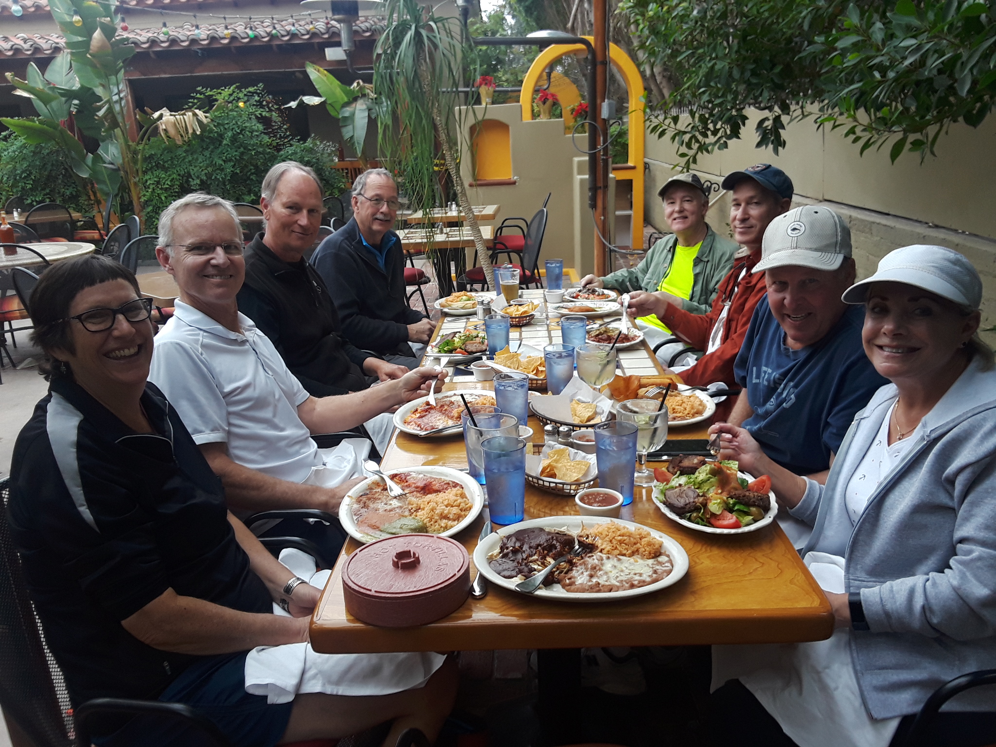
In the fall of 2023 my partner Steve and I sailed on four mostly consecutive mainstream cruises in 71 days, including Atlantic crossings from the east coast both ways. Of the 30 ports visited, some multiple times, we enjoyed 19 mostly easy but exhilarating eye-opening Mediterranean bike tours in Portugal, Spain, France, Italy, Greece and Turkey (plus one in Bermuda). All but 3 of the tours were on e-bikes, and 12 were led by impressive local guides. None were with the rare bike tour offered by our cruise ships.

Before the trip I did extensive research evaluating the ports for the best cycling opportunities, and read dozens of reviews to get a feel for which ones to try. I booked our tours mainly via the apps GetYourGuide and Viator, which made it convenient to keep track of them all. Both apps had liberal pay-later and 24 hour cancellation policies. Rentals and some tours were booked directly through the bike shops or tour agencies, and frequently they were less expensive than the app’s prices for the same tour. And all were significantly cheaper than typical cruise ship excursions, which guaranteed a return to the ship in time. However, I arranged the excursion times and scopes so that wouldn’t be an issue, for example, bike rentals had to include a rescue service, and the tour meeting / return points had to be a reasonable distance from the port.

Following is a summary of the very memorable bike tours that we experienced. Also included are photos of the ports that we did not bike from, and the reasons why. The autumn weather cooperated in miraculous ways and it was a great time to go with reduced crowds and more moderate temperatures compared to summer. Costs quoted are per person, in €uros. The apps actually charged in USD$, so those conversions are approximate.
Trip Itinerary: Carnival Freedom from Port Canaveral, Florida Sept 21 to Barcelona Oct 4. Celebrity Edge from Barcelona Oct 7 to Rome Oct 14. Fly Rome to Athens Oct 14. Holland America (HAL) Nieuw Statendam from Athens Oct 15 to Rome Nov 9. Norwegian (NCL) Breakaway from Rome Nov 12 to New York Nov 28. The ships were either able to dock directly in major cruise ports, or else a tender boat system was required to shuttle passengers ashore. Descriptions are listed by country, west to east, as opposed to by date and ship:
PORTUGAL
Ponta Delgada, Azores Carnival Freedom, Sept 29
Frequently visited on the transatlantic crossings, the Azores port of call on the largest of the islands, São Miguel, is the lovely 1500’s city of Ponta Delgada, with exquisite narrow streets lined with whitewashed buildings striped with black basalt.
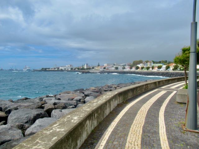
The most unique ride to do on the island is on the dirt paths around two volcanic crater lakes with sparkling blue and green waters from the extinct Sete Cicades volcano, however this area is frequently obscured by low clouds and fog. Excursions to that area are available from the port, and some include biking, but no bike tours were offered on our port day.

We remained near Ponta Delgada, renting a couple of nice acoustic bikes at Open Door Rentals, where Marcos gave us great directions and information. The shop was a 20 minute walk from the ship through the interesting old town. A seaside bike path starts a few blocks from the shop, near Forte de São Brás (“the fort”) and descends to the cruise terminal area, then back up to boulevard level. It follows the scenic waterfront adjacent to a pedestrian path, with some detours onto low traffic streets. It eventually passes three beaches before ending about 10 km (6 miles) from the start. More adventurous cyclists can continue into the hilly coastal country beyond.
Cost: 10€ (each) for a 2 hour rental. (Azores Bike Shop downtown had a bigger variety of bikes including e-bikes, but much pricier because they only charged by the day). Our November port visit here on NCL was cancelled due to severe weather.
Lisboa (Lisbon) Norwegian (NCL) Breakaway Nov 19
Lisboa (Lisbon) climbs up onto several hills on the north bank of the wide tidal Tagus River. The cruise port is conveniently situated next to Old Lisboa, which extends up a hill on cobblestone streets where famous Tram 28 climbs to Castelo (Castle) de São Jorge.
Several e-bike tours are offered in Lisboa. The well-reviewed hills of Lisboa tours are mostly on steep cobblestone streets, which we don’t prefer, so we opted to ride the flat river cruise offered by Boost Portugal – Urban Thrills instead. It followed the the bike/pedestrian promenades that run west along the river from the cruise port area to the historic port of Belém, where Portuguese explorers and conquistadors would set off from.

It was a Sunday so the river paths were crowded, but still rideable. Our knowledgeable guide, Oriana, provided interesting historical facts en route and treated us to delicious pastéis de nata, a local tart supplied by a food truck. The Belém portion consisted of riding past the impressive riverside monuments Torre de Belém (Belém Tower) and Padrão dos Descobrimentos (Monument of the Discoveries), but not through the historic town. It was an enjoyable scenic excursion on the basic e-bikes provided. Distance: ~17 km (12 mi). Cost: 40€ via Viator. After the tour we had time to hike through Old Lisboa all the way up to the castle.

Portuguese Ports Not Biked: Our ships did not stop in Porto, but bike tours are available there.
SPAIN
Cadiz NCL Nov 18
Located west of Gibraltar on Spain’s southwest Atlantic Ocean coast, Cádiz is Spain’s oldest city with a rich history dating back thousands of years including the embarkation point for two of Christopher Columbus’s voyages.

It is situated on a peninsula surrounded by water, with bike paths running around its stunning waterfront and through the city. The cruise port is conveniently located adjacent to the old city. Topography is mainly flat, so an e-bike is not necessary for most to have an enjoyable easy bike ride here.
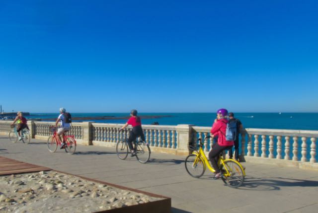
We booked a 2.5 hour bike tour with Cadizfornia Tours. Our guide did a great job showing us the highlights and providing a thorough understanding of the history of Cádiz as we cycled on its coastal bike paths and some charming cobblestone side streets. We stopped to tour a couple of beautiful parks on foot along the way.

We loved this tour, although it would be easy to navigate the coastal paths on your own. Being able to keep the bikes for an hour or two after the tour would have been ideal. Distance: ~10 km (6 mi). Cost: 50€ (35€ + 15€ e-bike supplement), booked directly. Also available on the apps.
Málaga Carnival Oct 2
Málaga is located on Spain’s Costa del Sol on the northern side of the Alboran Sea, the westernmost portion of the Mediterranean Sea. It has a beautiful port district and its scenic medieval old city is backed by close in hills.

We booked a guided e-bike tour with E-Bike Malaga, located a few minutes walk from the port entrance, although we took a shuttle bus in to save the 20 minute walk from our ship. Our guide was a fun animated architecture student and made the tour informative and enjoyable, providing a great introduction to the history and culture of Málaga.
We toured the old city and then were led up a beautiful wide paved path that climbed gradually, passing a mini Moorish Alhambra (Alcazaba), to a spectacular viewpoint (Mirador de Gibralfar) across the city, port, and out to sea.

We descended to town and rode around the port area, onto a nice greenbelt path, and to the lovely ample waterfront bike path. The beach near city center is very scenic, and the bike path leads to neighborhoods known for local non-touristy restaurants.

Málaga is a gem of a city and I recommend taking a bike tour to experience the optimal routes around town and learn about it in the process. Cost: 50€ via GetYourGuide; included keeping the e-bikes afterward to explore on our own, a great option. We spent our extra time on the scenic beach path. Distance: ~ 20 km (13 mi).
Valencia Carnival Oct 3
Valencia is Spain’s 3rd largest city with a busy port, and a cruise-affiliated shuttle is required to get from the cruise dock area to the edge of town. Unfortunately the medieval old city and other major attractions are several km from this point. A city bus can take you to these areas, where there are also bike rental places.

We didn’t find a convenient e-bike tour, so we rented e-bikes from well-reviewed Beach Bikes, a 25-minute walk from the port.

Valencia has a very impressive system of bike paths all over the city. Beach Bikes provided a pdf map for our phones that contained its recommended routes. A nice path follows the beach promenade, and another runs all through the city along a greenbelt with paths extending out from it. Cycling through the narrow streets of the old city was enjoyable. The modern Ciudad de las Artes y las Ciencias (City of Arts and Sciences) next to L’Oceanogràfic, the largest aquarium in Europe, is a highlight attraction, and accessible via bike path.

The paths are well used by locals and drivers were patient and appeared to have respect for bikers when paths crossed roadways. All in all this is one of the most bike friendly cities we’ve experienced. Terrain is mainly flat, so an e-bike is not a necessity for an easy ride, except if you wish to cover a long distance exploring the bike path network as we did. Afterwards we grabbed a taxi for 9€ that took us all the way back to the ship. Distance ~30 km (18 mi). Cost: 25€ booked direct.
Barcelona Carnival Oct 4
We had a three day stay in Barcelona between our Carnival and Celebrity cruises. On arrival day, thanks to the Bags&Go service that collected our bags at the port and dropped them at our Eixample district accommodation later, we were able to do a Gaudi Highlights E-Bike Tour conducted by Barcelona E-Bikes at 11:00 that morning. The port shuttle bus dropped us off near the start of Las Ramblas, then we walked along the river path and cut across to the ornate Gothic Quarter to get to their shop.

Barcelona is a large vibrant city, and I highly recommend taking a guided bike tour to lead you on the most bike-friendly routes. Our guide was well versed in history and everything Gaudi, and led us around the city on the extensive system of Class IV cycletracks and pedestrian promenades, staying off of the crazy roadways.

On this beautiful day we felt like we had acquired a good overview of the city, especially the Gaudi sites, beyond the famed Sagrada Familia. Cost: 37€ via Get Your Guide.

NCL Nov 16: We were happy to return to Barcelona for a port day on our return cruise, and were lucky to have great weather. We decided to just rent this time with another couple and Barcelona E-Bike Rent accommodated us well with comfortable e-bikes.
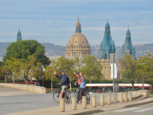
They gave us directions to climb Montjuic, site of the 1992 Olympics. Steve navigated on Google Maps and we had a scenic ride up there for the pano views, then across town mostly on separated Class IV cycletracks to Sagrada Familia and Arc de Triomf.

It was a fun scenic ride but I still recommend a guided tour to optimize your route and appreciation of Barcelona. Today’s distance: ~21 km (13 mi). Cost: 32€ for half day, booked direct.
Costa Brava Region Between Carnival & Celebrity Cruises, Oct 5
While not a viable option for a day trip from the Barcelona port, many cruises start or end in Barcelona, allowing for excursions farther afield on those extra days you may have. We rented a car in Barcelona from Virtuo and drove 90 minutes to the Costa Brava to the north, known as Spain’s premier bicycling region.

We had arranged in advance to rent e-bikes and do a self guided tour selected by BikeOn of Palafrugell based on my criteria of beautiful countryside, not too many big hills, away from traffic, and past medieval villages.

BikeOn has loaded numerous rides onto the Komoot app and set us up on a 30 mile (48 km) loop from their shop. The app worked brilliantly, giving verbal turn-by-turn directions. The trekking e-bikes performed well on the varied terrain of pavement, gravel, and dirt. It was an intricate route down obscure lanes through the countryside, and actually went through the heart of several medieval villages, which were quite impressive and had cafés where cyclists could stop for a beverage or tapas in beautiful squares.

Much of the route was even signed as the Pirinexus regional bike route. Our bike batteries gave out a couple of km before the end, but the bikes were still OK to pedal. It was a fantastic ride and a great experience. Cost: 50€ booked direct. Historic Girona to the northwest of Palafrugell has several bike rental options and tours available as well.
Spanish Port Not Biked
Ibiza, Celebrity Edge, Oct 9: The best cycling is reported to be in the more remote portions of the island, not reasonable for a time-limited cruise ship excursion. Cruise ships dock across the bay from Ibiza Town, aka Eivissa. A scenic 3 km (2 mile) bike/ped path runs around the bay from the cruise port into town. However, there are no bike rentals at the port, so passengers have to walk or take a shuttle bus or City Boat (as we did) to get into town. I noticed listings for an acoustic bike tour and an e-bike rental outfit, which you may want to check out. We had a great day wandering through the pretty waterfront old town that has plenty of inviting restaurants and shops, and trudging up the steep cobblestone streets to the ancient Dalt Vila with its fortress, cathedral, and stunning pano views.

FRANCE
Ajaccio, Corsica Celebrity, Oct 12
The cruise terminal in Ajaccio, the principal city on the isle of Corsica, is conveniently situated next to the interesting Old Town, known for being the birthplace of Napoléon Bonaparte.

Appebike’s excursion advertised as a self-guided “E-Bike tour along turquoise waters,” with promises of passing a long list of exciting features, got very mixed reviews. However, since Corsica Electric Bikes, which seemed to have a better selection of e-bikes, wouldn’t confirm my booking, we stuck with them. Upon arrival Appebike let us take a photo of a free tourist map without giving us a copy, nor an app to reference, and gave us minimal directions, nothing close to a “tour.” We just used Google Maps to navigate. The Peugeot e-bikes were good quality for rentals, except for very uncomfortable seats, and they had ignored my advance requests to save a larger frame bike for Steve.
The route began with a short stretch of waterfront path in the harbor area, followed by riding inland with cars through busy city streets, at low speed limits. It was annoying but not terrible for experienced cyclists. On the other side of downtown we reached the stretch of shoreline with beautiful beaches and views of those famous turquoise waters, which was spectacular on this sunny mild October day. After a bit of road riding a bike/ped path appeared on the sea side of the coastal road with stellar vistas, uncrowded on this weekday morning. It ended in a few km, putting us back on the road, with light traffic. Steve’s bike was so uncomfortable that he just stopped at this point and waited for me. I continued to the end of the road, which was the highlight of the ride. A beautiful park with scenic hiking paths leads to the ancient Tour de la Parata (tower) atop a hill surrounded by the sea on three sides, and overlooking the four islands of the Sanguinaires archipelago.

The return trip to the shop was more enjoyable because we were able to ride the one way road around the scenic coastal perimeter of the Old Town past Citadelle d’Ajaccio, and not battle as much downtown traffic. Distance ~28 km (18 miles). An optional return route winds up through the hills above town. Cost: 41€ via GetYourGuide
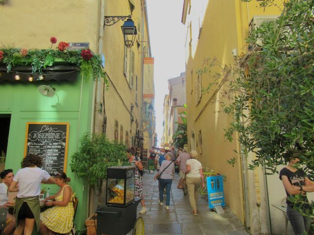
After returning the bikes and having lunch on the ship (they were having “French Day” including napoleans that we couldn’t find in town) we walked around Old Town to see the historical sites, mostly relating to Napolean. It was une très bonne journée despite the hiccup with Steve’s bike.
Cannes NCL Nov 15
We were lucky to actually get to Cannes since it’s a tender port that’s notorious for cancellations due to wind. We once again had perfect weather and did a city e-bike tour with Yourent Cannes, located a few minutes walk from the dock.

They provided Steve with a perfect upright large bike that I had requested. During the tour we posed on the film festival red carpet, rode coastal paths next to giant yachts to scenic viewpoints, then through town on a crowded street and up Suquet Hill to the Cannes Castle with an awesome vista, all in about 2 hours.

Our friendly fun French guide, Louis, did a good job leading us and describing Cannes and its history, but this is one place where just renting an e-bike may be preferable, which Yourent also offers on the apps or direct. The coastal path extends longer than our tour route took, and it would’ve been nice to be able to hop on and off the bikes over a longer period, grab a bite, and keep the bikes all day versus trudging around on foot like we did before and after the 1:00 tour. Cost: 59€ booked direct (~ 20€ more via the apps, which in my opinion would be expensive for this tour).

French Ports Not Biked
Our cruises did not stop at other ports along the French Riviera. Bike tours are offered elsewhere, especially from Nice and Marseilles.
ITALY
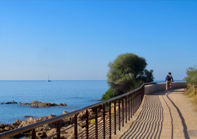
La Spezia/Cinque Terre Celebrity, Oct 13
Cinque Terre National Park is known for the spectacular hiking trails between the five charming seaside villages, although in fall 2023 the main easiest trail section, Via dell’Amore, was still closed due to landslide damage over 10 years earlier. I didn’t think biking was an option in the park, but after reading the ad for the tour hosted by EBikeInCinqueTerre out of Levanto, I had to try it, despite the long journey required to get to the starting point.

The Cinque Terre train runs between its two main access cities, La Spezia to the south where our ship was docked, and Levanto to the north, in 25 minutes, so it was possible to get to Levanto in time for the morning tour. The train costs 5€ per trip, or 18€ for a daily Cinque Terre Trento Pass that includes unlimited train rides and Cinque Terre Park perks. After the free shuttle from the ship to the port entrance we took a cab for 15€ to La Spezia Centrale train station, which is about 3 km uphill from the port. The train runs mostly through tunnels so it’s not an especially scenic ride. Passenger ferries provide a more scenic option for travel to and between the Cinque Terre villages.

EBikeIn offers rides into the National Park, way up in the hills on back roads, then dropping down into one of the villages. Though Cinque Terre is their calling card, they also offer an alternate route, which is outside of the park boundary but with similar views, and without the Cinque Terre crowds. Our group of four opted for this less crowded version. We climbed, and climbed, and climbed from Levanto into the Ligurian hills of Framura, our Class I e-bikes giving us plenty of assistance, with some exertion still required. Our wonderful guide, Sara, provided lots of interesting information about the region. The scenery was stunning as promised on this beautiful sunny day, with vistas out to sea and to far off villages in the hills. We stopped for coffee in a charming hamlet then glided back down to sea level.

We rode through the beautiful village of Bonassola and Sara served us local wine and delicious focaccias at a 400-year old chapel overlooking Bonassola Bay, .

We took the Mare e Monti rail trail back towards Levanto. It is mostly in lit tunnels with some breaks for sea vistas. This was a fabulously satisfying bike ride, the best ride of our trip. Distance: 24 km (18 miles); Elevation gain: 500 m (1,600 ft). Cost: 70-80€ if booked directly with EBikeIn, more via the apps.

After the tour, on our return train ride to La Spezia, we stopped at Vernazza since we wanted to experience at least one of the Cinque Terre villages. As expected it was a beautiful village in a stunning setting, though overflowing with tourists. From La Spezia Centrale we walked back to the port along pleasant pedestrian promenades through the city and along the shore.

Roma (Rome) Between Holland America & Norwegian Cruises, Nov 9
To get into Roma from its port requires a free shuttle to downtown Civitavecchia, and then taking a train, bus or taxi into Rome that can take 1 to 2 hours. Doing a ship-sponsored tour is expensive but ensures you get back and forth in time, however they rarely offer bike tours. On our port day during our Holland America cruise (Oct 29) we just did a walkabout around historic Civitavecchia, which was enjoyable.

Many cruises start or end in Roma, and thankfully in our case we had three days in Roma between cruises, so were able to do what we wanted without time constraints. Upon arrival we did an afternoon e-bike tour led by Mario of Landimensiontravel, which was marvelous. We were the only ones on the tour, but he was just as enthusiastic and fun as if it was a big group. He gave us the option of a route to see the major sites, or an alternate tour with hidden gems with less crowds, which we chose, since we had other days to see the sites like the Coliseum on foot. The shop was an easy walk from our accommodation near Piazza Navona, versus others that started near the Coliseum.

We explored Mario’s trendy Trastevere neighborhood, swung by St Peter’s Square and rode way up Janiculum Hill for pano city views. We wandered mostly along narrow cobblestone back streets, with minimal exposure to crazy Roman traffic, stopping to see some lesser known but fascinating points of interest, and two stops where we sampled some local sweet treats. It was the highlight of our Roma stay, and one of our favorite e-bike tours. Cost: 65€ via Viator. Our next two days spent wandering around Roma, my first time there, was transcending.

A wide variety of bike tours are available in Roma, as well as along the Appian Way past Roman aqueducts. Many rave about that route but it is bumpy and can be muddy and slippery. If you rent a bike you can also check out the paved bike path along the Tiber River through Roma.
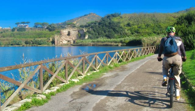
Napoli (Naples) NCL Nov 13
The port of Napoli is adjacent to the city, with no shuttle or tender required. The tour du jour with Mavin Rents was to a local vineyard north of the city. They offered pick up from the port, and got us set up with good, solid, e-bikes at their shop.

The route was on city bike paths and streets leaving the shop, emerging to a low traffic street along the stunning Pozzuoli seafront with views across to Capri. Our guide discussed the volcanic origins of the area that is still active and concerning. After riding through a historic district, a small industrial area and the ruins of the central market of the ancient Roman city of Pozzuoli, we reached the volcanic crater lake, Avernus (Lago d’Averno), “Gateway to Hades .” Across were ruins of Roman baths and a vineyard. We rode through the vineyard on a dirt path and were treated to red and white Campi Flegrei region wine made there, along with a delicious spread of local focaccia, olives, cheese and sandwiches. We had a good visit with the other participants, a nice feature when a tour includes a meal.


The ride back started out nicely around the lake, but soon led to a hilly busy artery with no bike lanes, and just a couple of views out to sea. Our one stop was to view the impressive Roman theatre site, Anfiteatro Flavio di Pozzuoli, circa 1AD, which was closed for renovations. I would have preferred to return via the scenic uncrowded coastal route instead of the busy inland route, even if it meant missing this one stop.

It turned out to be yet another fantastica exhilarating biking day from a port city. Distance: ~30 km (18 mi). Cost: 85€ via Viator.
Messina, Sicily Holland America (HAL) Nieuw Statendam, Oct 26
Messina has a compact and beautiful old town with the giant Piazza del Duomo facing the impressive Cathedral of Messina (Basilica Cattedrale di Santa Maria Assunta). Its bell tower contains the biggest and most complex mechanical and astronomical clock in the world.

At noon crowds gather to watch its gilded bronze statues move and emit sounds for 12 minutes related to Messina’s civil and religious tradition. On our second stop in Messina on the HAL cruise (Nov 7th) we made sure to catch this on our walkabout.

Downtown Messina can be easily explored by bike, or on foot, just a couple of blocks from the cruise port with no shuttles required. The signature easy scenic bike ride here is 32 km (20 miles) up and back from downtown Messina to the northeast tip of Sicily at Torre Faro where there is a quaint village, beautiful beaches, a fort, a nature preserve, and a giant tower, Pilone di Torre Faro, once used for high tension lines.
We rented e-bikes from MediterraneaBike, about 10 minutes walk from the port. The first km of cycling from downtown was dicey riding amongst impatient Sicilian drivers or on sidewalks, but a welcome seaside bike path then appeared, providing stunning views of the sea east across to the Italian mainland. Unfortunately the bike path does not continue to Torre Faro and after about 4.5 km we were once again thrown into the mix with the speedy little cars. Traffic thinned as the route led to a community along a lake, Lago di Ganzirri, and then to Torre Faro and the features described above.

A loop route wound around the other side of the lake and back the same way we came. I found this route on the Komoot app from MediterraneaBike’s web page, and it provided audible turn by turn instructions, which was very helpful for the Torre Faro loop portion at the end.
Cost: 50€, daily e-bike rental fee (no hourly). Since it is a flat route you may consider a regular bike instead for 25€. This was the 2nd and last bike that Steve could not tolerate, and he turned back halfway. It’s also the only ride I got rained on during our trip, but most of the ride was dry.
Bari HAL Nov 5
Bari is the principal city of the Puglia region of southeast Italy. Bari’s cruise port is located within a 10 to 15 minute walk of the old town district, Bari Vecchia, where bikes are allowed on the narrow streets when feasible to ride.
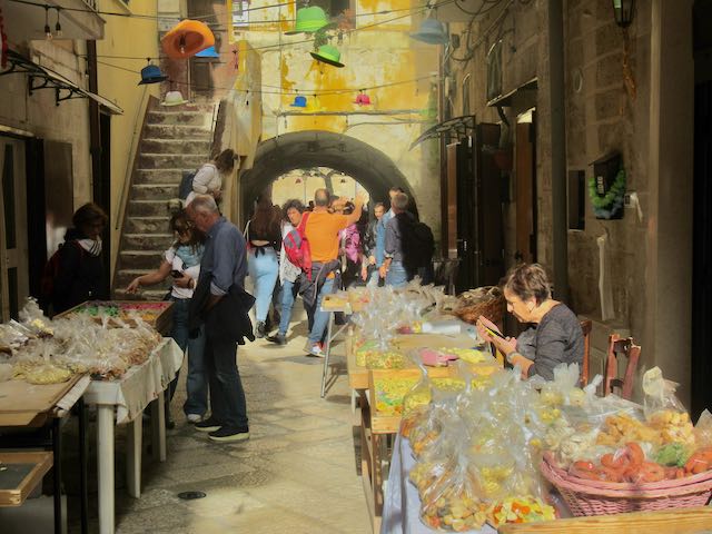
I had seen several bike tours on the usual sites, including one that included a pasta making session, but we chose the basic 2.5 hour Highlights of Bari e-bike tour operated by ToursPuglia. Our guide, Rocco, was fun, enthusiastic and proud of his city and that made us appreciate it even more. Interesting sights abound in Bari, such as ladies making and selling their pasta along the ancient streets, vendors frying polenta called Sgagliozze, and fishermen sorting and selling their catch including octopus at the harbor. Of the several historic churches, the main one is 12th Century San Nicola (Saint Nicolas) Basilica. Bari’s fortress, Castello Normanno-Svevo (Norman-Swabian Castle) was first completed in 1132.

We rode a portion of the scenic Lungomare e Murat (Bari Promenade) along the Adriatic Sea. Otherwise, biking outside Bari Vecchia in the newer sections was on a few bike paths or with traffic, sometimes in bike lanes. The e-bikes were the most comfortable of any on our trip and we would’ve liked even more actual riding with such nice bikes. Topography is fairly flat, so while it was nice to have e-bikes, they are not necessary for an easy ride.

A guided tour is the best way to navigate around Bari on bikes. We enjoyed the thorough introduction to Bari and the Puglia region, saw all the key sights, and had a great time. After leaving Rocco we walked around Bari Vecchia until we were pooped. Un’altra fantastica giornata in Italia! Cost: 52€ via Viator.
Italian Ports Not Biked
Portofino Celebrity, Oct 11: I found no biking opportunities at this tender port, but this stunningly beautiful town is better seen by a walkabout anyway, especially around the village and on paths up to the Castello Brown fort and the lighthouse with its al fresco cafes. If your ship tenders you to nearby Santa Margherita Ligure instead, Ciclomania offers rentals and tours. A scenic coastal road connects to Portofino in under 30 minutes riding.

Livorno NCL Nov 14: Livorno was the gateway for our bus excursion to Firenza (Florence). Between the required shuttle to downtown Livorno to catch the next phase of travel, and uncertainty of the timing of getting to Firenza (at least 90 minutes by bus excursion with no traffic) it was impossible to meet the bike tours’ starting times, and none were offered by the ship. Walking is the best way to see Firenza as we did, but if you have the time, the city and surrounding Tuscan countryside is lovely to experience via several bike tours offered.

Salerno HAL Oct 27, 28 Salerno was our jumping off point to tour Pompeii and the Amalfi Coast, so we didn’t bike here. No bike tours were offered here anyway, but we did enjoy a walkabout around the city.

Sorrento HAL Nov 7 We went to bed expecting to be in Salerno again, but due to damage to their cruise dock in yet another storm that we bypassed, we woke up at the tender port of beautiful Sorrento on the other end of the Amalfi Coast instead. We didn’t have the chance to look into cycling there, but walking was the perfect way to explore the town in the time allotted. If you can plan ahead it’s worth looking into e-bike tours into Sorrento’s surrounding countryside famous for its lemon groves.
GREECE
Athens Prior to HAL cruise, Oct 15
A few e-bike tours were available to explore Athens, but we were glad to have chosen Athens By Bike. One of the many features we rode by was the modern Olympic (Panathenaic) stadium, and they deserve a gold medal for finding such safe and scenic routes through this mostly bike unfriendly city.

We just followed our excellent guide, Maria, like baby ducks, I couldn’t tell you the route if I tried. We enjoyed many views of the Acropolis and other historic ruins sites and cathedrals, plus iconic neighborhoods like the Plaka and some hip areas we wouldn’t have known about otherwise.

Maria was thoroughly versed on historic and contemporary trends and attitudes. The wide city bike tires helped navigate some of the uneven cobblestone streets, and the few hills made us glad to have e-bikes, which were comfortable and worked well. It was a great way to see the highlights of Athens, and we had a wonderful outing on this sunny Greek Sunday morning. Cost: 50€ via GetYourGuide

We stayed overnight near the Acropolis after flying in from Rome, and the tour started nearby the next morning. If you are here on a port day mid-cruise you could take the train in from the Piraeus port but most likely you’ll need to take a taxi to make a tour’s start time. We dashed to the port after the tour in a taxi (20€ ) to catch our Holland America 25-day Adriatic cruise, complete with two new pickleball courts, what paradise.
Corfu HAL Nov 1
Large cruise ships can dock at Corfu town (Kerkyra), the main town on the island. A free shuttle takes passengers to a terminal building, although it is also walkable. The main attraction is the Old Town, a UNESCO World Heritage Site about 30 minutes walking from the port exit, or via city bus or cruise ship shuttle.

No bike tours were available from near the port, but Corfu Port Bicycles was just a 10 minute walk from the terminal exit. We had reserved, then rented two solid comfortable e-bikes there. The proprietor, George, outlined an optimal route for us on a Corfu tourist map I had picked up. It was mostly on roads with traffic, but speeds were low and he assured us it was a safe endeavor. The route first passed the newer 1600’s Venetian fortress, then around to the impressive Byzantine Era old fortress topped by the 14th century Venetian Palaio Frourio, situated on an island east of town. Bikes are allowed all through the narrow winding streets of Old Town between the two fortresses, which was fun riding, especially earlier when it was less busy.

After exploring all over town we followed the coastal route south. We hopped on a brick bike path that parallels part of the Leof. Dimokratias coastal road, which was a nice relief from riding on streets for a while. An attraction en route is Mon Repos Estate, birthplace of QE2’s husband Prince Philip, Duke of Edinburgh. A car-free lane through a wooded nature park ends at the small seaside palace, now housing an archeological museum, a filming location from the PBS show The Durrell’s in Corfu. Beyond is a dirt path that leads to the ruins of the ancient Doric temple of Kardaki. Back on the main road we followed signs to the small town of Kanoni, and sipped a cold drink at an outdoor cafe overlooking an island with the Holy Monastery of Panagia Vlacherna on it, as well as the end of Corfu airport’s (Ioannis Kapodistrias) runway.

We rode back to Corfu town, choosing some different streets in Old Town this time, stopping for gelato and some shopping. It was a beautiful day, and we thoroughly enjoyed riding around for 4 hours, going about 20 km (12 mi). Cost: 25€ booked directly. Corfu is a large hilly island, and there are opportunities to bike elsewhere, where other rental companies and tours may be available, although that would be trickier to coordinate with your time at port.
Chania, Crete HAL Oct 24
Crete is the largest of the Greek islands and offers some spectacular biking along the coast or in its interior mountain ranges. The two major cruise ports are Heraklion and Souda port near Chania, where our ship docked. An easy 20 minute city shuttle bus (3€ round trip) from the port drops passengers off in the center of Chania.

Unfortunately, no tour companies offered coastal e-bike adventures to cruise passengers from Chania, whereas lots of great opportunities exist on Crete if you are here for a longer period.
Since Steve was under the weather on this day I couldn’t do the “two person minimum” e-bike tour of Theriso Gorge booked with Fit in Crete (who kept our 40€ deposit) but I was able to book last minute with Ride Around Chania, whose shop is a 10-minute walk from the shuttle stop.

They only offered acoustic city bikes but that was fine for this locale. Our local Greek guide, Dimitre, was passionate in his thorough depiction of the area’s rich history and description of more current events and controversies. This is exactly what I hope for in these tours, an immersion into the local culture, combined with a very scenic bike ride. He showed the three participants all the highlights including the houses of worship, fortifications, and cultural points of interest including explanations of some significant graffiti. Chania’s touristic area extends from the stunning crescent shaped Venetian waterfront harbor promenade, with a fort and city walls, several blocks into the old city with its narrow streets and alleys.

The route varied from crowded alleys and seaside promenades to wider streets with less crowds, and a couple of hills that were manageable without e-assist. Dimitre later served us a special iced tea and nutrition bars at an overlook of the harbor. It was once again a very enjoyable bike tour, then Steve was able to meet up for gelato in town afterwards, the important part. Cost: 40€ booked directly, also available through apps.
Greek Ports Not Biked
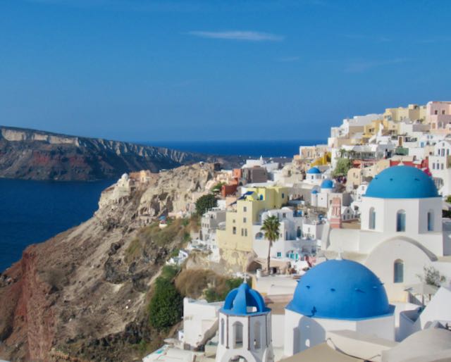
Santorini HAL Oct 17 Cruise ships tender ashore at picturesque Fira (weather permitting), but the town of Oia is the one seen in most pictures of Santorini with the whitewashed white and blue buildings on cliffs overlooking the sea. Our original plan was to do the fabled 10 km (6 mi) hike one way along the rim of the extinct caldera between Fira and Oia, but we’re glad we spent all of our time strolling around magical Oia, having one of our favorite days of the trip. Getting back to Fira’s port took some doing, but it was well worth it. Bike rentals and tours are available on the island, better suited for longer stays or if you’ve already seen Oia.
Napflio, Peloponnese HAL Oct 18 An acoustic bike tour was offered by Land Life Travel for ~100€ but in a city we thought could easily be seen on foot that seemed way too expensive for a short tour with no e-bike. After tendering ashore we enjoyed the day in this lovely former capital of Greece doing a walkabout along the scenic seaside promenade and through town with its Venetian square, stopping for Greek coffee, Greek lunch, and gelato.

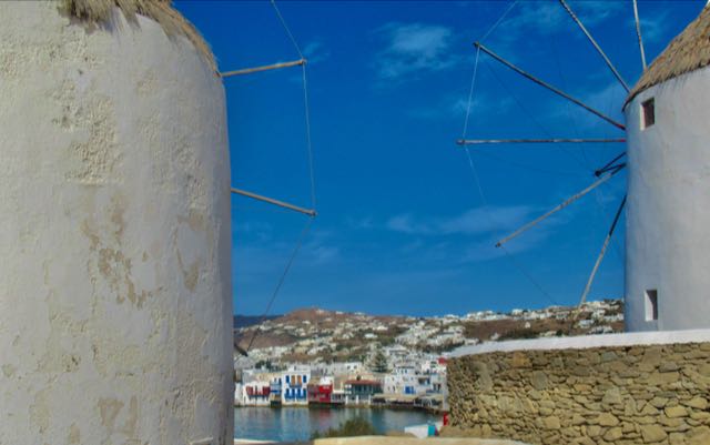
Mykonos HAL Oct 23 We had only a short day and a tender to deal with at Mykonos, with no easily accessible bike rentals or tours available at the port. Walking around the beautiful Greek village was the thing to do here anyway, viewing the famous windmills and Little Venice. If you have more time here you may want to check out popular Yummy Pedals tours, which would require a taxi to get to from the port.
Near Greece: Croatian and Albanian Ports Not Biked
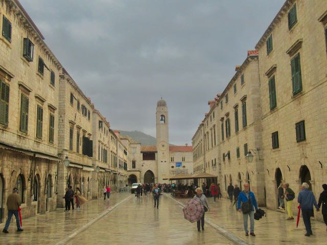
Dubrovnik Oct 31 HAL Bikes are not allowed in Dubrovnik’s spectacular Old Town, aka Kings Landing from Game of Thrones. We did a self-guided walking tour here. If you’ve already experienced Old Town, you can seek out bike tours into the Dalmation countryside.
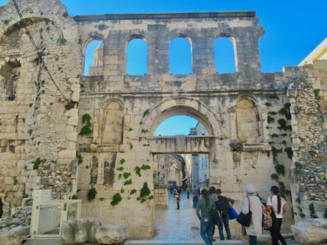
Split, Croatia Nov 3 HAL No bike tours were available on our port day, but you can look into e-bike tours that go up Marjan Hill for pano views. We enjoyed a self guided walking tour of the incredible Diocletian’s Palace and surrounding city that kept us busy all day.
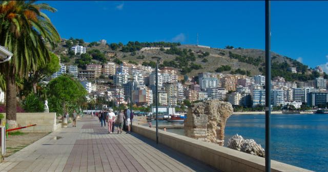
Sarandë, Albania Nov 2 HAL No cycling opportunities were available here, so we just strolled around town including the extensive beautiful waterfront promenade and savored the signature Albanian dish, tavë kosi. Just being in Albania was something new and different.
TüRKIYE
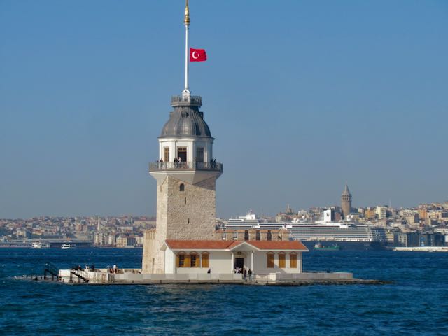
Istanbul Oct 21, 22 HAL
Cruise ships dock at the new Galataport complex on the European side of Istanbul, where we had fabulous views of the city right from the ship. An epic walk was required to get out of the huge port complex, but it led to the adjacent chic Galata district. The main attractions of the Golden Horn across Galata Bridge was a 25 minute walk from there.

Istanbul spans two continents, and the prospect of doing a Eurasia ride was too exciting to pass up, despite there being no e-bikes available for a fairly hefty 30 km (19 mi) tour. Since our ship was staying overnight, there was no issue with making it back in time, although the promised 2:00 pm ending time would usually be sufficient. We took taxis for 15€ each way to get to tour provider Istanbul on Bike in the Balat district rather than trying to figure out the crowded tram system.

The acoustic city bikes provided were adequate with multi gears and comfort positions. Our local guides Ramo and Ceyda led us through back streets to a ferry terminal, and we enjoyed a 30 minute uncrowded ferry ride to Üsküdar on the Asian side, taking in views of Galata Bridge, Topkapi Palace, Hagia Sophia, Maiden Tower, Süleymaniye Mosque, and the Bosphorus Bridge en route.
In Asia we were greeted by very scenic waterfront promenades and bike paths as we rode generally south along the Bosphorus Strait. When a Ukrainian freighter sailed by it underscored the international importance of this waterway. After a detour on roads over a small hill, bike paths continued around an inlet, past Kalamış Park and Yacht Marina, and then to Fenerbahce Park, where friendly feral cats climbed all over us and purred as the group sat on park benches. This was a highlight of the ride, especially for the British dad and his two teen daughters who were also on the tour.

We stopped for lunch and Turkish tea (not included in tour price) at the waterfront Romantica Cafe in the park, which overlooks the Princes’ islands, a popular bicycling location.

On the return route we rode on sidewalks and busy city streets to a Kadıköy pier for a crowded ferry ride to Karakoy back on the European side. From there a waterfront bike path led to the Atatürk Bridge over Golden Horn Bay with stellar vistas from its wide bike/ped path of the Golden Horn sites described above. Escalators and elevators were available to transport the bikes to and from bridge level. We then rode through a matrix of interesting narrow streets in Balat back to the shop.

Our guides were very informative, welcoming and fun; we felt like we really experienced Istanbul with the locals. It was a wonderful exhilarating, fascinating 5+ hour outing on a beautiful October day. Cost: 60€ booked direct, cash only. (Apps charge ~85€).
Turkish Port Not Biked
Kusadasi Oct 19, HAL This seaside resort city with a large bazaar district is the gateway to the amazing Ephesus ruins. Because of this we didn’t consider looking into biking here and enjoyed our minibus excursion to Ephesus very much, returning to walk around Kusadasi and eat Turkish food.

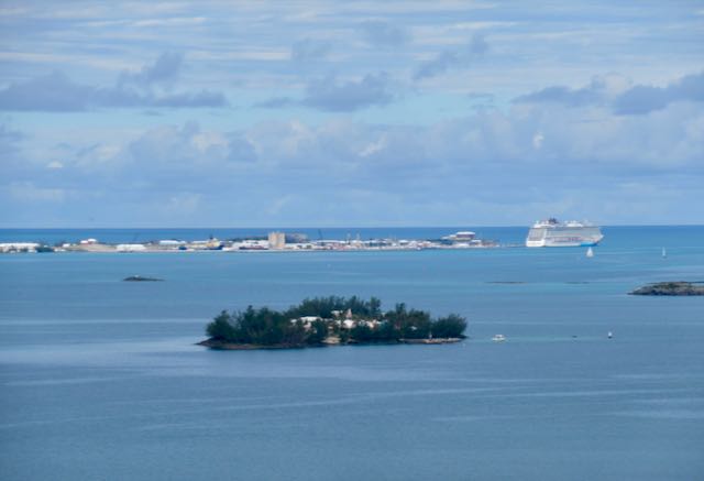
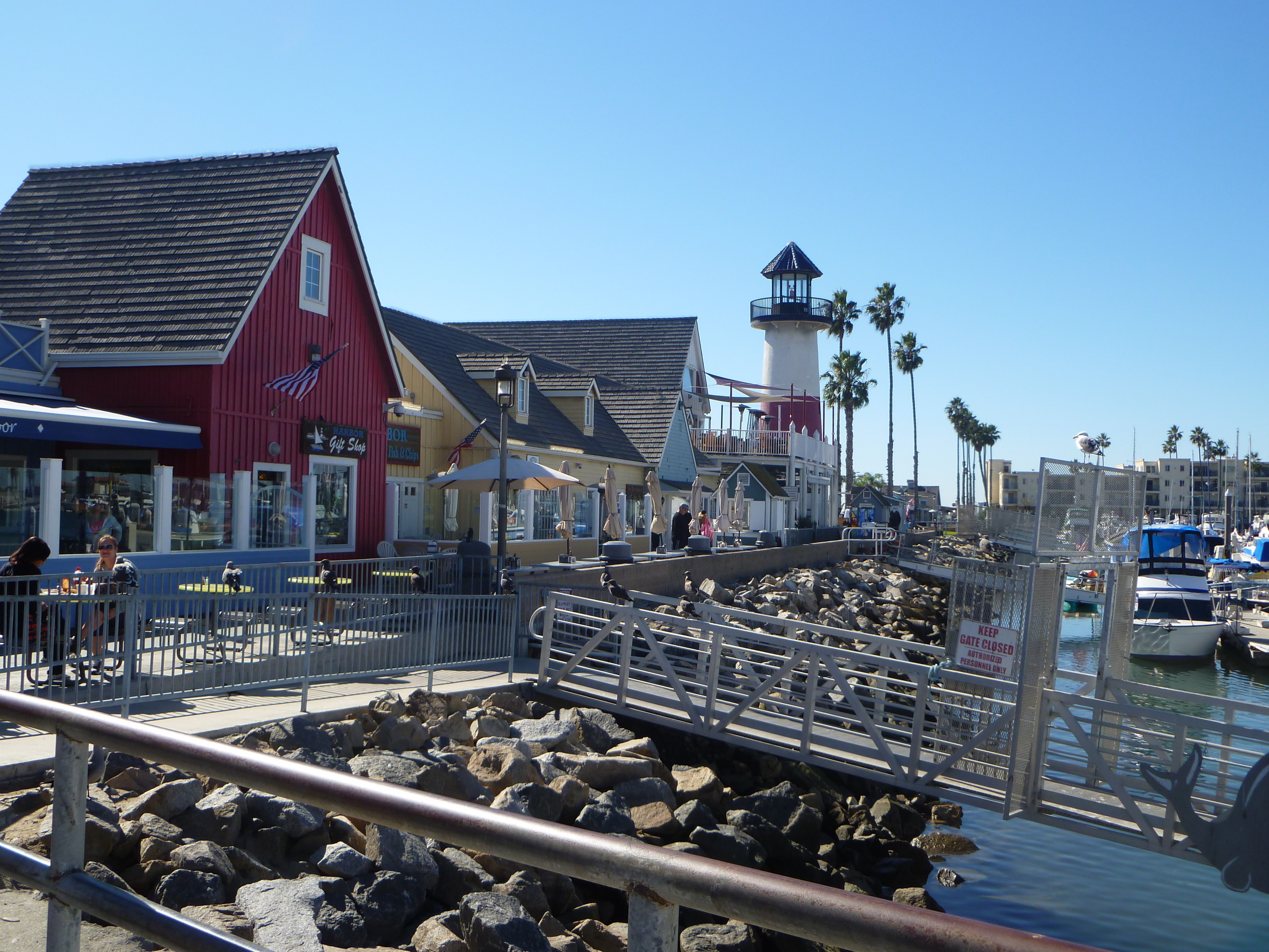
Bermuda – Atlantic Crossings
Epilogue Epilogo
We had the time of our lives on this fabulous 71 day trip, the highlight of which were three weeks’ worth of bike tours in spectacular world class locations spread out along the way. It’s not a substitute for those catered hosted bike tours, such as by VBT, but we had lots of time to spend and not lots of money, so it was perfect. We probably got in 2 1/2 months of travel for the cost of 2 1/2 weeks with those, and we had a long bucket list of places to see all across the region that was accomplished on this trip. It was also perfect for us as a couple, since I’m more of an avid cyclist than Steve, who probably wouldn’t enjoy an all-cycling vacation with long days in the saddle, so it was fortunate how we were able to intersperse the bike rides with other activities. Of course it required a ton of planning to find activities at each port, versus a catered bike tour where everything is done for you. Although I planned most of the outings well in advance, we could still alter activities almost last minute based on weather, illness/injury, or if we discovered something better.

We had to adapt to a different rental bike each time, which was fine for me with my average 5’9″ height, and I actually enjoyed experiencing different bikes. However, it was more of an issue for 6’5″ Steve. I always made advanced requests for a larger size bike, but in two instances the bikes were very uncomfortable for him. So, if you are very tall, or very short for that matter, inquire in advance to ensure that they reserve a bike that fits. Many have minimum height requirements, and a few have weight limits for their bikes.

A risk with any independent tour excursion is if the ship does not end up docking at the port because of weather with less than a day’s cancellation notice, some businesses may not issue a refund for that circumstance. Thankfully that never happened to us on this trip.
All the bike companies provided optional helmets, which were not ideal but they always had one that fit us and we didn’t have to take up room in the suitcases with our own, or have to carry them around the ports after the tours. Perhaps bring a doo rag for sanitary purposes if that’s a concern, and bring your own bike gloves. I brought a portable USB tire inflator (that I never needed) that also served as a battery backup for the phone, but it was heavy. A backpack was helpful since not all bikes had places to carry even a water bottle. Several outfits offered panniers to carry items like a lock for the rental bikes. I would have liked to have a clip-on mirror for riding in traffic.
Does this kind of trip sound good? Go for it! You’re not getting any younger.
Bon voyage! Rrugë të mbarë! Bon viatge! Sretan put! Kaló taksídi! Buon viaggo! Boa viagem! Buen viaje! Iyi yolculuklar!


 My guidebook enCYCLEpedia Southern California – The Best Easy Scenic Bike Rides (3rd Ed, 2021) contains detailed ride descriptions through the most scenic areas,


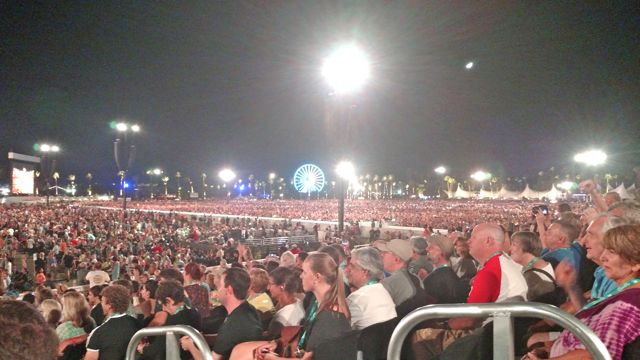
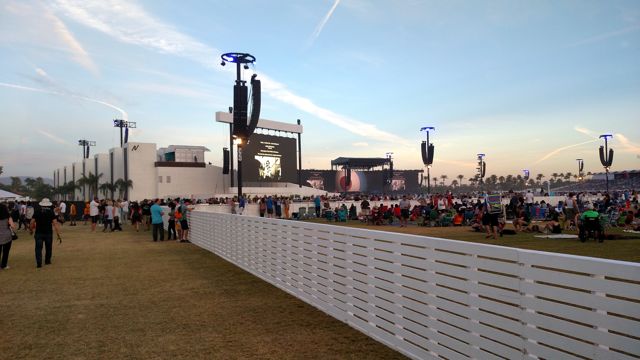
 Logistics of getting to a massive event (70-80,000 folks expected) was a concern, but as avid casual cyclists we decided to try and ride our bikes to the event. The venue maps that came in the Desert Trip box with the tickets (along with the 3D view master) showed designated color-coded routes and bike parking areas; it looked simple. On Day 1, we visited friends that live near the northeast corner of the venue, left the car there and biked in. It was a nice and flat ride, only a couple of miles. However none of the many people directing traffic knew where to direct bikes. There was supposedly a “Yellow Path” starting near Madison and 49th, but we never found it. Instead, we rode with cars through the very dusty dirt Platinum lot, for those that had purchased the $1,700 tickets. We were told to lock our bikes to a fence near the venue entry, and we went in with the VIP ticket holders, a short distance from the main venue. Security was tight, with no liquids allowed, similar to airport security, only empty bottles with water fill up stations inside. They had metal scanners and guards with wands. I was glad for the extra security, as this event would seem to be a high profile target.