SANDAG’s Go By Bike initiative continues to expand bikeways throughout San Diego. An interactive map depicts current and future bike lanes, protected Cycle Tracks and bike paths in the region.
Some of the most interesting places to bike in downtown San Diego are along the vibrant waterfront path and up in Balboa Park. Previously, to connect the two areas, cyclists had to contend with on-street bike routes, commingling with traffic. Now cyclists can get between these areas on Class IV Cycle Tracks. Cycle Tracks are bike lanes adjacent to streets with physical barriers from traffic and can be one-way or two-way. SANDAG also went the extra mile by installing bike traffic signals and where appropriate red no-turn arrows for vehicles when the bike signals are green to prevent hook type crashes.
The new 5th Ave one-way northbound Cycle Track features bike signals. There are no crossing buttons for cyclists, but appear to be cameras to sense their presence.
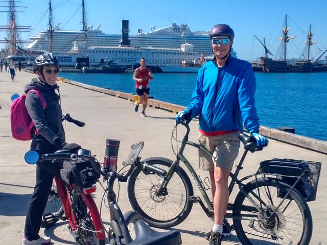
The multi-use paths along the San Diego waterfront are visually spectacular, although portions tend to get crowded with tourists, best visited at off-peak times. The interesting vistas and points of interest make it worthwhile though, including the Maritime Museum, Midway Aircraft Carrier Museum, cruise ships, and many other highlights.
Update, as of 2024 the Port has put up “No E-Bikes” signs on its harbor paths.
Maritime Museum and cruise ship in port.
The “Victory Kiss” statue in front of the Midway museum.
Cyclists need to detour around, or walk bikes through the popular Seaport Village complex, and in the future expect a major redevelopment project there. The harbor bike tour can be staged in many places. We’ve used Shelter and Harbor Islands in the past, but now prefer the new diverse massive Liberty Station complex (parks, restaurants, museums, grocery, etc) located up an inlet of San Diego Bay. A bike path goes under Harbor Drive and connects with the harborfont path. The harbor tour ride is described in enCYCLEpedia as ride SD4.
Waterfront path along a bay inlet, along the Liberty Station complex, a good staging spot.
San Diego view from the harborfront pathway.
Currently, protected Cycle Tracks cut across downtown San Diego east-west on Beech and J streets. You can get to Beech St from the harbor path by crossing at the light at Ash St and cutting through the park to the left.
Start of the two-way Beech St E-W Cycle Track just past Kettner Blvd
After the Cycle Track starts past Kettner Blvd the next block is India St (one-way north). The main part of the Little Italy district is to the left (north) here where you can find lots of sidewalk dining and the ped-only Piazza della Famiglia at Date St (below). We walked our bikes through here to get to Columbia St, which is one-way south, back to Beech. Grape St is another option.
On another occasion we biked here for “slices” and enjoyed some at Mr. Moto’s Pizza across from the Piazza:
The Beech St Cycle Track intersects the Cycle Track on 4th Ave (one way south) which extends south to B St but just ends there, so is not recommended from here. Next, the 5th Ave Track that starts at B St a few blocks south of here heads one way to the north. The Beech Track ends at 6th Ave, where a 2-way Track heads to the south only.
To do a loop up to Balboa Park/Zoo and the hip Hillcrest district, take the new 5th Ave Cycle Track north (1st photo, above). E-bikes have an edge here since it is an uphill journey. Once you near the top of the hill, next to Balboa Park, you’ll cross under the San Diego airport landing pattern, close overhead. To visit Balboa Park, take Laurel St to the right. It becomes El Prado past 6th Ave and crosses over a tall concrete bridge with the 163 freeway far below.
Tour around on the park roads. Our favorite route around the park is described in enCYCLEpedia’s ride SD6. The San Diego Zoo is adjacent to the north. If you’re a local, consider becoming a zoo member so you can just pop in whenever you want and visit your favorite animals.
Exit the park the same way, but look for a bike path to the right before reaching Balboa Dr and 6th Ave. It ends at Upas St. Cross 6th Ave and return to the 5th Ave Cycle Track heading north if you want to explore or dine in Hillcrest, or else go to 4th Ave and head south in its Cycle Track. There certainly are plenty of great dining options in Hillcrest, many along the Cycle Tracks.
We stopped for brunch along the 5th Ave path at Snooze, and although no tables were available on the patio, they let us bring our expensive e-bikes inside so we could be seated immediately.
The 5th Ave Cycle Track ends at Washington. The connection along Washington to the 4th Ave Cycle Track to head south was awkward, it needs work. You may want to cross over before Washington. The one-way southbound 4th Ave route is part Cycle Track and part buffered bike lane. Warning, you may want to stop at Babycakes bakery en route. We encountered a one-block detour onto the roadway in March 2022.
Returning to Beech St, head left on the Track to 6th Ave, then cross it and turn right onto the 2-way Cycle Track.
This is a busy section of downtown, so expect lots of stops at lights, but thankfully they are all equipped with bike signals coordinated with “no turn” signals for vehicles. This Cycle Track skirts the Gaslamp Quarter, passes the east-west track on J St (an option to return to the waterfront) and ends at L Street. Cross L and make your way to a plaza to the right to reach 5th Ave. Use the 5th Ave signal to cross the tracks, the MLK rail trail, and Harbor Dr. Go left in the Harbor Dr bike lane to the first light at Park Blvd. Cross Park and take the sidewalk on the right that leads to the waterfront path next to the Hilton San Diego Bayfront.
Wind sculptures next to the Hilton San Diego Bayfront, Petco Park (Padres) beyond, Convention Center to the left.
From here complete the loop along the harborfront paths (~20 miles staged from Liberty Station). Check out the new state of the art Rady Shell venue at Jacobs Park, Embarcadero Marina Park South across from the Convention Center. Bike to the summer concert series by the San Diego Philharmonic, and others.
The passenger/bike ferry to Coronado also leaves from this area (next to Joe’s Crab Shack) but that’s the subject of another post (and enCYCLEpedia Ride SD7). Either take the ferry and ride over there, then take the ferry back, or do a ~24 mile loop around the bay via Imperial Beach and other cities.
Harbor pedestrian ferry allows bikes for no extra$. Boats leave to Coronado Ferry Landing from the Convention Center area or for a longer ride on a larger boat for the same price, the downtown waterfront.
Europe is known for it’s extended bike trail systems like EuroVelo 6 through lovely villages, pastoral countryside, and medieval cities. The routes along pretty rivers such as the Danube attract thousands of cyclists, and easy access to rail enables hopping from place to place. Although Southern California does not offer the same wealth of cycling infrastructure, it does have its fair share of bike trails and pleasant bike routes that are conducive to touring the region on two wheels. Using its bike friendly rail system, cyclists can experience a Euro-style holiday, particularly along its spectacular coastal region that attracts visitors from the world over to its beautiful beaches and charming towns, many with Spanish-influenced architecture. A trip can last a weekend or a month, depending on schedule and budget. If being away from your car is too inconvenient, you can still use the trains to cover more ground on day trips.
My guidebook enCYCLEpedia Southern California – The Best Easy Scenic Bike Rides (3rd Ed, 2021) contains detailed ride descriptions through the most scenic areas, referenced throughout this article. enCYCLEpedia‘s rides are geared for the average cyclist who prefers to stay away from traffic whenever possible, and avoid high speed, dangerous, or very hilly roads.
The goal of this journey is to use the train to access the most desirable areas, and skip over the parts that are overly difficult, dangerous, or uninteresting. Based on our experiences, the zen of taking a bike on the train adds to the excitement of it all. Options are also mentioned for more advanced riders who may prefer to ride through some of those areas anyway rather than taking the train past them.
You’ll find lots of accommodation options in the featured locales, and if you prefer bike camping, many of the coastal State Parks have reservable tent sites, but they fill fast at peak times, so advance planning is required. A few also have non reservable bike-in campsites, although spaces are not guaranteed, especially on summer weekends.
The northern part of our trip (San Luis Obispo to Los Angeles) is serviced primarily by the bike-friendly Amtrak Surfliner line that runs from San Luis Obispo to San Diego, stopping at many of the lovely locales described. To travel on the Surfliner, you will need some advance planning, since a free reservation is required to bring your bike along. The good news is it doesn’t have to be boxed like on other Amtrak lines. From LA’s Union Station and south, lots of options open up for less expensive and more bike-friendly commuter lines.
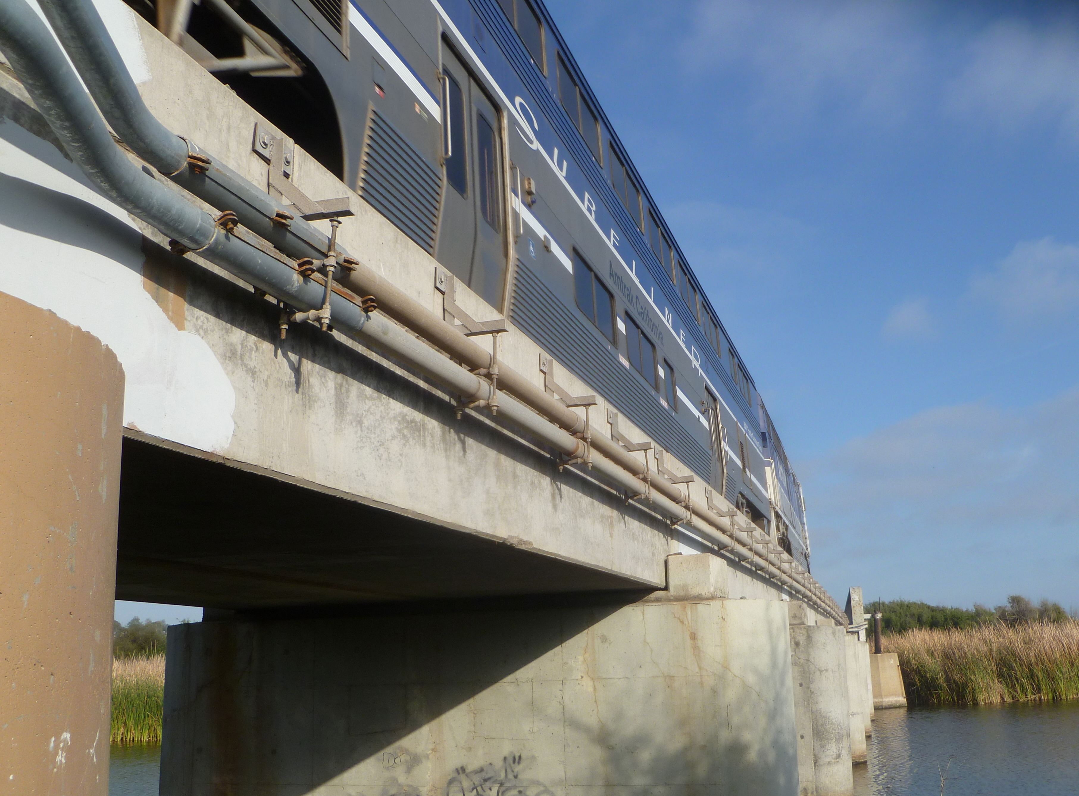
Amtrak Surfliner on rebuilt “trestles” next to San Clemente’s famous Trestles surf beach (SC3).
Whistlestop 1: San Luis Obispo (SLO)
Taking the Amtrak Surfliner north from Los Angeles to San Luis Obispo, or SLO Town, is a world class spectacular ride, with California coastal scenery on display between Ventura and Pismo Beach, much of which is not even accessible to the public past Santa Barbara. If you arrive in SLO from the north via Amtrak’s Coast Starlight train, it is also scenic but is not along the coast, as that would mean it would be along the Big Sur coast, which can barely handle a roadway. The Coast Starlight (between LA and Seattle) is not as bike friendly, since bikes need to be boxed and incur baggage and box fees.
View of the Santa Barbara County coastline from the Surfliner.
SLO Town is a charming university city about 13 miles inland from the coastal town of Morro Bay. While SLO Town does not have much in the way of bike trails, it does have bike friendly streets and plenty of desirable places to sleep and eat in the vital downtown sector west of the train depot. It is a good place to spend some time to explore, provision and get oriented. You can try a wine country tour, or a popular bike route to the coast at Los Osos/Morro Bay via Los Osos Valley Road.
Mission San Luis Obispo de Tolosa, downtown SLO
At the coast you can explore Morro Bay, which offers some delightful coastal riding (enCYCLE Ride MB1), and lots of accommodations (reserve for best selection in summer) and popular waterfront seafood restaurants. To its south is Montana de Oro State Park (Ride MB2), a coastal gem with a couple of great easy rides on packed dirt, some more challenging mountain biking, and spectacular hiking trails. Bike-in or reservable tent camping is available at Morro Bay, Morro Strand, and Montana de Oro State Parks.
Bike path to Morro Rock in Morro Bay (MB1)
Whistlestop 2: Grover Beach/Pismo Beach
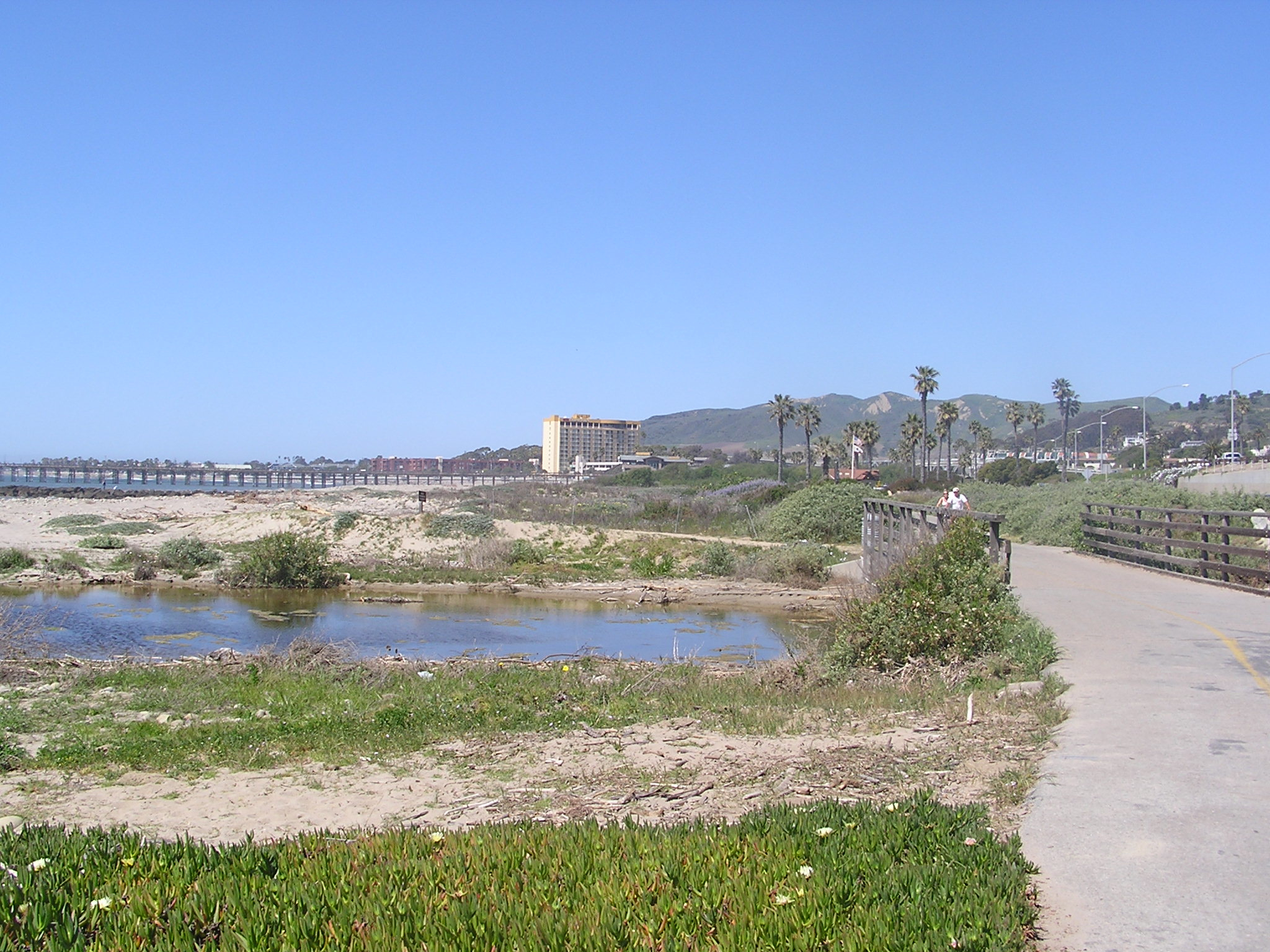
Pubic passage south down the coast from Morro Bay is blocked by the Diablo Canyon nuclear plant property, so you’ll need to ride back to SLO. Continuing south from SLO you can either ride along Class II roads adjacent to Hwy 101 (or a steep route over the hills on dirt roads) or take the Surfliner to the next stop in Grover Beach/Pismo Beach. If you cycle, your next destination can be the small, quaint beach community of Avila Beach, with the last few miles along the lovely creekside Bob Jones Trail, that will someday connect to SLO, making that a must-do stretch by bike (Ride AV1). Continue riding south to the Pismo station from Avila Beach. You can also reach Avila Beach on a scenic coastal Class II bike route north from the Pismo station if you choose that option.
Avila Beach Pier (AV1)
Pismo Beach is the southern end of our recommended exploration in SLO County, and the train station is just south of town in Grover Beach. There’s no bike trails in town, yet, so hop on the bike lanes along Hwy 1 and head north into town (Ride PB2), past several public campgrounds, and the spot where the Monarch butterflies congregate in winter. The delightful downtown has a bunch of restaurants and accommodations. At lower tides, you can ride on the compact sands of the wide beautiful beach here, our only recommended SoCal beach ride (Ride PB1). The route north of downtown (Ride PB3) is on Class 2 lanes of a fairly busy roadway, but the ocean vistas are spectacular in places and you can detour to the waterfront and ride on some parkside trails. If you chose to ride all the way south from SLO, you’ll be southbound on that route toward downtown and the Pismo station. And now, back to the Surfliner for our next destination.
Riding the compact sands of Pismo Beach (PB1)
Whistlestop 3: Surf Beach/Lompoc, Santa Barbara County
An optional stop, Surf Beach is the loneliest Amtrak stop along the coast, located in a beach parking lot adjacent to Vandenberg Air Force Base. You can walk for miles along the beautiful beach, but signs warn against swimming here due to two fatal shark attacks. Amtrak doesn’t stop here often, so schedule carefully.
The lonely Surf Amtrak Station, 9 miles west of Lompoc (LOM1)
From here you can easily ride to pretty Ocean Beach County Park at the delta of the Santa Ynez River. For grub and overnight accommodations, including hotels, B&B’s, and camping (River Park), the city of Lompoc awaits (Ride LOM1). The City of Arts and Flowers with murals on its downtown buildings is reached via a flat 9 mile ride along Class II Ocean Ave (55 mph speed), an interesting stretch when the fields of cultivated flowers are in bloom in spring and summer. Lompoc is not as appealing as some of the other coastal towns, but is a good place to restock and refresh.
Those in tip top condition may consider a road trip over substantial and steep hills and windy rural roads, to isolated Jalama County Beach, where there is a beach campground and general store and grill. If you took the Surfliner northbound you would’ve gone right by it. This would make an epic weekend trip on its own from the big city.
Another option, though risky logistically, is to take the Wine Country Express bus from Lompoc to the Danish tourist village of Solvang, and explore the beautiful Santa Barbara Wine Country in Los Olivos and Santa Ynez by bike (Ride SO1). Buses have bike racks, but can take only a couple at a time. You could also leave your bikes at your Lompoc accommodation, take the bus, and rent bikes in Solvang.
Whistlestops 4, 5, 6, 7: Goleta, Santa Barbara, Carpinteria, Ventura
The ride between Lompoc and Santa Barbara is very hilly and/or along the 101 Freeway, only for the most advanced riders. So, all aboard the Surfliner at Surf! The corridor between the next stops of Goleta, Santa Barbara, Carpinteria and Ventura is rideable by most cyclists, so you can pick and choose where you’d like to explore, how far to ride, and when to use the Surfliner to help you out.
From the Goleta Station, ride to the coast and explore the beautiful paths along the University of California at Santa Barbara (Ride SB2).
Paths around the UCSB Lagoon (SB2)
Class I and II routes connect to the downtown and waterfront district of Santa Barbara (Ride SB1). A scenic beachfront path passes a multitude of restaurants and accommodations there, although there is no bike camping in town. The Amtrak station is in the center of town, so if you disembark there, you can easily explore the extensive Spanish-influenced downtown and beautiful waterfront.
Cabrillo Beachway, Santa Barbara Waterfront (SB1)
A Class II route, very doable but not the most wonderful, leads through the tony community of Montecito, then Summerland, to the lovely low-key beach town of Carpinteria, and the next Amtrak station (Ride SB1, Option 2). Find lots of great restaurants and choice of accommodations from B&B’s to bike-in and reservable campsites at Carpinteria State Beach.
Someday there will be a bike path connecting Carpinteria to the new path to Ventura, but for now there is only a 3-mile fairly hilly on-road route. If you are willing to tackle that, the reward is the new waterfront bike path adjacent to the 101 Freeway that leads to the north end of Ventura (Ride VE4). You could also access it if you take the train directly to Ventura and ride north.
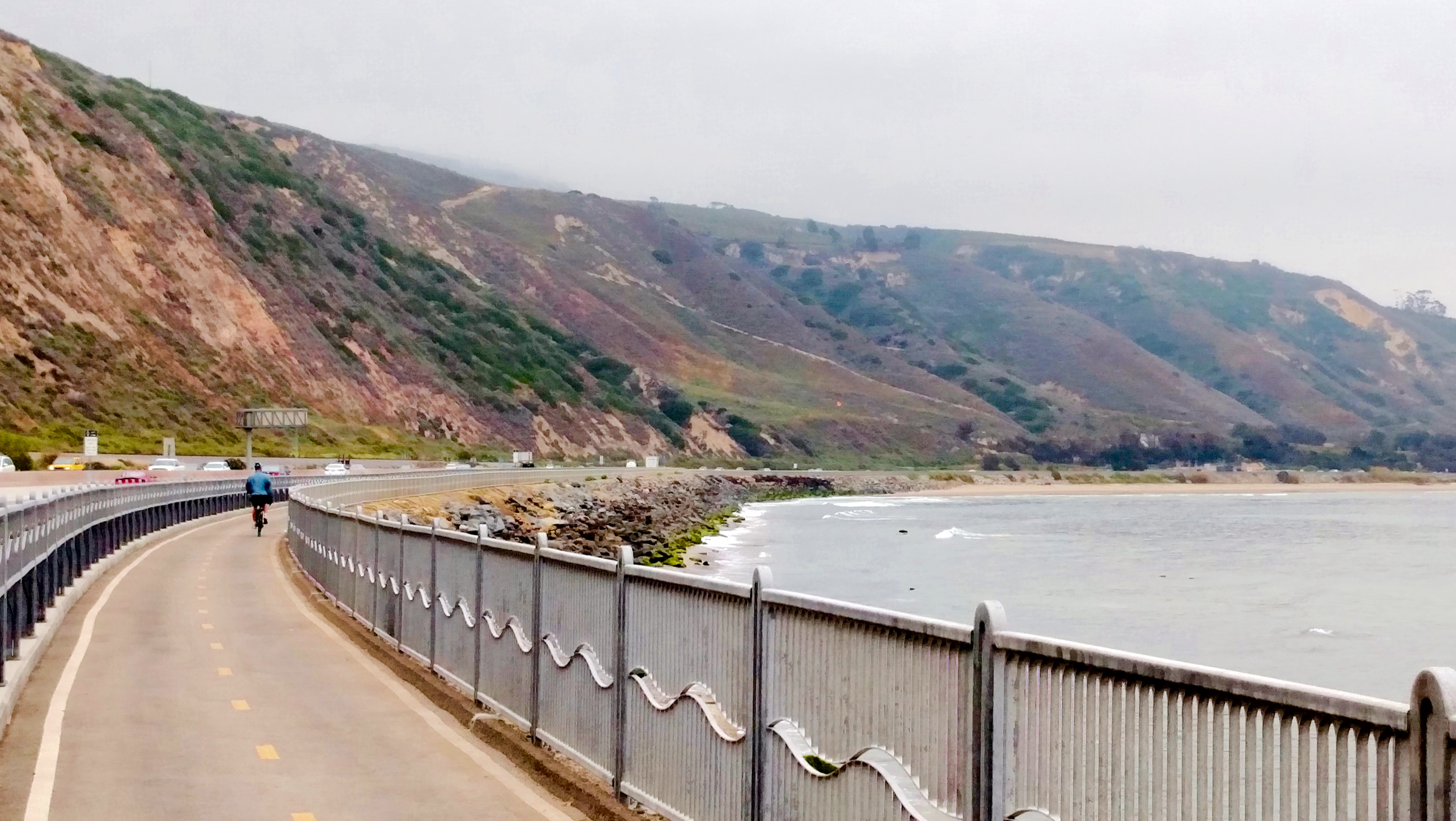
Rincon Bike Path along US 101 between Carpinteria and Ventura (VE4)
The bike path ends on the Old Rincon Hwy, a popular bike route that leads to the Ventura waterfront trail system (Ride VE1). Via that path you can access the historic downtown center, enjoy the beautiful coastline and pier, and find all sorts of restaurants and accommodations. The depot is downtown between the beach and Main Street. Bike-in and reservable camping are available at McGrath State Beach nearby in Oxnard.
Path through San Buenaventura State Beach near downtown Ventura (VE1)
From Ventura consider riding up a scenic rail trail about 16 miles inland to the lovely spa resort town of Ojai, either as a day trip and lunch stop or an overnight destination (Rides VE2 and 3). Camping is available at two county parks near the route.
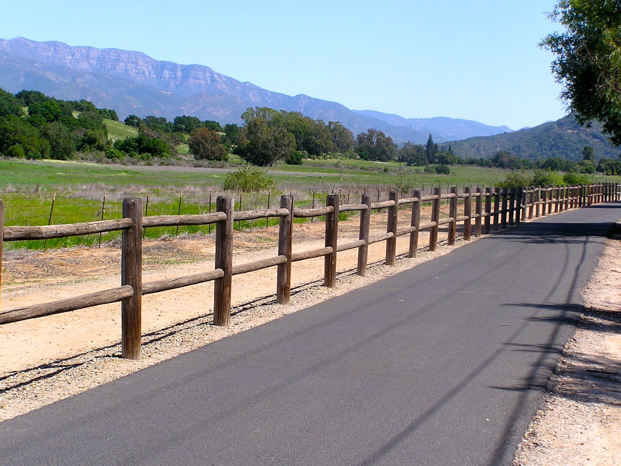
Rail trail through the Ojai Valley (VE3)
Ventura is the last stop for the northern part of our adventure. Cycling south from Ventura is only for very experienced cyclists. The subsequent 50-mile coastal route first passes through the city of Oxnard, while the last 35 miles is along the busy, hilly, speedy, Coast Highway to and through Malibu. The reward is that it ends up on the fabulous 22-mile Los Angeles beach trail. But you can also access that path by taking local rail from downtown, along our rail route. So, most of you will want to hop on the Surfliner in Ventura and head to downtown LA. Or, make your way across town to Oxnard and take the more bike friendly Metrolink commuter train from that route’s western terminus (weekdays only).
Whistlestop 8: Los Angeles Union Station
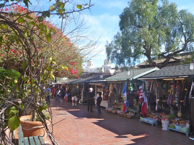
Historic Union Station is an attraction in itself, but riding in downtown LA is not for the faint of heart, except perhaps early on a Sunday morning. However, if you can very securely lock up your bike and belongings, or find an accommodation nearby, it is a worthwhile area to spend some time exploring on foot, with attractions such as the touristy Olvera Street, El Pueblo de Los Angeles, Chinatown, and lots more.
Historic Olvera Street near LA’s Union Station
From Union Station you have a choice, depending on your timing and preferences. Logistically, the easiest thing to do is hop on Metrolink’s Orange County Line, and head south to our next stop, San Juan Capistrano. Or, if you would like to experience LA and Orange County’s best and most fabulous coastal trails, joining up with the train route further south, make the following extra trip using local Metro Rail:
Extra Trip: The Urban LA and OC Coastal Paths
LA County’s world renowned beach trail runs some 22 miles through Santa Monica and Venice, Hermosa, Manhattan and Redondo Beaches (Rides LA1 and 2). Metro Rail’s new Exposition Line can get you there: Take the Red or Purple lines from Union Station to meet the Expo Line, and get off at its terminus in Santa Monica. There’s no tent camping along the coast, so you’ll need hotel accommodations near the beach communities, preferably as close to the beach as possible to avoid some dicey areas and possibly dangerous street riding
North end of LA coastal bike trail aka Martin Braude Trail (LA1)
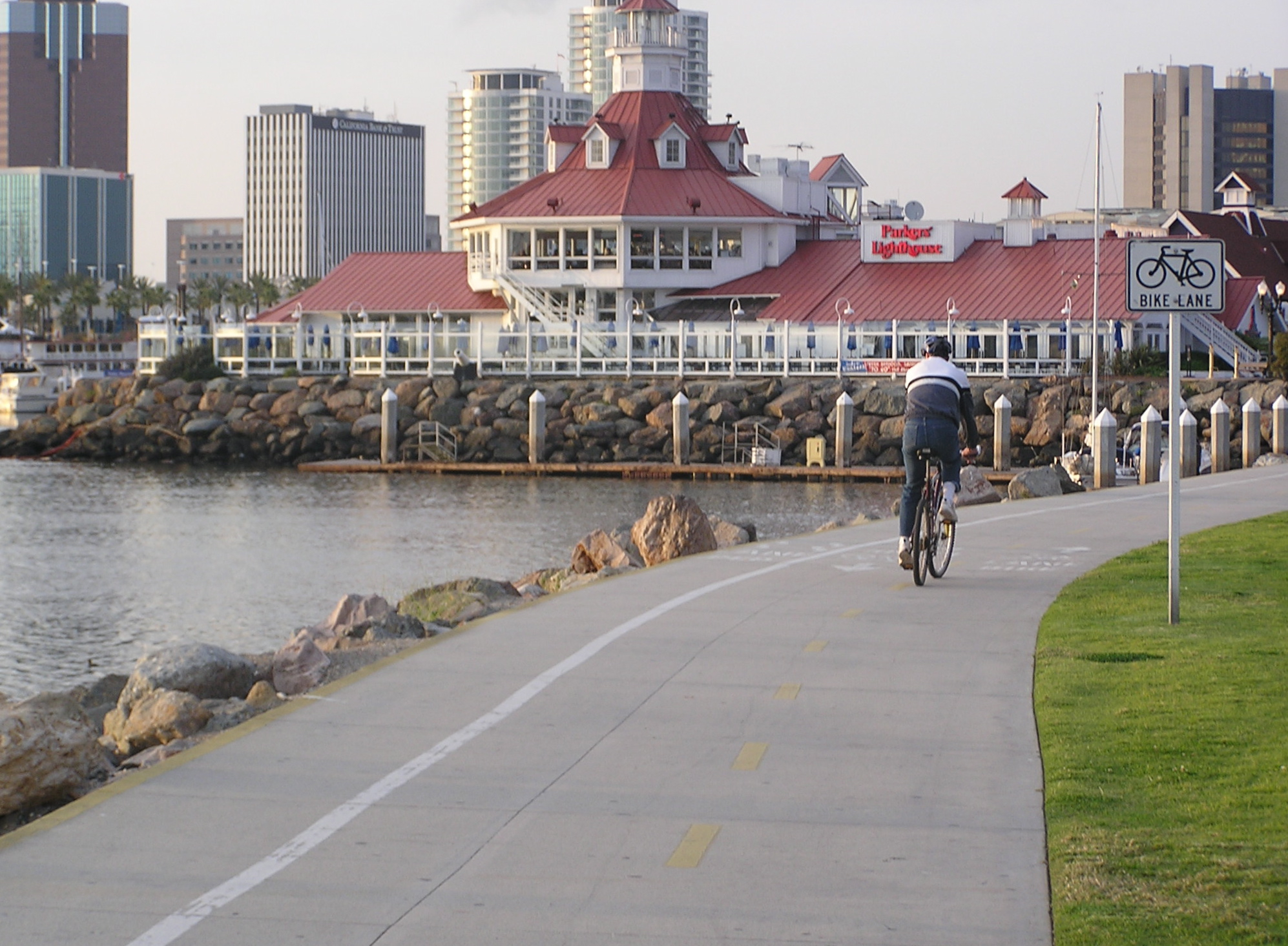
Believe me you don’t want to ride between the LA beach trail through the industrial districts to Long Beach, so head back to a Metro Rail train, either the Expo Line in Santa Monica or the Green Line accessible further south. Connect to the Blue Line southbound and get off in downtown Long Beach, a bike-friendly city. Explore the world class rejuvenated waterfront area and visit the Queen Mary or Aquarium of the Pacific (Ride LO1). There’s no tent camping but find oodles of accommodations, dining and shopping.
Bike path through Long Beach’s Shoreline Village restaurant area (LO1)
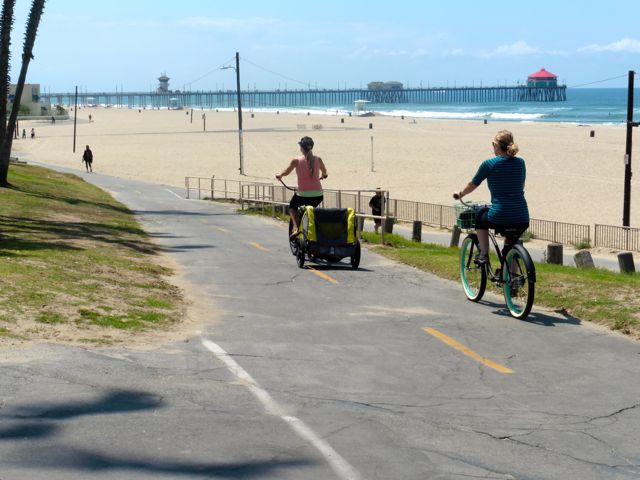
A state of the art bike trail runs along the beach to the Belmont Shore district, a great place to stroll and dine. Explore the canals of Italian-inspired Naples Island (Ride LO2), and ride across the San Gabriel River and into Orange County and the delightful beach community of Seal Beach (Ride SE1). Carefully navigate a couple miles on the Class II Coast Highway into the community of Sunset Beach, taking the parallel residential street when able, that leads to the fabulous 8 mile Huntington Beach coastal trail (Ride HB1). Camping along here is only for self contained RV’s, so find accommodations and restaurants in Sunset Beach or halfway down the trail in the revitalized downtown core near the pier.
Huntington Beach path near the pier (HB1).
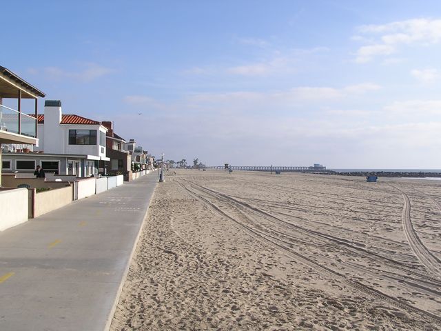
From the south end of the beach path connect via residential streets to the Newport Beach coastal trail that runs along the Balboa Peninsula, where you’ll find plenty of accommodations and food (Ride NB1). Take the cute 3-car ferry across to Balboa Island to continue the ride south. An expensive tent-camping option is at Newport Dunes resort in the Back Bay, a great place to get some fun riding in (Ride NB2).
Newport Beach’s oceanfront path.
Only very experienced cyclists should do the through-ride south along the coast from here. It is indeed a scenic journey, however, perhaps warranting an up-and-back ride for the first few miles. It starts with the Corona del Mar waterfront, connecting to the spectacular Crystal Cove State Park with its blufftop oceanview bike path (Ride NB3) and option to stop at the historic Crystal Cove district for lunch on the beach. Mountain bikers may be able to access a primitive campsite in the inland section of the park. The hilly coastal highway into Laguna Beach is a busy 4 lane road. Once in town, alternate routes are available through most of it (Ride LB2), but in South Laguna there are no good options to get off of the highway until you reach Dana Point, where bike lanes widen as you pass beautiful Salt Creek Beach Park, the Ritz Carlton, and the main business district. From Dana Point you can access bike trails to the San Juan Capistrano or San Clemente train stations.
Laguna Beach is the jewel of Orange County, with its rocky coves, sandy beaches, and lovely downtown right on the beach, but it can be a bitch to bike through (LB2).
Those who prefer bike paths to busy roadways should skip the route through Laguna Beach and follow the excellent paths along Newport Back Bay (Ride NB2) connecting to the San Diego Creek path inland through Irvine (Ride IR1) and end up at either the Tustin (Ride TU1) or Irvine train stations. From either station, take the Metrolink train south to San Juan Capistrano, joining those who skipped the urban coastal section and took the train directly there from Union Station, or braved the ride through Laguna Beach.
Whistlestop 9: San Juan Capistrano
The Santa Fe Depot is in the center of the restored historic Spanish downtown that includes the popular and beautiful San Juan Capistrano Mission and the Del Rio district, the oldest neighborhood in California (Ride SJ1). Bike paths lead one way into horse country, and the other way to the sea at Dana Point, another area to explore at its harbor (Ride DP1). A coastal bike trail connects to San Clemente, and coastal tent camping is available in Dana Point at Doheny State Beach and at San Clemente State Beach, atop a bluff at the south end of its lovely beach trail (Ride SC1).
San Juan Capistrano’s historic Los Rios District next to the train depot (SJ1).
Most cyclists will want to hop on the Metrolink at San Clemente’s North Beach Station for the scenic oceanfront trip south to Oceanside. More adventurous cyclists may enjoy the ride past classic surfing beaches like Trestles (Ride SC3) and perhaps ride into San Diego County through Camp Pendleton all the way to Oceanside. However getting an advance permit to ride through the Camp Pendleton roadways has become quite an ordeal. An option is to ride along I-5 for that stretch which is permitted, if you dare. Tent camping is available near the north end of the route at San Onofre State Beach’s inland San Mateo or summer-only coastal Bluffs campgrounds.
Elevated portion of San Clemente’s Beach Trail (SC1).
Whistlestop 10: Oceanside
Oceanside is a transit hub, where LA’s Metrolink ends and San Diego’s Coaster and Sprinter train lines begin. Amtrak’s Surfliner also stops here. You can ride inland on the 9 mile San Luis Rey River Trail, visit California’s largest mission en route, and access camping at Guajome Regional Park at trail’s end. Oceanside’s waterfront has a bike lane along its beach promenade, a pier, and a revitalized downtown core.
Oceanside Harbor, a great place to stop for a meal after the ride through Camp Pendleton from San Clemente (SC3) or just riding around town (OC1).
Those who prefer to stay off of busy roadways should continue on the Coaster train to the San Diego stations. Otherwise, make your way down the very scenic Class II coastal highway through the lovely beach cities of Carlsbad, Encinitas and Solana Beach. We do this ride frequently, it’s one of our exceptions of road riding since it’s so much fun (Ride SDC1). Tent camping is available at South Carlsbad and San Elijo State Beaches. Advance reservations are needed at both, and they do not have bike-in sites.
A typical view heading south along the north San Diego County coastal highway (SDC1).
Whistlestop 11: Solana Beach
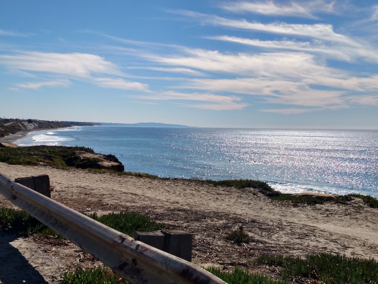
I recommend for those who rode down the coast to hop on the southbound Coaster train in Solana Beach. After Solana Beach the train bipasses the next city, Del Mar, then heads inland. If you choose to cycle to San Diego, the route becomes extremely hilly past Del Mar, recommended for experienced and top-shape riders, or those on e-bikes with plenty of battery power left, who can make their way through La Jolla and reach the Mission Bay area.
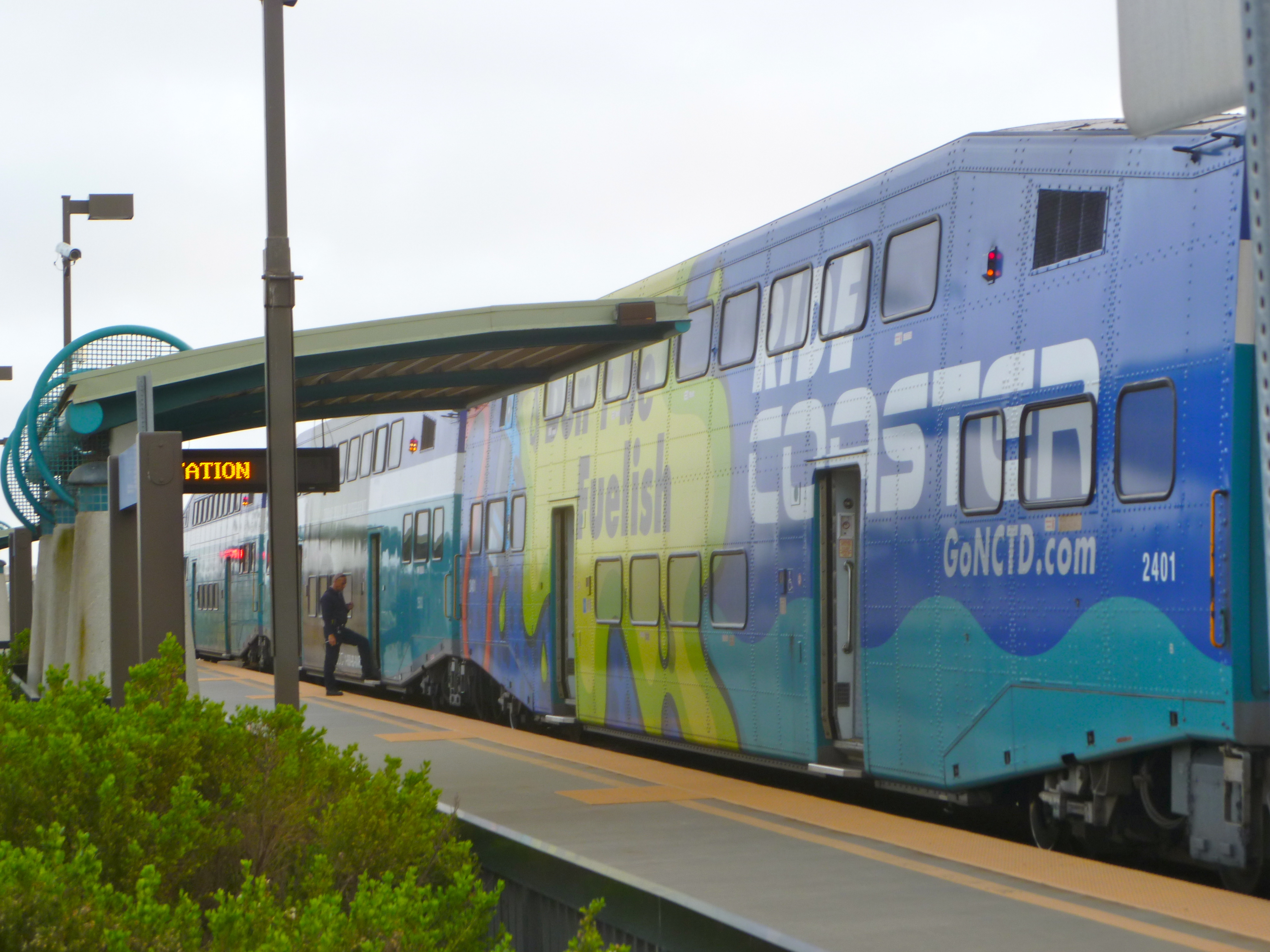
A Coaster station in north San Diego County
Whistlestop 12: San Diego Old Town
This major transit center is adjacent to San Diego Old Town State Historic Park, a restored settlement and mega tourist attraction with lots of museums and Mexican restaurants in and around it. You’ll need to lock up and walk or wheel your bike through here, but it’s worthwhile to do so. From here, you can connect to the fabulous bike trails around Mission Bay and the boardwalk along Mission Beach/Pacific Beach, and also access Sea World by bike (Ride SD1). Tent camping is available at private Campland-on-the-Bay.
Scenic north end of Ocean Front Walk in Pacific Beach (SD1)
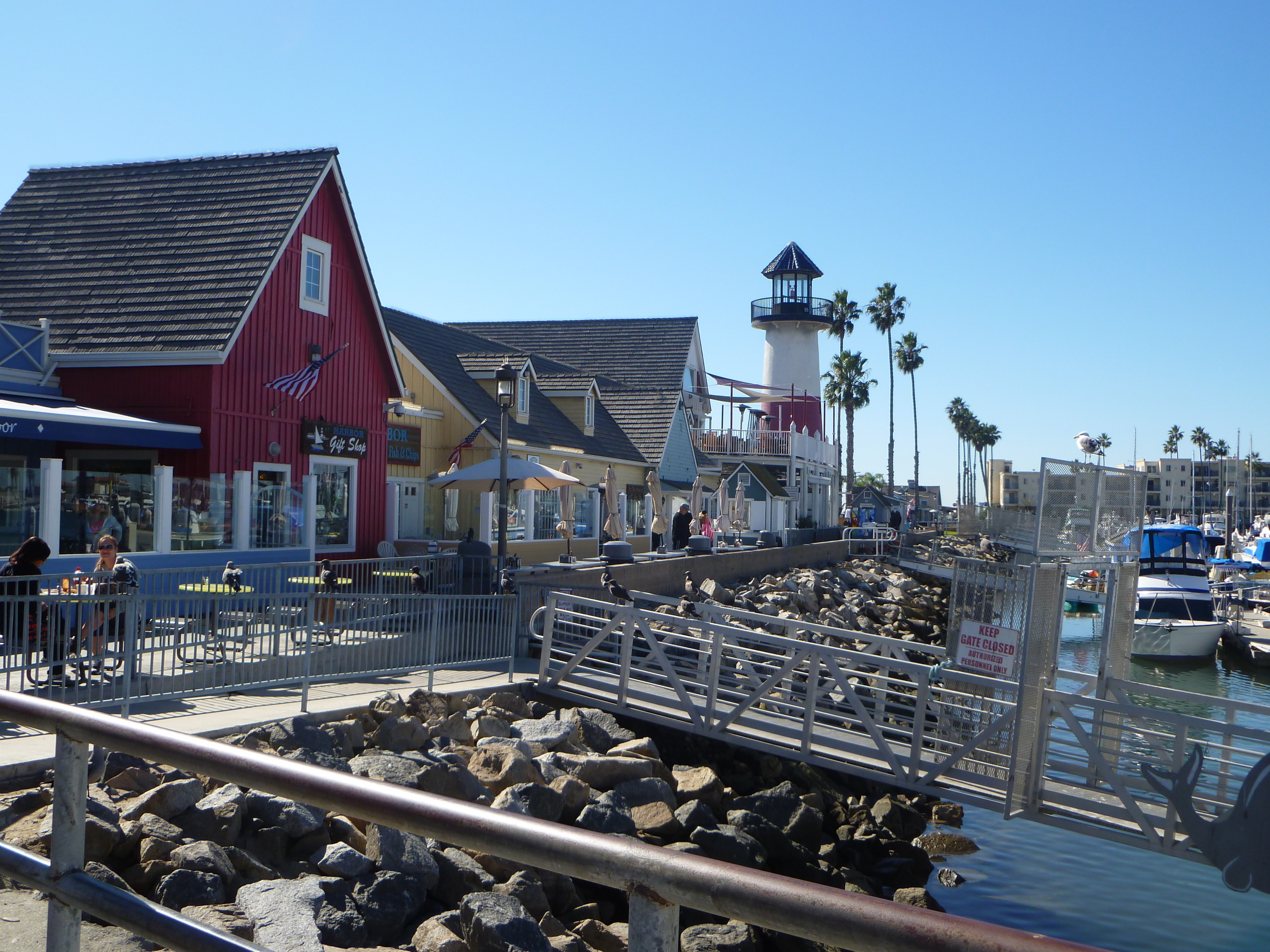
From the Mission Bay area you can ride to ritzy La Jolla (Ride SD2) and laid back Ocean Beach (Ride SD3). A Class II route leads to the stimulating bike trail along San Diego Harbor (Ride SD4). From there, a bike/ped ferry accesses the beautiful bike riding on the Coronado peninsula (Ride SD7: Cover photo – Hotel del Coronado). And, on-road bike routes lead up to the very European Balboa Park and the San Diego Zoo (Ride SD6).
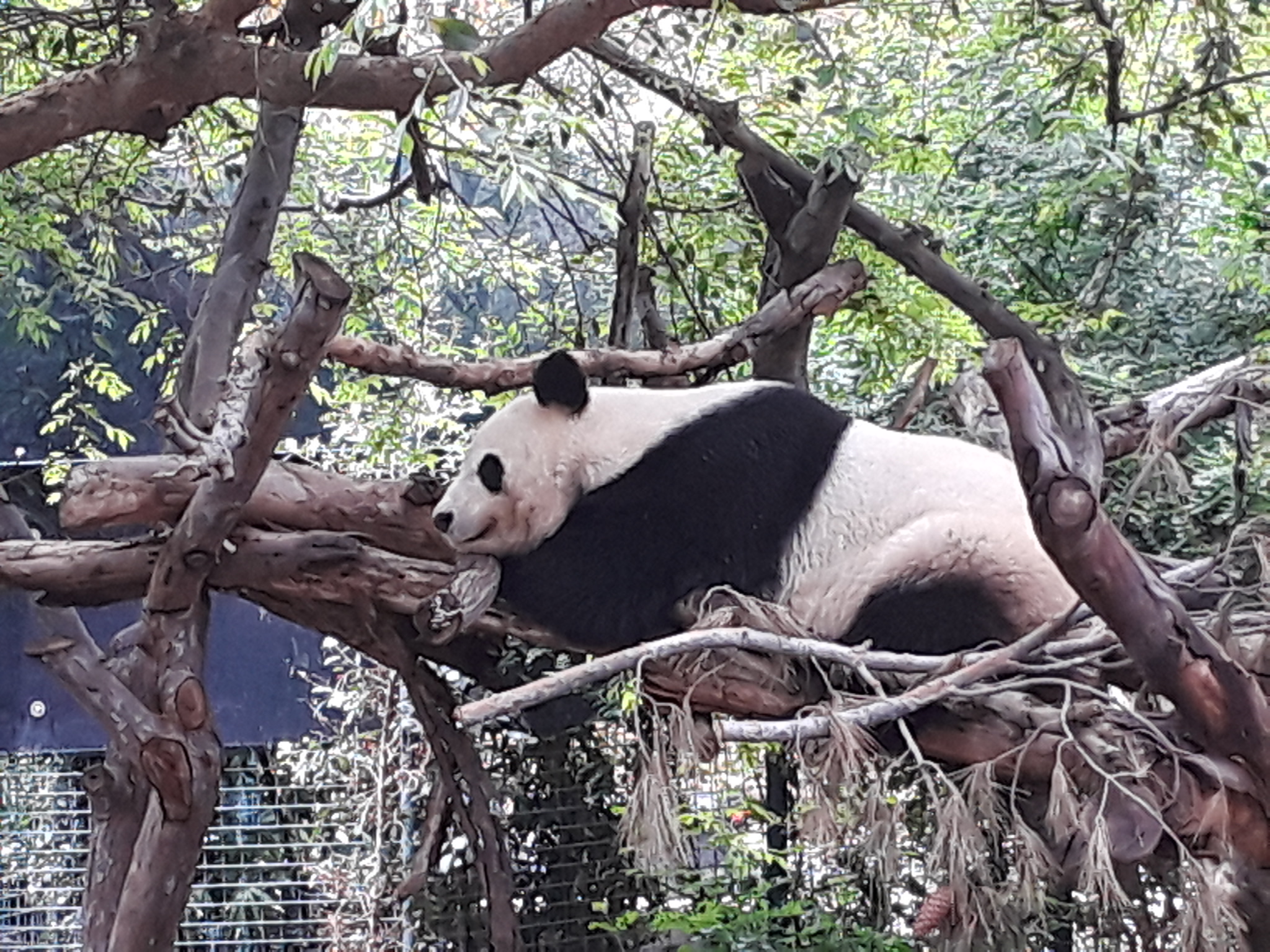
The amazing San Diego Zoo (SD6).
Whistlestop 13: Downtown San Diego Santa Fe Depot
The historic downtown depot, just a couple of blocks from the harborfront trail, is our final stop, and the best station to access the harbor ride (SD4), Coronado via the ferry (SD7) and Balboa Park/Zoo (SD6). More advanced riders or e-bikers with battery to spare can continue UP the hill to the spine of the Point Loma Peninsula to visit the spectacular Cabrillo National Monument at its tip (Ride SD5).
A moving bike statue along Coronado’s scenic waterfront path (SD7)
Return to your origin from downtown San Diego, either taking the Coaster, transferring to the Metrolink in Oceanside, or Amtrak’s Pacific Surfliner the entire way.
Southern California is serviced by Amtrak and several bike-friendly regional rail lines. I wrote an article for Southern California Life Magazine’s July-August 2015 issue highlighting the best easy scenic bike rides accessible along Amtrak’s Surfliner coastal route, as well as the local Metrolink and Coaster lines that use the same tracks between Ventura and San Diego Counties.
The easy scenic cycling adventures of Richard Fox, author of the 2014 (2nd Ed 2017, 3rd Ed 2021) guidebook "enCYCLEpedia Southern California – The Best Easy Scenic Bike Rides."


 My guidebook enCYCLEpedia Southern California – The Best Easy Scenic Bike Rides (3rd Ed, 2021) contains detailed ride descriptions through the most scenic areas,