by Richard Fox
Here’s a fun Camp ‘n Ride, or an option if you are cycling around San Diego Bay (enCYCLEpedia Ride SD7 Option 2) and want to explore some new territory.
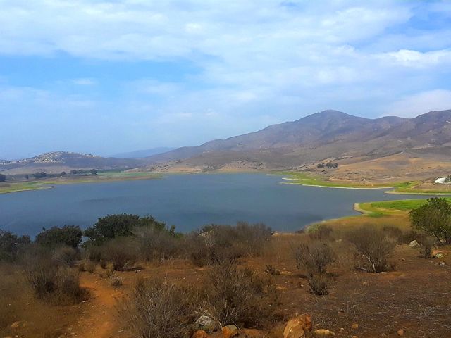
Sweetwater Summit Regional Park is located east of the southern San Diego suburb of Chula Vista. This San Diego County Park has a large spacious campground on top of a hill with RV hookups, adjacent to the Sweetwater Reservoir, which is not accessible to the public. A series of packed sand trails meander through the park, and down to a pedestrian bridge over the SR 125 toll freeway. This is the only hill involved in the route, and the return back up to the summit campground may be strenuous for some. The bridge leads to wide packed sand paths popular with cyclists, strollers, and equestrians, running adjacent to Bonita Golf Course and Chula Vista Golf Course, and past the town of Bonita where there are lots of restaurants. There is only one street crossing along the entire path to the sea. Road bikers stick to the main roadway, Bonita Road.
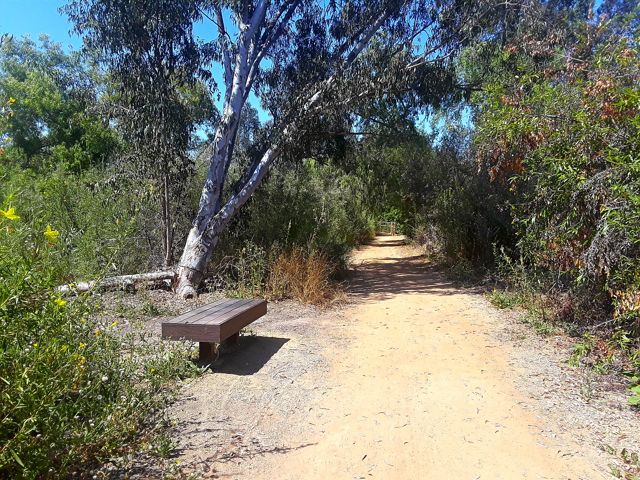
After crossing under Willow Street the path veers away from civilization and becomes a bit narrower and more isolated but also more scenic with riparian riverbottom vegetation, and resting benches. At about mile 5 this “Sweetwater Riverbottom Trail” meets a paved path. To the left leads to Bonita Road, and straight ahead continues to San Diego Bay. It emerges at Plaza Bonita Road in front of the Plaza Bonita Mall with several restaurants, where it becomes a painted path on a wide sidewalk. It veers off onto the Sweetwater Bikeway that follows the channelized Sweetwater River for 2.5 miles to San Diego Bay at National City’s Pier 32 Marina, crossing under several roadways en route including I-805 and I-5.
Near the end it crosses and becomes part of the 26-mile Bayshore Bikeway route that encircles San Diego Bay by way of the San Diego-Coronado ped/bike ferry, discussed in another blog post. The Waterfront Grill at the marina is a popular spot for cyclists with its large patio, open for lunch and weekend breakfast. At this point you’ve cycled a little under 9 miles.
Safety note: Except for the section between the campground and Bonita, this seems to be a “ride with a friend” trail because of the isolated sections in the thick brush, and homeless encampments as you get closer to Plaza Bonita. The path along the Sweetwater River has a lot of graffiti and abandoned shopping carts, and the section between the freeway and the river has no exit options. I rode it solo on a summer Saturday morning with no issues.