enCYCLEpedia ride #CAT1. See the book for a map and more detail.
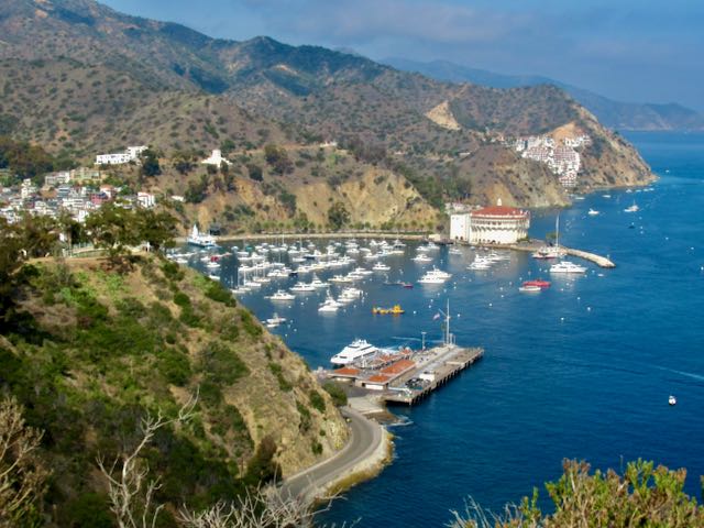
Do you have the urge to visit a Mediterranean Island? If you can choose a warm sunny day, which can happen any time of year, a visit to Santa Catalina Island can be a sublime experience. There is no car ferry to the island so the only vehicles are from the residents of the village of Avalon. Most get around on golf carts. You can bring your own bike, or rent from a couple of concessions including Brown’s Bikes. It’s a great way to get around, combining a bike ride with the other activities that range from mini golf to zip line to scuba diving. There is no shortage of shops to engage you and plenty of restaurants to savor. Accommodations range from high end B&B’s and inns to a campground. The 20+mile ferry crossing takes about 1- 1.5 hours from several ports in Orange and LA Counties, and bikes are allowed for a fee. Check for particulars on transporting e-bikes on the ferries.
The easiest cycling is around the quaint village and on ultra scenic waterfront roads north and south of town. A gradual hill through a canyon leads up to the must-see Wrigley Memorial and Botanic Garden. But for the most scenic roads and vistas, some substantial hill climbing north and south of town is required. You’ll need a multi-geared bike or better yet an e-bike to tackle those. Adventurous mountain bikers can get a permit or take a guided tour to cycle farther south, above Avalon, on Catalina Conservancy land, home of the bison herd. Or try cycling the length of the rugged 22-mile island.
Avalon’s downtown waterfront.
Avalon, the village.
Short waterfront road north of the historic Casino.
Waterfront road south of the village.
Vista including historic Casino from road to Mt Ada, south of town.
Scenic riding on hilly roads north of the village.
Breathtaking vista from the hilly north roadways.
Dramatic but hilly roads north of the village.
Allow a lot of extra time to gaze at and photograph the vistas.
Cathedral City reportedly got its name from Colonel Henry Washington, who during a survey of the Colorado Desert in 1855 stood in Cathedral Canyon and observed that certain rock formations resembled cathedrals. It’s not a name that resonates with tourists as one of the must see places of the Coachella Valley, but its Civic Center Plaza in its Arts and Entertainment District is one of the most unique spots in the area, definitely worth a visit. The centerpiece is the expansive Fountain of Life in Town Square Park, a unique, fun, and whimsical piece, popular on hot days with people splashing around in its “sprayground.” The park is a good place to meet up for a ride around the area, with shaded benches and public art such as sculptures of musicians.
Fountain of Life
The fountain is surrounded by the interesting Spanish architecture of City Hall, the Mary Pickford movie theatre (our personal area favorite), and the Bell Tower. Also in this downtown district are the Coachella Valley Repertory theatre, several restaurants, and the expansive new Agua Caliente Casino. Across Hwy 111 is the new Jurassic Wonders, a vacant lot filled with metal life size dinosaur sculptures by Ricardo Breceda. The Civic Center’s large festival lawn hosts November’s Hot Air Balloon Festival featuring a Saturday evening food truck corral and Balloon Glow event, where the balloons are lit up, set to music. The Taste of Jalisco festival, a celebration of its sister city in Jalisco, Mexico is in February, and March brings LGBT Days, California’s earliest Pride event.
November’s Balloon Glow during Balloon Fest
Except during the festivals, the district is enjoyable to pedal around and explore. It’s not a long enough ride on its own, but can be a destination via a detour from other rides featured in enCYCLEpedia, like Palm Springs’ Tahquitz Creek Loop via the Jenkins Trail, and sidepaths along Hwy 111 or Gerald Ford from the Rancho Mirage/Palm Desert rides.
Cathedral City Hall
Eduardo “Lalo” Guerrero, father of Chicano music and former Cat City resident.
The Bell Tower
Pickford Theatres
Jurassic Wonders
Danger!
Rainbow crosswalk indicative of the LGBT-friendly city.
You can also add to the ride with a hilly excursion in the Cathedral City Cove neighborhood across Hwy 111 to the south. The Cove is another of the Valley’s un-gated communities that makes for a nice place to ride without being on sidewalks or busy boulevards. However, it is very hilly so probably of most interest to the e-bikers in the easy cycling realm. Acoustic bikers enjoy the workout from the 400-foot elevation gain within 1.75 miles. You can get in several miles of enjoyable biking by making your own way around or enCYCLEpedia readers can follow the suggested route map on its website. Properties tend to get nicer farther up into the Cove. The Cove is surrounded by Santa Rosa & San Jacinto Mountains National Monument land, and two trailheads are located at the top of the Cove as indicated. The one to the east starts as wide double track, while the one to the west is narrow sandy singletrack.
From top of the Cove enjoy vistas back down across the Valley.
Scenic section of the Jenkins Trail that connects to Tahquitz Creek Loop in Palm Springs
Most of the Jenkins Trail leaves something to be desired, but it beats riding on the highways.
Here’s a fun Camp ‘n Ride, or an option if you are cycling around San Diego Bay (enCYCLEpedia Ride SD7 Option 2) and want to explore some new territory.
Sweetwater Summit Regional Park is located east of the southern San Diego suburb of Chula Vista. This San Diego County Park has a large spacious campground on top of a hill with RV hookups, adjacent to the Sweetwater Reservoir, which is not accessible to the public. A series of packed sand trails meander through the park, and down to a pedestrian bridge over the SR 125 toll freeway. This is the only hill involved in the route, and the return back up to the summit campground may be strenuous for some. The bridge leads to wide packed sand paths popular with cyclists, strollers, and equestrians, running adjacent to Bonita Golf Course and Chula Vista Golf Course, and past the town of Bonita where there are lots of restaurants. There is only one street crossing along the entire path to the sea. Road bikers stick to the main roadway, Bonita Road.
After crossing under Willow Street the path veers away from civilization and becomes a bit narrower and more isolated but also more scenic with riparian riverbottom vegetation, and resting benches. At about mile 5 this “Sweetwater Riverbottom Trail” meets a paved path. To the left leads to Bonita Road, and straight ahead continues to San Diego Bay. It emerges at Plaza Bonita Road in front of the Plaza Bonita Mall with several restaurants, where it becomes a painted path on a wide sidewalk. It veers off onto the Sweetwater Bikeway that follows the channelized Sweetwater River for 2.5 miles to San Diego Bay at National City’s Pier 32 Marina, crossing under several roadways en route including I-805 and I-5.
Near the end it crosses and becomes part of the 26-mile Bayshore Bikeway route that encircles San Diego Bay by way of the San Diego-Coronado ped/bike ferry, discussed in another blog post. The Waterfront Grill at the marina is a popular spot for cyclists with its large patio, open for lunch and weekend breakfast. At this point you’ve cycled a little under 9 miles.
Safety note: Except for the section between the campground and Bonita, this seems to be a “ride with a friend” trail because of the isolated sections in the thick brush, and homeless encampments as you get closer to Plaza Bonita. The path along the Sweetwater River has a lot of graffiti and abandoned shopping carts, and the section between the freeway and the river has no exit options. I rode it solo on a summer Saturday morning with no issues.
Sweetwater Reservoir, adjacent to Sweetwater Summit campground. It dams the Sweetwater River that starts in the mountains at Cuyamaca State Park.Dirt paths meander around Sweetwater Summit Regional Park. Ride right from the campsites, across the bike bridge over SR125 to continue through Bonita on dirt paths. Road bikers use the roadways and connect to the Sweetwater Bikeway near the Plaza Bonita Mall.Dirt paths past golf courses and riparian areas through Bonita connect Sweetwater Summit Regional Park with the Sweetwater Bikeway to the bay.Sweetwater Bikeway runs 2.5 miles between the Plaza Bonita (Westfield) Mall to National City’s Pier 32 Marina and joins the Bayshore Bikeway that circumnavigates the bay. The river here has a natural bottom, and is tidal, attracting bird life. The last 2 miles are between the SR54 Freeway and the river, with no exit until Hoover Ave, just before I-5.Sweetwater Bikeway rounds a bend to reach the Pier 32 Marina in National City. This section is part of the Bayshore Bikeway.End of the ride at Pier 32 Marina and the Waterfront Cafe for an al fresco lunch. The one-way ride is under 9 miles. Of course you have the option of adding the 26 mile Bayshore Bikeway loop around San Diego Bay, which requires a ferry ride between downtown San Diego and Coronado.
Europe is known for it’s extended bike trail systems like EuroVelo 6 through lovely villages, pastoral countryside, and medieval cities. The routes along pretty rivers such as the Danube attract thousands of cyclists, and easy access to rail enables hopping from place to place. Although Southern California does not offer the same wealth of cycling infrastructure, it does have its fair share of bike trails and pleasant bike routes that are conducive to touring the region on two wheels. Using its bike friendly rail system, cyclists can experience a Euro-style holiday, particularly along its spectacular coastal region that attracts visitors from the world over to its beautiful beaches and charming towns, many with Spanish-influenced architecture. A trip can last a weekend or a month, depending on schedule and budget. If being away from your car is too inconvenient, you can still use the trains to cover more ground on day trips.
My guidebook enCYCLEpedia Southern California – The Best Easy Scenic Bike Rides (3rd Ed, 2021) contains detailed ride descriptions through the most scenic areas, referenced throughout this article. enCYCLEpedia‘s rides are geared for the average cyclist who prefers to stay away from traffic whenever possible, and avoid high speed, dangerous, or very hilly roads.
The goal of this journey is to use the train to access the most desirable areas, and skip over the parts that are overly difficult, dangerous, or uninteresting. Based on our experiences, the zen of taking a bike on the train adds to the excitement of it all. Options are also mentioned for more advanced riders who may prefer to ride through some of those areas anyway rather than taking the train past them.
You’ll find lots of accommodation options in the featured locales, and if you prefer bike camping, many of the coastal State Parks have reservable tent sites, but they fill fast at peak times, so advance planning is required. A few also have non reservable bike-in campsites, although spaces are not guaranteed, especially on summer weekends.
The northern part of our trip (San Luis Obispo to Los Angeles) is serviced primarily by the bike-friendly Amtrak Surfliner line that runs from San Luis Obispo to San Diego, stopping at many of the lovely locales described. To travel on the Surfliner, you will need some advance planning, since a free reservation is required to bring your bike along. The good news is it doesn’t have to be boxed like on other Amtrak lines. From LA’s Union Station and south, lots of options open up for less expensive and more bike-friendly commuter lines.
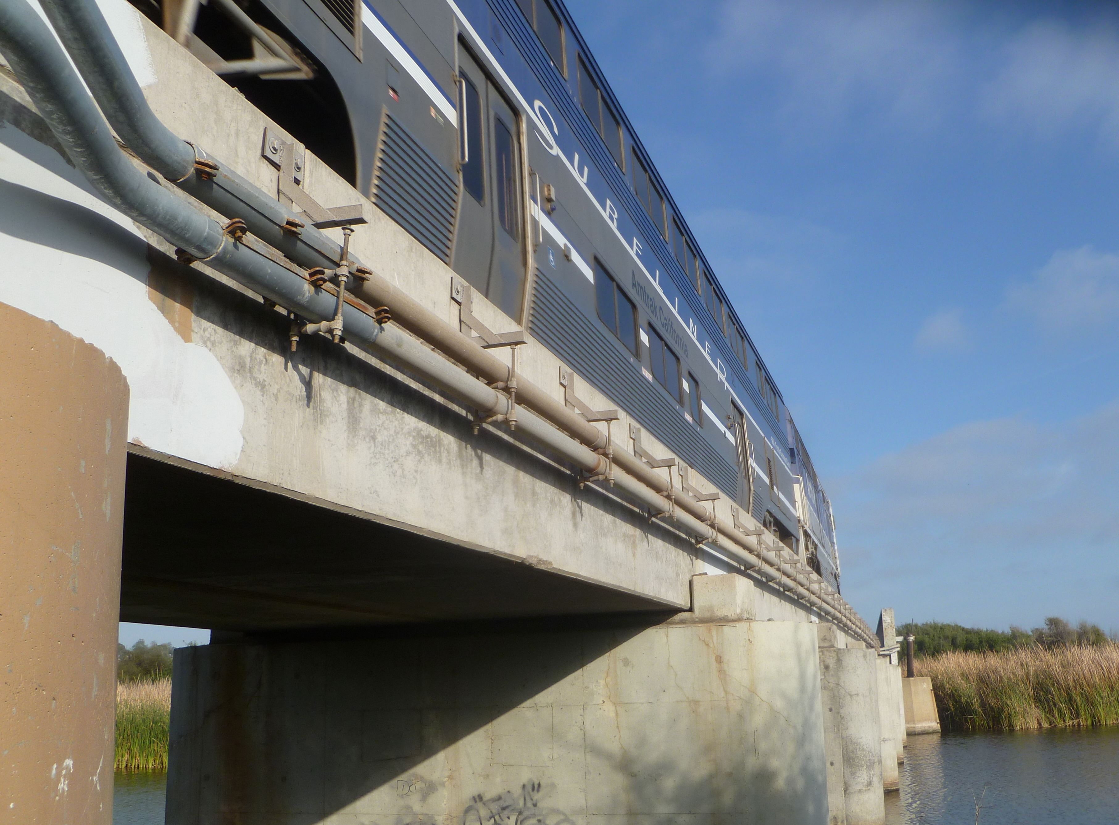
Amtrak Surfliner on rebuilt “trestles” next to San Clemente’s famous Trestles surf beach (SC3).
Whistlestop 1: San Luis Obispo (SLO)
Taking the Amtrak Surfliner north from Los Angeles to San Luis Obispo, or SLO Town, is a world class spectacular ride, with California coastal scenery on display between Ventura and Pismo Beach, much of which is not even accessible to the public past Santa Barbara. If you arrive in SLO from the north via Amtrak’s Coast Starlight train, it is also scenic but is not along the coast, as that would mean it would be along the Big Sur coast, which can barely handle a roadway. The Coast Starlight (between LA and Seattle) is not as bike friendly, since bikes need to be boxed and incur baggage and box fees.
View of the Santa Barbara County coastline from the Surfliner.
SLO Town is a charming university city about 13 miles inland from the coastal town of Morro Bay. While SLO Town does not have much in the way of bike trails, it does have bike friendly streets and plenty of desirable places to sleep and eat in the vital downtown sector west of the train depot. It is a good place to spend some time to explore, provision and get oriented. You can try a wine country tour, or a popular bike route to the coast at Los Osos/Morro Bay via Los Osos Valley Road.
Mission San Luis Obispo de Tolosa, downtown SLO
At the coast you can explore Morro Bay, which offers some delightful coastal riding (enCYCLE Ride MB1), and lots of accommodations (reserve for best selection in summer) and popular waterfront seafood restaurants. To its south is Montana de Oro State Park (Ride MB2), a coastal gem with a couple of great easy rides on packed dirt, some more challenging mountain biking, and spectacular hiking trails. Bike-in or reservable tent camping is available at Morro Bay, Morro Strand, and Montana de Oro State Parks.
Bike path to Morro Rock in Morro Bay (MB1)
Whistlestop 2: Grover Beach/Pismo Beach
Pubic passage south down the coast from Morro Bay is blocked by the Diablo Canyon nuclear plant property, so you’ll need to ride back to SLO. Continuing south from SLO you can either ride along Class II roads adjacent to Hwy 101 (or a steep route over the hills on dirt roads) or take the Surfliner to the next stop in Grover Beach/Pismo Beach. If you cycle, your next destination can be the small, quaint beach community of Avila Beach, with the last few miles along the lovely creekside Bob Jones Trail, that will someday connect to SLO, making that a must-do stretch by bike (Ride AV1). Continue riding south to the Pismo station from Avila Beach. You can also reach Avila Beach on a scenic coastal Class II bike route north from the Pismo station if you choose that option.
Avila Beach Pier (AV1)
Pismo Beach is the southern end of our recommended exploration in SLO County, and the train station is just south of town in Grover Beach. There’s no bike trails in town, yet, so hop on the bike lanes along Hwy 1 and head north into town (Ride PB2), past several public campgrounds, and the spot where the Monarch butterflies congregate in winter. The delightful downtown has a bunch of restaurants and accommodations. At lower tides, you can ride on the compact sands of the wide beautiful beach here, our only recommended SoCal beach ride (Ride PB1). The route north of downtown (Ride PB3) is on Class 2 lanes of a fairly busy roadway, but the ocean vistas are spectacular in places and you can detour to the waterfront and ride on some parkside trails. If you chose to ride all the way south from SLO, you’ll be southbound on that route toward downtown and the Pismo station. And now, back to the Surfliner for our next destination.
Riding the compact sands of Pismo Beach (PB1)
Whistlestop 3: Surf Beach/Lompoc, Santa Barbara County
An optional stop, Surf Beach is the loneliest Amtrak stop along the coast, located in a beach parking lot adjacent to Vandenberg Air Force Base. You can walk for miles along the beautiful beach, but signs warn against swimming here due to two fatal shark attacks. Amtrak doesn’t stop here often, so schedule carefully.
The lonely Surf Amtrak Station, 9 miles west of Lompoc (LOM1)
From here you can easily ride to pretty Ocean Beach County Park at the delta of the Santa Ynez River. For grub and overnight accommodations, including hotels, B&B’s, and camping (River Park), the city of Lompoc awaits (Ride LOM1). The City of Arts and Flowers with murals on its downtown buildings is reached via a flat 9 mile ride along Class II Ocean Ave (55 mph speed), an interesting stretch when the fields of cultivated flowers are in bloom in spring and summer. Lompoc is not as appealing as some of the other coastal towns, but is a good place to restock and refresh.
Those in tip top condition may consider a road trip over substantial and steep hills and windy rural roads, to isolated Jalama County Beach, where there is a beach campground and general store and grill. If you took the Surfliner northbound you would’ve gone right by it. This would make an epic weekend trip on its own from the big city.
Another option, though risky logistically, is to take the Wine Country Express bus from Lompoc to the Danish tourist village of Solvang, and explore the beautiful Santa Barbara Wine Country in Los Olivos and Santa Ynez by bike (Ride SO1). Buses have bike racks, but can take only a couple at a time. You could also leave your bikes at your Lompoc accommodation, take the bus, and rent bikes in Solvang.
Whistlestops 4, 5, 6, 7: Goleta, Santa Barbara, Carpinteria, Ventura
The ride between Lompoc and Santa Barbara is very hilly and/or along the 101 Freeway, only for the most advanced riders. So, all aboard the Surfliner at Surf! The corridor between the next stops of Goleta, Santa Barbara, Carpinteria and Ventura is rideable by most cyclists, so you can pick and choose where you’d like to explore, how far to ride, and when to use the Surfliner to help you out.
From the Goleta Station, ride to the coast and explore the beautiful paths along the University of California at Santa Barbara (Ride SB2).
Paths around the UCSB Lagoon (SB2)
Class I and II routes connect to the downtown and waterfront district of Santa Barbara (Ride SB1). A scenic beachfront path passes a multitude of restaurants and accommodations there, although there is no bike camping in town. The Amtrak station is in the center of town, so if you disembark there, you can easily explore the extensive Spanish-influenced downtown and beautiful waterfront.
Cabrillo Beachway, Santa Barbara Waterfront (SB1)
A Class II route, very doable but not the most wonderful, leads through the tony community of Montecito, then Summerland, to the lovely low-key beach town of Carpinteria, and the next Amtrak station (Ride SB1, Option 2). Find lots of great restaurants and choice of accommodations from B&B’s to bike-in and reservable campsites at Carpinteria State Beach.
Someday there will be a bike path connecting Carpinteria to the new path to Ventura, but for now there is only a 3-mile fairly hilly on-road route. If you are willing to tackle that, the reward is the new waterfront bike path adjacent to the 101 Freeway that leads to the north end of Ventura (Ride VE4). You could also access it if you take the train directly to Ventura and ride north.
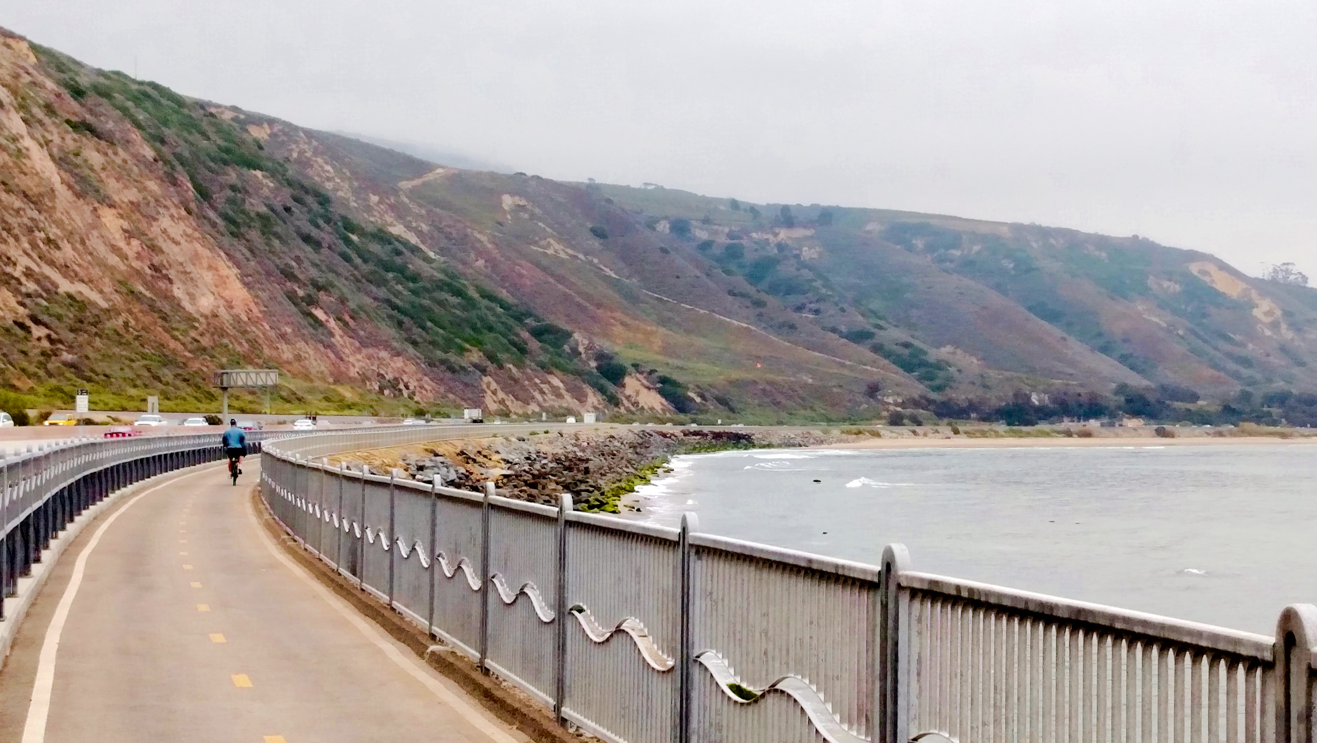
Rincon Bike Path along US 101 between Carpinteria and Ventura (VE4)
The bike path ends on the Old Rincon Hwy, a popular bike route that leads to the Ventura waterfront trail system (Ride VE1). Via that path you can access the historic downtown center, enjoy the beautiful coastline and pier, and find all sorts of restaurants and accommodations. The depot is downtown between the beach and Main Street. Bike-in and reservable camping are available at McGrath State Beach nearby in Oxnard.
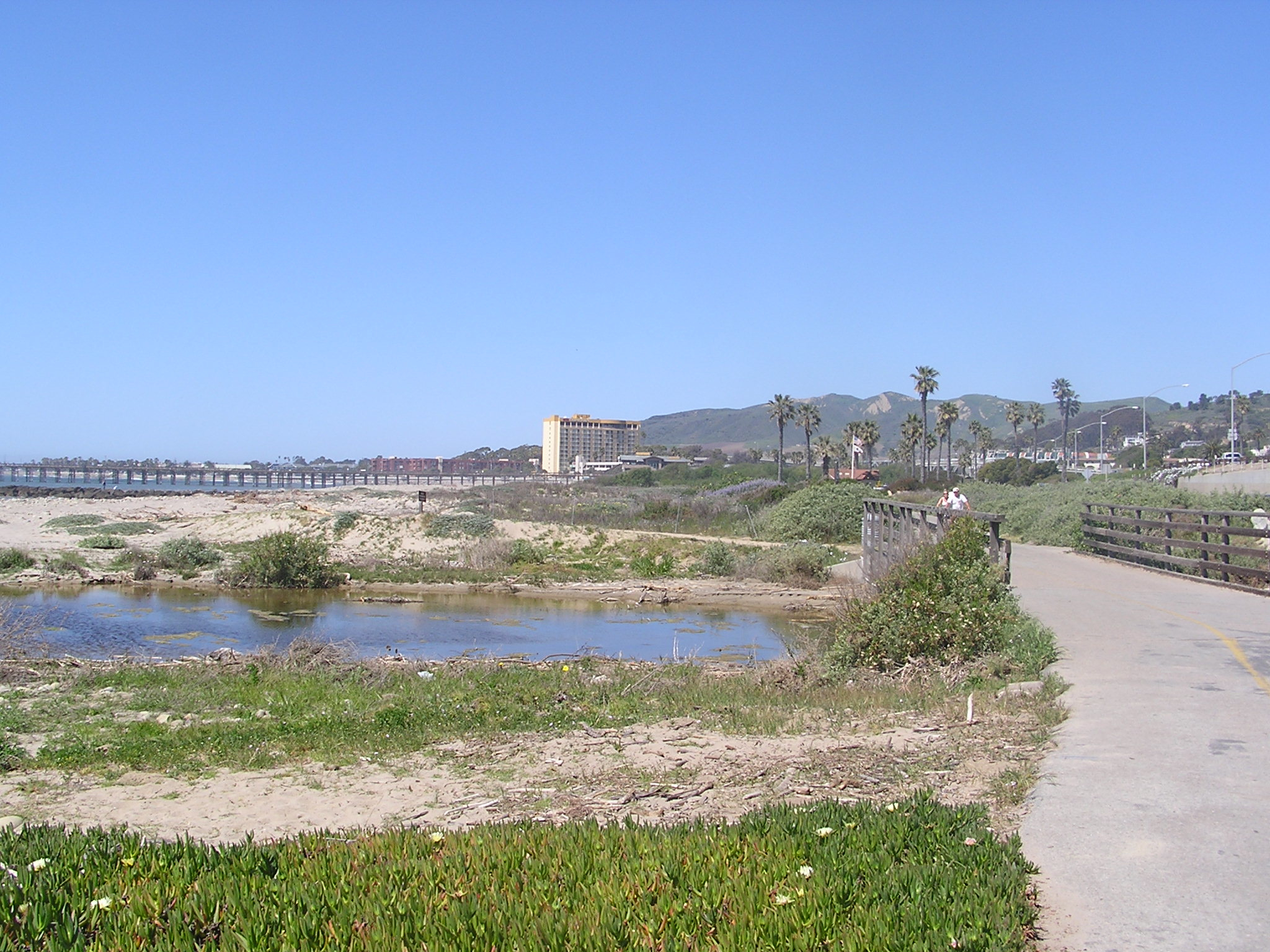
Path through San Buenaventura State Beach near downtown Ventura (VE1)
From Ventura consider riding up a scenic rail trail about 16 miles inland to the lovely spa resort town of Ojai, either as a day trip and lunch stop or an overnight destination (Rides VE2 and 3). Camping is available at two county parks near the route.
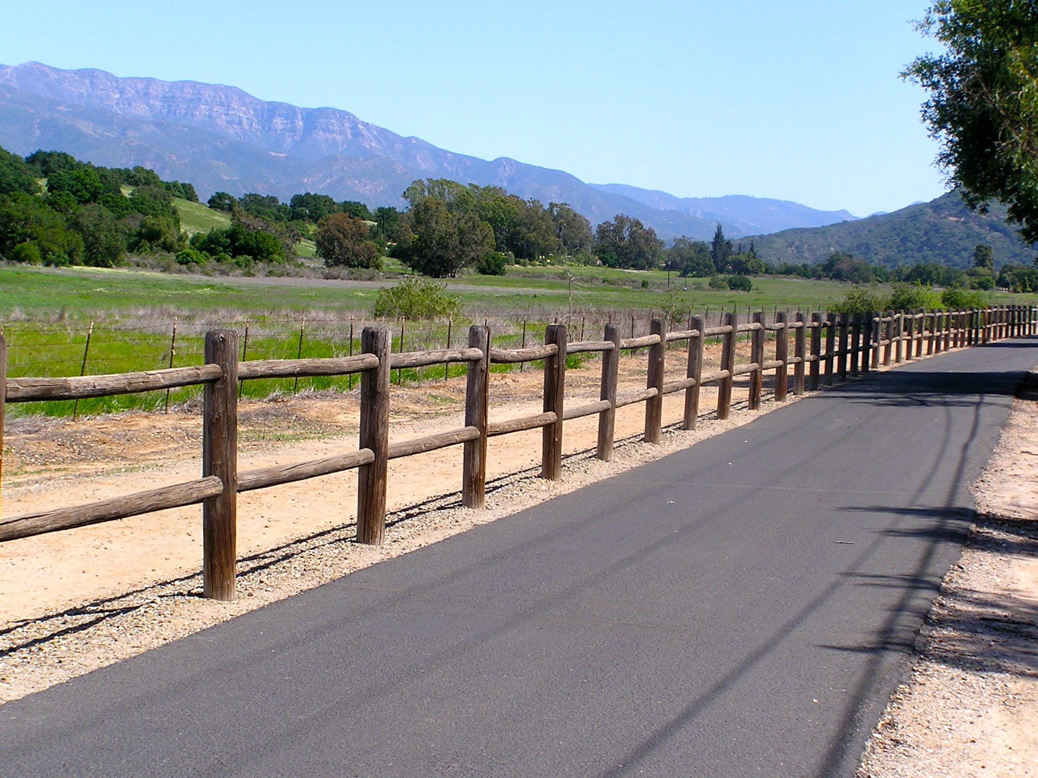
Rail trail through the Ojai Valley (VE3)
Ventura is the last stop for the northern part of our adventure. Cycling south from Ventura is only for very experienced cyclists. The subsequent 50-mile coastal route first passes through the city of Oxnard, while the last 35 miles is along the busy, hilly, speedy, Coast Highway to and through Malibu. The reward is that it ends up on the fabulous 22-mile Los Angeles beach trail. But you can also access that path by taking local rail from downtown, along our rail route. So, most of you will want to hop on the Surfliner in Ventura and head to downtown LA. Or, make your way across town to Oxnard and take the more bike friendly Metrolink commuter train from that route’s western terminus (weekdays only).
Whistlestop 8: Los Angeles Union Station
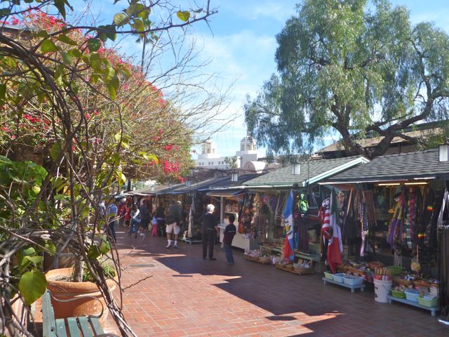
Historic Union Station is an attraction in itself, but riding in downtown LA is not for the faint of heart, except perhaps early on a Sunday morning. However, if you can very securely lock up your bike and belongings, or find an accommodation nearby, it is a worthwhile area to spend some time exploring on foot, with attractions such as the touristy Olvera Street, El Pueblo de Los Angeles, Chinatown, and lots more.
Historic Olvera Street near LA’s Union Station
From Union Station you have a choice, depending on your timing and preferences. Logistically, the easiest thing to do is hop on Metrolink’s Orange County Line, and head south to our next stop, San Juan Capistrano. Or, if you would like to experience LA and Orange County’s best and most fabulous coastal trails, joining up with the train route further south, make the following extra trip using local Metro Rail:
Extra Trip: The Urban LA and OC Coastal Paths
LA County’s world renowned beach trail runs some 22 miles through Santa Monica and Venice, Hermosa, Manhattan and Redondo Beaches (Rides LA1 and 2). Metro Rail’s new Exposition Line can get you there: Take the Red or Purple lines from Union Station to meet the Expo Line, and get off at its terminus in Santa Monica. There’s no tent camping along the coast, so you’ll need hotel accommodations near the beach communities, preferably as close to the beach as possible to avoid some dicey areas and possibly dangerous street riding
North end of LA coastal bike trail aka Martin Braude Trail (LA1)
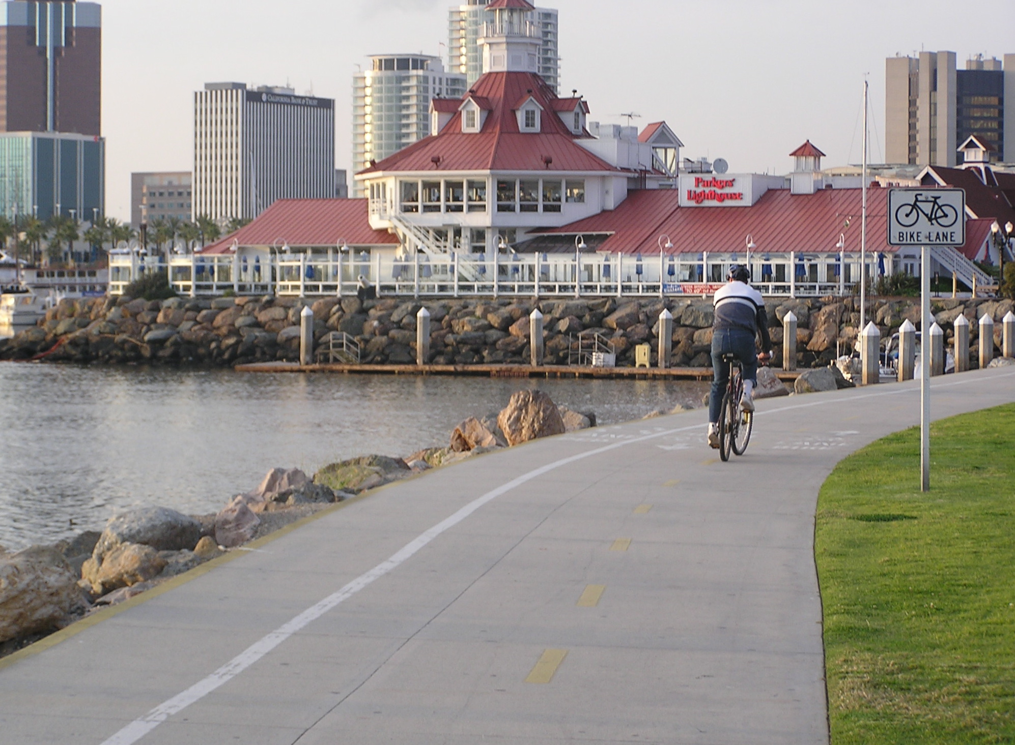
Believe me you don’t want to ride between the LA beach trail through the industrial districts to Long Beach, so head back to a Metro Rail train, either the Expo Line in Santa Monica or the Green Line accessible further south. Connect to the Blue Line southbound and get off in downtown Long Beach, a bike-friendly city. Explore the world class rejuvenated waterfront area and visit the Queen Mary or Aquarium of the Pacific (Ride LO1). There’s no tent camping but find oodles of accommodations, dining and shopping.
Bike path through Long Beach’s Shoreline Village restaurant area (LO1)
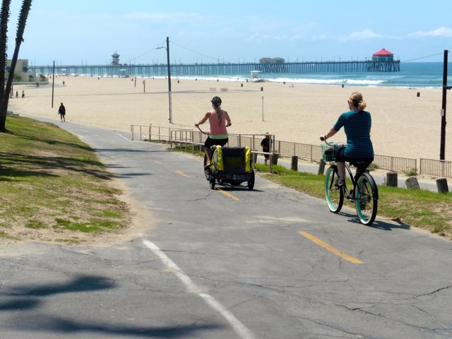
A state of the art bike trail runs along the beach to the Belmont Shore district, a great place to stroll and dine. Explore the canals of Italian-inspired Naples Island (Ride LO2), and ride across the San Gabriel River and into Orange County and the delightful beach community of Seal Beach (Ride SE1). Carefully navigate a couple miles on the Class II Coast Highway into the community of Sunset Beach, taking the parallel residential street when able, that leads to the fabulous 8 mile Huntington Beach coastal trail (Ride HB1). Camping along here is only for self contained RV’s, so find accommodations and restaurants in Sunset Beach or halfway down the trail in the revitalized downtown core near the pier.
Huntington Beach path near the pier (HB1).
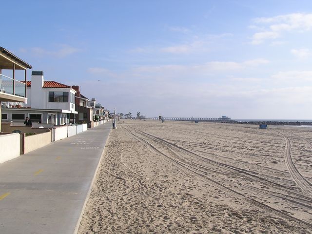
From the south end of the beach path connect via residential streets to the Newport Beach coastal trail that runs along the Balboa Peninsula, where you’ll find plenty of accommodations and food (Ride NB1). Take the cute 3-car ferry across to Balboa Island to continue the ride south. An expensive tent-camping option is at Newport Dunes resort in the Back Bay, a great place to get some fun riding in (Ride NB2).
Newport Beach’s oceanfront path.
Only very experienced cyclists should do the through-ride south along the coast from here. It is indeed a scenic journey, however, perhaps warranting an up-and-back ride for the first few miles. It starts with the Corona del Mar waterfront, connecting to the spectacular Crystal Cove State Park with its blufftop oceanview bike path (Ride NB3) and option to stop at the historic Crystal Cove district for lunch on the beach. Mountain bikers may be able to access a primitive campsite in the inland section of the park. The hilly coastal highway into Laguna Beach is a busy 4 lane road. Once in town, alternate routes are available through most of it (Ride LB2), but in South Laguna there are no good options to get off of the highway until you reach Dana Point, where bike lanes widen as you pass beautiful Salt Creek Beach Park, the Ritz Carlton, and the main business district. From Dana Point you can access bike trails to the San Juan Capistrano or San Clemente train stations.
Laguna Beach is the jewel of Orange County, with its rocky coves, sandy beaches, and lovely downtown right on the beach, but it can be a bitch to bike through (LB2).
Those who prefer bike paths to busy roadways should skip the route through Laguna Beach and follow the excellent paths along Newport Back Bay (Ride NB2) connecting to the San Diego Creek path inland through Irvine (Ride IR1) and end up at either the Tustin (Ride TU1) or Irvine train stations. From either station, take the Metrolink train south to San Juan Capistrano, joining those who skipped the urban coastal section and took the train directly there from Union Station, or braved the ride through Laguna Beach.
Whistlestop 9: San Juan Capistrano
The Santa Fe Depot is in the center of the restored historic Spanish downtown that includes the popular and beautiful San Juan Capistrano Mission and the Del Rio district, the oldest neighborhood in California (Ride SJ1). Bike paths lead one way into horse country, and the other way to the sea at Dana Point, another area to explore at its harbor (Ride DP1). A coastal bike trail connects to San Clemente, and coastal tent camping is available in Dana Point at Doheny State Beach and at San Clemente State Beach, atop a bluff at the south end of its lovely beach trail (Ride SC1).
San Juan Capistrano’s historic Los Rios District next to the train depot (SJ1).
Most cyclists will want to hop on the Metrolink at San Clemente’s North Beach Station for the scenic oceanfront trip south to Oceanside. More adventurous cyclists may enjoy the ride past classic surfing beaches like Trestles (Ride SC3) and perhaps ride into San Diego County through Camp Pendleton all the way to Oceanside. However getting an advance permit to ride through the Camp Pendleton roadways has become quite an ordeal. An option is to ride along I-5 for that stretch which is permitted, if you dare. Tent camping is available near the north end of the route at San Onofre State Beach’s inland San Mateo or summer-only coastal Bluffs campgrounds.
Elevated portion of San Clemente’s Beach Trail (SC1).
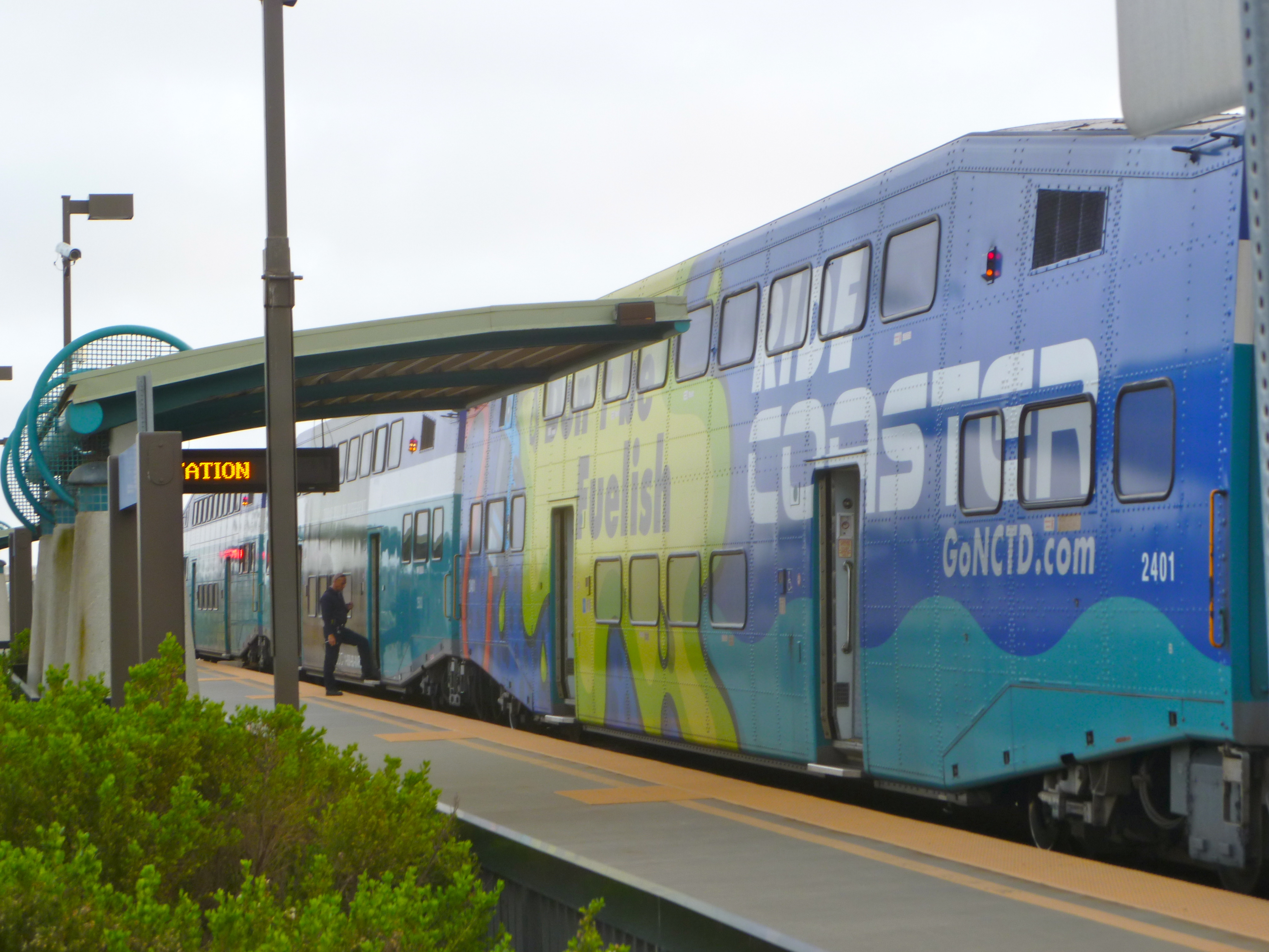
Whistlestop 10: Oceanside
Oceanside is a transit hub, where LA’s Metrolink ends and San Diego’s Coaster and Sprinter train lines begin. Amtrak’s Surfliner also stops here. You can ride inland on the 9 mile San Luis Rey River Trail, visit California’s largest mission en route, and access camping at Guajome Regional Park at trail’s end. Oceanside’s waterfront has a bike lane along its beach promenade, a pier, and a revitalized downtown core.
Oceanside Harbor, a great place to stop for a meal after the ride through Camp Pendleton from San Clemente (SC3) or just riding around town (OC1).
Those who prefer to stay off of busy roadways should continue on the Coaster train to the San Diego stations. Otherwise, make your way down the very scenic Class II coastal highway through the lovely beach cities of Carlsbad, Encinitas and Solana Beach. We do this ride frequently, it’s one of our exceptions of road riding since it’s so much fun (Ride SDC1). Tent camping is available at South Carlsbad and San Elijo State Beaches. Advance reservations are needed at both, and they do not have bike-in sites.
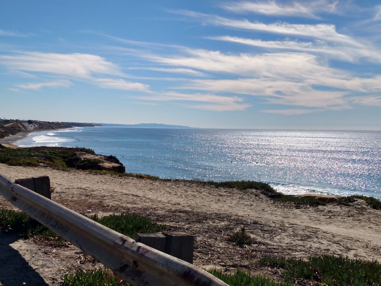
A typical view heading south along the north San Diego County coastal highway (SDC1).
Whistlestop 11: Solana Beach
I recommend for those who rode down the coast to hop on the southbound Coaster train in Solana Beach. After Solana Beach the train bipasses the next city, Del Mar, then heads inland. If you choose to cycle to San Diego, the route becomes extremely hilly past Del Mar, recommended for experienced and top-shape riders, or those on e-bikes with plenty of battery power left, who can make their way through La Jolla and reach the Mission Bay area.
A Coaster station in north San Diego County
Whistlestop 12: San Diego Old Town
This major transit center is adjacent to San Diego Old Town State Historic Park, a restored settlement and mega tourist attraction with lots of museums and Mexican restaurants in and around it. You’ll need to lock up and walk or wheel your bike through here, but it’s worthwhile to do so. From here, you can connect to the fabulous bike trails around Mission Bay and the boardwalk along Mission Beach/Pacific Beach, and also access Sea World by bike (Ride SD1). Tent camping is available at private Campland-on-the-Bay.
Scenic north end of Ocean Front Walk in Pacific Beach (SD1)
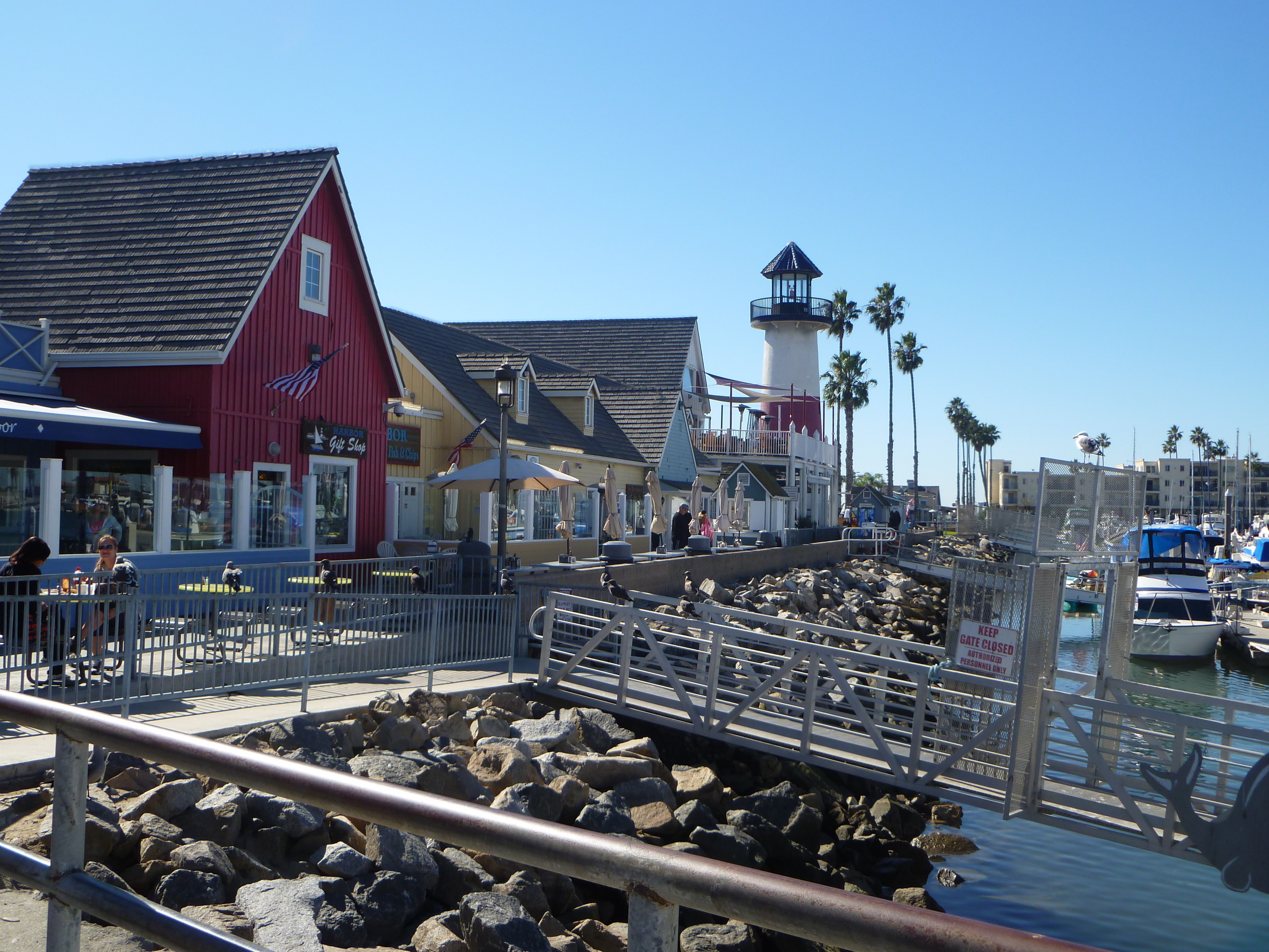
From the Mission Bay area you can ride to ritzy La Jolla (Ride SD2) and laid back Ocean Beach (Ride SD3). A Class II route leads to the stimulating bike trail along San Diego Harbor (Ride SD4). From there, a bike/ped ferry accesses the beautiful bike riding on the Coronado peninsula (Ride SD7: Cover photo – Hotel del Coronado). And, on-road bike routes lead up to the very European Balboa Park and the San Diego Zoo (Ride SD6).
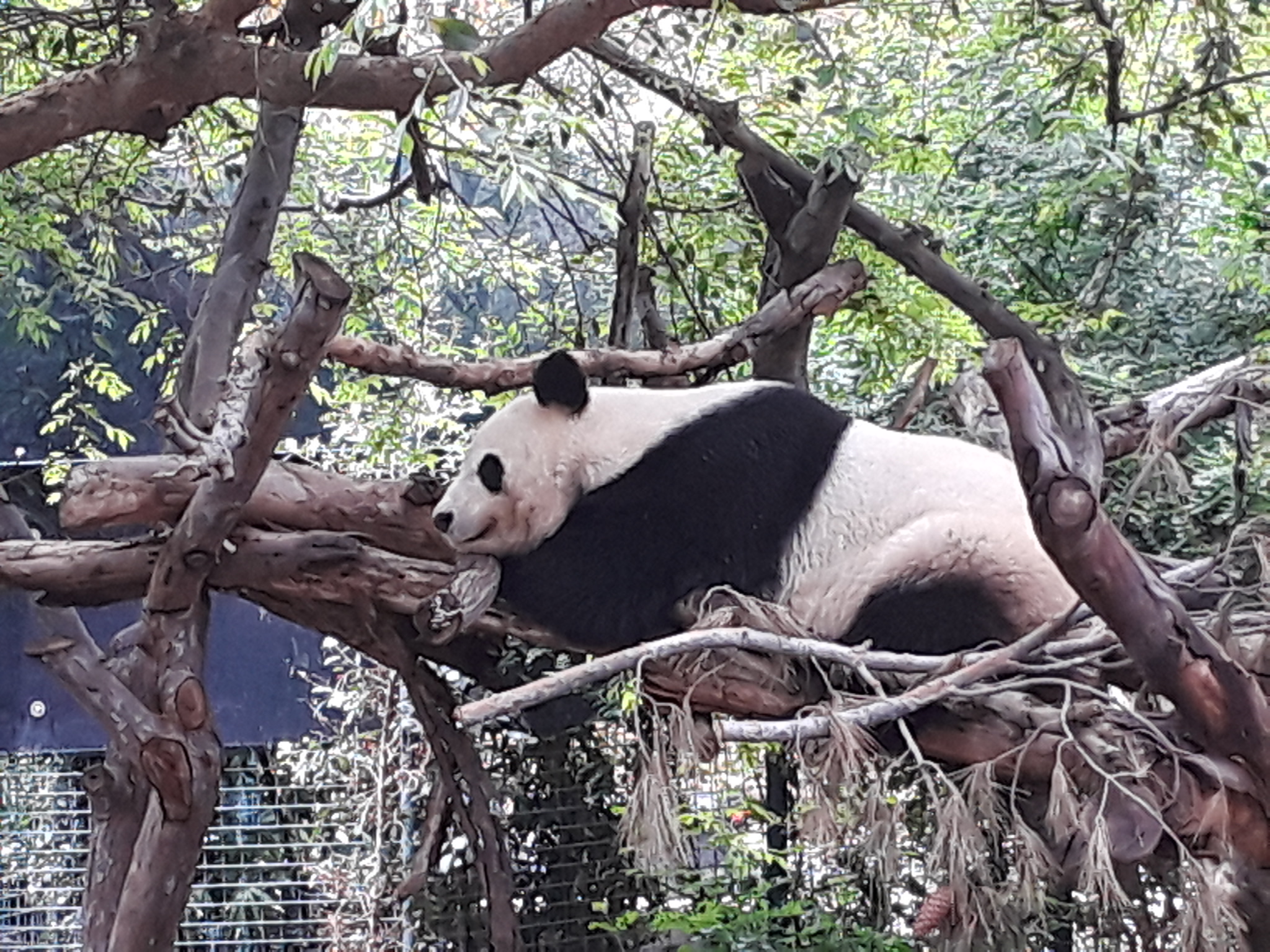
The amazing San Diego Zoo (SD6).
Whistlestop 13: Downtown San Diego Santa Fe Depot
The historic downtown depot, just a couple of blocks from the harborfront trail, is our final stop, and the best station to access the harbor ride (SD4), Coronado via the ferry (SD7) and Balboa Park/Zoo (SD6). More advanced riders or e-bikers with battery to spare can continue UP the hill to the spine of the Point Loma Peninsula to visit the spectacular Cabrillo National Monument at its tip (Ride SD5).
A moving bike statue along Coronado’s scenic waterfront path (SD7)
Return to your origin from downtown San Diego, either taking the Coaster, transferring to the Metrolink in Oceanside, or Amtrak’s Pacific Surfliner the entire way.
Big Bear Lake sits about 7,000 feet above the urban valley floor in the spectacular San Bernardino Mountains of Southern California. Long known as a year round recreation playground with winter ski resorts and summer lake activities, cycling has mostly been of the hard-core variety, with little to offer to the more casual cyclist… until now.
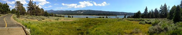
The long-established Alpine Pedal Path runs ~2.4 miles along the northeast shore of Big Bear Lake, connecting campgrounds to the Stanfield Cutoff that leads to town. It’s not flat, but is easy enough, with plenty of gorgeous lake views and forest scenery. On warm days the pines emit a delightful aroma, and summer wildflowers can abound. A beautiful but hilly 1-mile spur leads through the pretty forest to the Discovery Center. In summer 2017 the main path was widened and re-paved making it much better for bikes and peds to coexist. Still, weekdays are much preferred in that regard. Meanwhile, the City of Big Bear Lake has developed a system of bike routes through serene residential streets, leading to the quaint Village, the hub of dining and tourist shopping. A bike path runs parallel to Pine Knot Ave.
Projects are underway to make a better connection between Alpine Pedal Path and the rest of the city bike routes. A separated bike path across Stanfield Cutoff connecting to the Pedal Path was completed in 2020 along the west side of roadway, which is short but sweet and one of the most scenic stretches of path in SoCal with iconic views across the lake. At time of writing that path is being extended (expect by late 2021) to Big Bear Blvd, and to the southwest adjacent to that main road, connecting to Sandalwood and pleasant in-town bike routes. Future plans also include a bike path from the Bear Mountain ski area all the way down to the lake along the Rathbun Creek corridor, intersecting Sandalwood. A very impressive 0.7-mile portion is already completed between Elm St near the new Zoo location and the Sizzler parking lot. Several agencies, including the US Forest Service, CALTRANS, San Bernardino County and the City of Big Bear Lake have been coordinating all of these projects. Signed bike routes through neighborhoods also traverse Big Bear City.
The other option for casual cyclists with fat tires is the Sky Chair lift at Snow Summit ski resort that leads to a choice of a fire road or the new Skyline Trail east down the mountain, as well as other options, depending on ability. You can also ride up the mountain on Forest Service Road 2N10 from the Bear Mountain area, a trip that e-bikers will be more appreciative of. A reward of a meal at the outdoor Skyline Taphouse BBQ (when open) can await you. It’s a very scenic ride through the National Forest with some awesome vistas.
We’ve spent one to two months RV camping near the lake’s northeast corner every summer since July 2017, and enjoyed near perfect weather (high 70’s – low 80’s, sunny, with an occasional fun monsoon thunderstorm) while the valley below was baking. We rarely needed our truck; we just hopped on our bikes to explore the paths and new routes, which I mapped out for enCYCLEpedia’s 2nd and 3rd Editions, with the latest maps available on the enCYCLEpedia website for book owners.
Re-paved and widened Alpine Pedal Path, north shore.
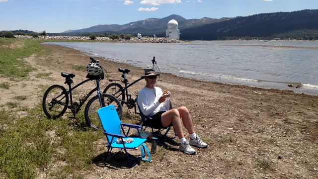
Steve relaxing at the west end of the Alpine Pedal Path along the lake. The Solar Observatory in the background at times has offered free tours to small groups weekly in summer.
Rich pausing along the bike routes on the south shore near town.
Steve on Pine Knot, the main Village street, with horse and buggy going by.
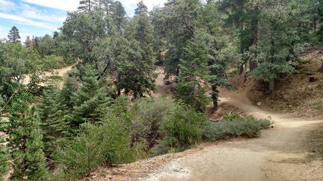
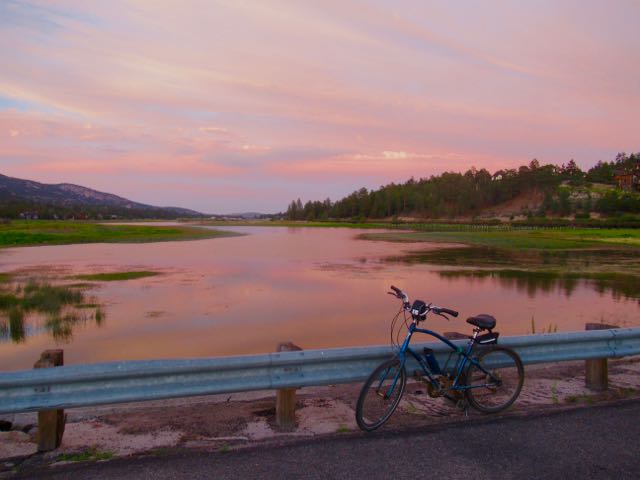
The Towne Trail is a fairly hilly forest path, an alternate route to taking the city streets from the Snow Summit lifts west to The Village. It also serves as a feeder for MTB’ers who descended the west side of the mountain, returning to the lifts. The Snow Summit website says e-bikes are not allowed on this trail, for what that’s worth. Spur trail off the Alpine Pedal Path to the Discovery Center.Sunset from the Stanfield Cutoff (pre-bike trail). New ultra scenic path along Stanfield Cutoff connects to Alpine Pedal Path. Bumpy boardwalks above Stanfield Marsh and dirt paths create a safer alternative to the busy main roads between Stanfield Cutoff and Division. Signed bike routes through Big Bear City.Short but sweet completed section of the Rathbun Creek Trail. Cycling up FS 2N10 with views of Mt San Gorgonio.View of Big Bear Lake from near the Snow Summit lift station. Skyline Taphouse at Snow Summit near the lifts, accessible via FS 2N10D. Cyclists arriving via the Snow Summit Sky Chair.
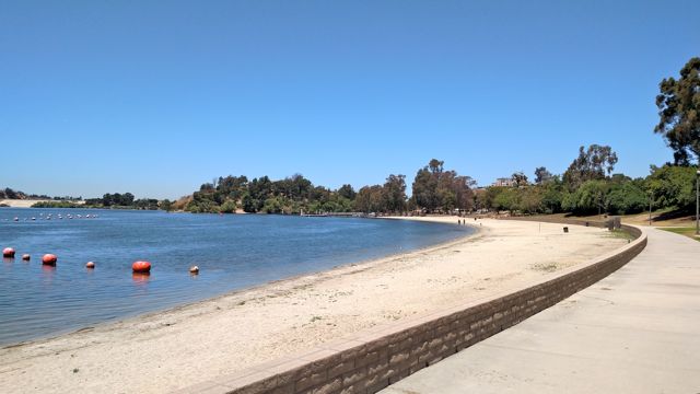
At the east end of Los Angeles County, at the junction of Pomona, San Dimas and La Verne, lies Puddingstone Reservoir, a flood control and groundwater recharge facility that for decades has been a draw for its fishing, boating and swimming. It is surrounded by Frank Bonelli Regional Park and the huge Raging Waters water park, while the LA Fairgrounds (Fairplex), and Bracket Field small plane airport are adjacent.
Bonelli Bluffs (Formerly East Shore) RV Resort) has around 500 sites, although half of those are long term. They also have some tent sites. Built in the hills above the lake, many sites have panoramic views of the lake and the San Gabriel Mountains.
At the lower, or “Unit F” Loop, two trailheads lead to our main attraction, a fairly easy bike route around the reservoir, with only a handful of manageable hills. It is a combination of paved lakefront promenades along the north and south sections of Bonelli Park, a scenic novice mountain bike trail, and a long easy scenic cruise across Puddingstone Dam. It is a 5-mile loop, or 8-9 miles if you opt to cycle on Class I/III roadways around the airport, perhaps stopping at Norms Hanger cafe for breakfast or lunch, a popular thing to do with cycling groups.
Bonelli Park has a lot of trails throughout, and much of it is more challenging mountain bike singletrack. For those who like to stick to roadways, there are both easy and difficult hilly options around the lake. East Shore RV Park is expensive, and is full well in advance most weekends. We take advantage of the 3-for-2 weekday special.
View of lake and dam from our site at C Loop of East Shore RV Park.
Path leading from Unit F along east side of lake.
Path winding along southeast shore of lake.
Scenic mountain bike trails on west side of reservoir.
Long flat road over Puddingstone Dam.
Nice promenade along north section of Bonelli Park.
Closed road next to Bracket Field leads back to Unit F of the campground. Norm’s Hanger is a popular spot to park/stage from, and have an al fresco meal on the patio watching the small planes take off and land.
Cambria is an upscale jewel of a coastal community near the north end of San Luis Obispo County, and is the gateway to San Simeon, home of the fabled Heart Castle. Its historic downtown is located inland, east of Hwy 1, a popular destination for shopping and dining. The spectacular coastline is accessed along Moonstone Beach Drive, a short bike ride from the downtown. The coastal Fiscalini Ranch Preserve contains some welcome open space and provides a mile-long bike cruise on a fire road, or some hilly singletrack for mountain biking. A very pleasant ride on trails and low speed limit roads will take you to all of these Cambria highlights. Those who feel comfortable with rural road riding can amble inland up scenic Santa Rosa Creek Road to the Stolo Winery and Linn’s Fruit Stand, famous for its Olallieberry pies. The perfect way to explore the town nicknamed “Pines by the Sea” is via a two-wheeled cruise, as described in the book “enCYCLEpedia Southern California- The Best Easy Scenic Bike Rides.”
It’s beginning to look a lot like Big Sur since Cambria is the gateway to the spectacular Hwy 1 coastline. Pictured is the boardwalk along Moonstone Beach Drive, great for a stroll but bikes must ride on the adjacent low-speed roadway.
Find free parking and restrooms at Leffingwell State Beach at the north end of Moonstone Beach Drive, an option for your ride start.
The hardpacked fine gravel fire road provides a very scenic 2 mile round trip ride across the coastal Fiscalini Ranch Preserve. A hike-only path closer to the sea allows better views of the sea otters foraging in the kelp beds.
Beautiful coastal vistas from a neighborhood park en route to the Fiscalini Ranch Preserve.
Singletrack MTB trails in Fiscalini Ranch Preserve lead to a grove of rare Monterey pines.
Downtown is split into West Village, and East Village, where you’ll find historic Linn’s restaurant, among others.
Choose from many restaurants in town. This interesting Danish breakfast is at the Creekside Garden Cafe, popular with cyclists.
Lovely Stolo Winery, open for tastings, is 1.5 miles up scenic Santa Rosa Creek Road.
Linn’s Farm Stand, 5 miles up Santa Rosa Creek Road, sells fresh pies and fruit-related gifts.
Linn’s famous olallieberry pie.
October is a great time to visit Cambria, when most businesses and organizations create a scarecrow to represent themselves in lighthearted satire.
Here is a humorous scarecrow at Cambria’s dog park.
Cape Disappointment State Park is a gem, situated at the southwest corner of Washington State near Long Beach, where the Columbia River empties into the Pacific Ocean. A jetty built in 1917 to aid in shipping navigation resulted in the formation of most of the land comprising the lowlands of the park, including the campgrounds and the beautiful sandy ocean beach. Dramatic Cape Disappointment and North Head lighthouses stand sentinel over the entrance to the Columbia and the region known as “The Graveyard of the Pacific” because of the over 2,000 shipwrecks that have occurred in this area.
This very popular park near the resort area of Long Beach contains a large campground for RV’s with hookups or tents. We explored the park by bike, riding along the firm sands of the beach, then up past “Waikiki Beach” and several installations of the Confluence Project, which features structures replicating those used by Native Americans. The return ride is through the idyllic park road for a total of about 5.5 very scenic and flat miles.
Following is a video of our experience from May 2016.
Those wanting more of a challenge can ride on the hilly roadways to the two lighthouses.
Nearby is the 8.5 mile Discovery bike/hike Trail, that runs mostly behind sand dunes and through forest between Ilwaco and Long Beach, skirting the State Park but not connecting to the park’s flat coastal section. We will be exploring that trail on our next visit to the area. In the meantime, here is a nice description of it: http://outdoorsnw.com/2012/escapes-long-beach-wash/
The spectacular Oregon Coast is a worldwide destination for ambitious cyclists that brave busy and hilly US 101 for the rewards of ocean vistas, pastoral countryside, and access to many wonderful coastal towns. For the Easy Scenic Cyclist, however, there are precious few places available to explore this region by bike.
My favorite town along the coast is Yachats, the “Gem of the Oregon Coast.” It lies between Newport and Florence, just north of the spectacular Cape Perpetua coastline. Cyclists riding along Hwy 101 can pass through the town in a matter of minutes, but those of us that enjoy slower, scenic riding can linger on its waterfront gravel 804 Trail in the north (part of the Oregon Coastal Trail) and Yachats Ocean Road to the south, with the lovely village in between that offers several interesting eateries to choose from. You can spend over an hour pedaling around this town that travel guru Arthur Frommer named as his #7 travel destination in the world!
This short video gives you a feel for what it’s like to pedal around Yachats.
Colorado offers endless opportunities for mountain biking, especially in the Rocky Mountains. Most trails are technical but there are also lots of trails that the novice can handle.
The aspens turn bright yellow in late September to early October depending on elevation, adding even more stunning beauty to the mountain scenery. Kenosha Pass is one of the most popular leaf peeping areas in the state because of it’s location about an hour southwest on US285 from the Denver metro area and the wide panoramas of fall foliage seen there.
The Colorado Trail crosses US285, open to mountain biking here. The trail that heads west is steeper and more technical, however the eastern side that is open to bikes for its first 6.5 miles is more for the novice. During peak leaf peeping season, however, expect scores of hikers on the trail, especially on weekends. Another option is a forest service road that starts here and passes some great aspen stands.
Trailhead for the Colorado Trail at Kenosha Pass.
Colorado Trail with fall color.
Cycling the Colorado Trail at Kenosha Pass.
A great spot for lunch overlooking the valley.
Heading back down the Colorado Trail.
The easy scenic cycling adventures of Richard Fox, author of the 2014 (2nd Ed 2017, 3rd Ed 2021) guidebook "enCYCLEpedia Southern California – The Best Easy Scenic Bike Rides."


 My guidebook enCYCLEpedia Southern California – The Best Easy Scenic Bike Rides (3rd Ed, 2021) contains detailed ride descriptions through the most scenic areas,