Category Archives: Environment

Bicycle Tours From Mediterranean Cruise Ports – Part 3: Italy

Tour in bicicletta dalle città portuali italiane

By Richard Fox, December 2023

There’s nothing like bicycling in Italy. Most bike tourists experience extended tours of places like the Tuscany region, but we cruise ship travelers also had our fair share of Italian cycling bliss. Three of our four cruises stopped at a total of nine Italian ports, and some ports were visited more than once. We enjoyed five bike tours from the Italian ports.

Starting from the northwest, our Celebrity Edge stopped in the beautiful town of Portofino. There were no biking opportunities there, but it is better seen on foot anyway, especially walking around the town and out to the fort and lighthouse. The Edge also stopped in La Spezia, where we accessed a spectacular bike tour in the hills and coast outside of Cinque Terre National Park. Livorno, a stop on Norwegian Breakaway, was the gateway for a bus excursion to Firenza (Florence). Between the required shuttle to downtown Livorno to catch the next phase of travel, and uncertainty of the timing of getting to Firenza it was near impossible to coordinate a bike tour, and none were offered by the ship. Walking is the best way to see Firenza as we did, but if you have the time, it is also a lovely city and surrounding Tuscany area to explore on a bike tour.

The situation is similar in Roma, where passengers first have to take a shuttle to downtown Civitivecchia, and then figure out how to get to Roma from there, making the timing of a tour difficult. We had a few days in Roma between two cruises, and were able to take advantage of a fabulous bike tour there. The Napoli (Naples) port is adjacent to downtown, so when our Norwegian ship docked there it was easy to meet our guides nearby and do a great bike tour to a vineyard. We spent three days in Salerno from Holland America, but that was our jumping off point to tour Pompeii and the Amalfi Coast, so we didn’t bike there. Our stop in lovely Sorrento was from a surprise last minute change, so we didn’t have the chance to look into cycling there, although it seems walking was the perfect way to explore the town in the time allotted. Bike tours are offered in the surrounding countryside, better suited for longer stays there.

Holland America stopped twice in Messina on the island of Sicily, and we did a nice coastal self-guided ride there. Finally, in the Puglia region on the southeast coast we experienced a delightful bike tour of the city of Bari.

The four guided tours were led by wonderfully knowledgable and affable locals that made the already beautiful and interesting routes even more enjoyable. The spectacular scenery always thrilled the senses, and the local cuisine we sampled delighted the palate, especially the pasta, focaccia, and gelato. Like most of the Mediterranean ports, these areas combined scenic waterfront paths with fascinating and welcoming ancient cities to cycle through. The tours were booked either through the apps GetYourGuide or Viator, or directly from the shops.

Our 2nd of four cruise ships, Celebrity Edge anchored off of Portofino (banner photo) on the Italian Riviera, showing a tender heading towards the ship.

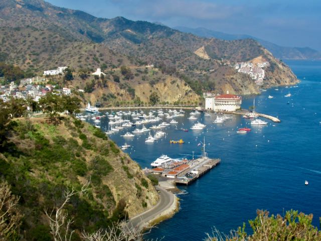
LEVANTO – LA SPEZIA: Cinque Terre Area, Liguria

Cinque Terre National Park is all about the hiking between the five charming seaside villages, although in fall 2023 some of the main trail sections were still closed due to landslide damage. The Cinque Terre train runs between the two main access cities, La Spezia to the south and Levanto to the north. Unfortunately the train mostly runs through tunnels with a paucity of vistas. The more scenic transport option if you have time is the ferry that accesses the villages. La Spezia Centrale train station is about 3 km uphill from the port, where our Celebrity Edge ship was docked. After the free shuttle from the ship to port entrance we took a cab for 15€ to get to the station for the 25 minute trip to Levanto to meet our bike tour. We later walked back to the port through pleasant pedestrian promenades through town and along the shore. I noticed bikes on La Spezia streets and the waterfront promenade, so if you stay in town you can look into a rental to explore there. 
EBikeInCinqueTerre in Levanto offers e-bike adventures into the National Park, way up in the hills on back roads, then dropping down into one of the villages. Though Cinque Terre is their calling card, EBikeIn also offers an alternate route, which is outside of the park boundary but with similar views, and without the Cinque Terre crowds. Our group of four opted for this less crowded version. We climbed, and climbed, and climbed from Levanto into the Ligurian hills of Framura, our Class I e-bikes giving us plenty of assistance, with some exertion still required. Our wonderful guide, Sara, provided lots of interesting information about the region. The scenery was stunning as promised on this beautiful sunny day, with vistas of the sea and far off villages. We stopped for coffee in a small charming hamlet then back down to sea level. We passed the village of Bonassola and at a 400-year old chapel overlooking Bonassola Bay, Sara brought out local wine and delicious focaccias. We took the Mare e Monti rail trail back toward Levanto. It was mostly in lit tunnels, with some breaks for sea vistas. This was a fabulously satisfying bike ride, a home run, the best ride of our trip. No surprise that EBikeIn gets all 5* reviews. Distance: 24 km (18 miles); Elevation gain: of 500 m (1600 ft). Cost: 70-80€ each if booked directly with EBikeIn, more via the apps.
After the tour, on our return train ride to La Spezia, we stopped at Vernazza since we wanted to experience at least one of the Cinque Terre villages. As expected it was a beautiful village in a stunning setting, though overflowing with tourists. We had our traditional gelato while gazing at the village from the harbor. The Cinque Terre train is 5€ per trip, or 18€ for a daily Cinque Terre Trento Pass that includes unlimited train rides, admission to a couple of park hiking trails that require an entry fee, and other perks.

Sara at Madonnina della Punta
Bonassola Bay
Bonassola
Mare e Monti rail trail
A small hamlet in Framura
Vernazza
Vernazza

ROMA

To get into Rome from its port requires a free shuttle to downtown Civitavecchia, and then taking a train, bus or taxi into Rome that can take 1 to 2 hours. Doing a ship-sponsored tour is expensive but ensures you get back and forth in time, however they rarely offer bike tours. On our port day during our Holland America cruise we just did a walkabout around Civitavecchia, which was enjoyable. Many cruises start or end in Rome, and thankfully in our case we had three days in Rome between our Holland America and Norwegian cruises, so were able to do what we wanted without time constraints.

On our arrival day in Rome, thanks to a helpful AirBnB host who let us check in early, we did a very memorable afternoon e-bike tour, led by Mario of Landimensiontravel.it. We were the only ones on the tour, but he was just as enthusiastic and fun as if it was a big group. He gave us the option of a route to see the major sites, or an alternate tour with hidden gems with less crowds, which we took, since we had other days to see the sites like the Coliseum on foot. The shop was an easy walk from our AirBnB near Piazza Navona, versus others that started near the Coliseum. We explored his trendy Trastevere neighborhood, and swung by St Peter’s Square and way up Janiculum Hill for pano city views. We sampled some local sweet treats as we wandered mostly along narrow cobblestone back streets, with minimal exposure to crazy Rome traffic, stopping to see some lesser known but fascinating points of interest. It was the highlight of our Rome stay, and one of our favorite e-bike tours. Cost: ~65€, directly or via Viator, as we did.

There’s a wide variety of bike tours available in Rome, as well as along the Appian Way past Roman aqueducts. Many rave about that route but it can be bumpy and muddy so check conditions before taking a tour or renting a bike to do that. There is also a paved bike path along the Tiber River through Rome. 

A hidden gem on a Roma backstreet
Riding towards Castel Sant’Angelo, also known as Hadrian’s mausoleum, a cylindrical fortress that lies on the banks of the Tiber River near Vatican City.
St Peters Square
View from Janiculum Hill
Mario showed us how to use Rome’s famous and drinkable water fountains
Church of Santa Cecilia in Trastevere. Saint Cecilia, a Roman virgin martyr, is the patron Saint of musicians.
Famous Biscottificio Artigiano. Mario had arranged to get us cookie samples. Deliziosa!
Mario treated us to fabulous granitas in a Trastevere cafe.

NAPOLI - Campi Flegrei Region

The port of Naples is adjacent to the city, with no shuttle or tender required. We wanted to dive right in and get the feel of this historic city with a famed Margherita pizza in our cartoon balloon. We were willing to brave its crazy streets to do a city e-bike tour that included sampling of pizza. Alas our tour with Mavin BikeRent via Viator was cancelled last minute because of an ill guide. We were offered a substitute, a tour to a local vineyard north of the city, so we did that instead. All participants were picked up from near the port and driven about 20 minutes north to the outskirts of Naples to their shop and provided with good, solid e-bikes.

The route was on city bike paths and streets leaving the shop, emerging to a low traffic street along the stunning Pozzuoli seafront with views across to Capris. Our guide discussed the volcanic origins of the area that is still active and concerning. After riding through a historic district, a small industrial area and the ruins of the central market of the ancient Roman city of Pozzuoli, we reached the volcanic crater lake, Avernus (Lago d’Averno), “gateway to Hades .” Across were ruins of Roman baths and a vineyard. We rode through the vineyard on a dirt path and were treated to red and white Campi Flegrei region wine made there, along with a delicious spread of local focaccia, olives, cheese and sandwiches. We had a good visit with the other participants, a nice feature when a tour includes a meal.

The ride back started nicely around the lake, but soon went to a hilly busy road with no bike lanes, with just a couple of panoramic views out to sea from the hilltops. Our one stop was to view the impressive Roman theatre site, Anfiteatro Flavio di Pozzuoli, circa 1AD, the third largest amphitheater built by the Romans. It was closed for renovations so we just peered in from the street. I would have preferred to return via the scenic uncrowded coastal route instead of the busy inland route, even if it meant missing this one stop, although Steve enjoyed the faster inland route. Our guide exclaimed “if Napoli drivers honk at you, they’re just saying hello!” When we returned to port it was too late to go into town for pizza, alas we will just have to return. All in all It turned out to be yet another fantastic exhilarating biking day from a port city. Cost: ~85€, directly or via Viator, as we did.

Pozzuoli seafront path
Our guide explains the volcanic origins of and current threats to this region
Ruins of Roman Pozzuoli marketplace
Lago d’Averno and ruins of Roman baths

MESSINA – Sicily

Messina has a compact and beautiful old town with the giant Piazza del Duomo facing the impressive Cathedral of Messina (Basilica Cattedrale di Santa Maria Assunta). Its bell tower contains the biggest and most complex mechanical and astronomical clock in the world. At noon crowds gather to watch its gilded bronze statues move and emit sounds for 12 minutes related to Messina’s civil and religious tradition .

Downtown Messina can be easily explored by bike, or on foot, just a couple of blocks from the cruise port with no shuttles required. Other interesting historic parts of town are up in the hills. The signature easy scenic bike ride here is 32 km (20 miles) up and back from downtown Messina to the northeast tip of Sicily at Torre Faro where there is a quaint village, beautiful beaches, a fort, and a giant tower, Pilone di Torre Faro, once used for high tension lines. The Riserva Naturale Orientata Laguna di Capo Peloro – Pantano Piccolo o Lago di Torre Faro (nature preserve) is also in this area.

We rented e-bikes from MediterraneaBike, about 10 minutes walk from the port. The first km of cycling from downtown was dicey riding amongst impatient Sicilian drivers, but a welcome seaside bike path then appeared, providing stunning views of the sea across to the Italian mainland. Unfortunately the bike path does not continue to Torre Faro and in a few km we were once again thrown into the mix with the speedy little cars. Traffic thinned as the route led to a community along a lake, Lago di Ganzirri, and then to Torre Faro and the features described above. A loop route wound around the other side of the lake and back the same way we came. I found this route on the Komoot app from MediterraneaBike’s web page, and it provided turn by turn instructions, which was very helpful for the Torre Faro loop portion at the end. Cost: 50€, daily e-bike rental fee, no hourly. Since it is a flat route you may consider a regular bike instead for 25€ .

Cathedral of Messina at noon, and this is shoulder season
Parrocchia S. Maria delle Grazie
Lago di Ganzirri
Torre Faro
Torre Faro and the Pilone di Torre
Faro di Capo Peloro (lighthouse)
Torre Faro area seen from cruise ship

BARI – Puglia Region

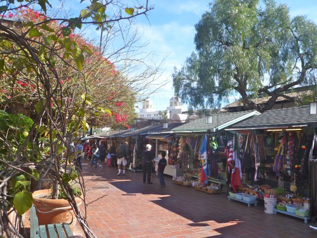
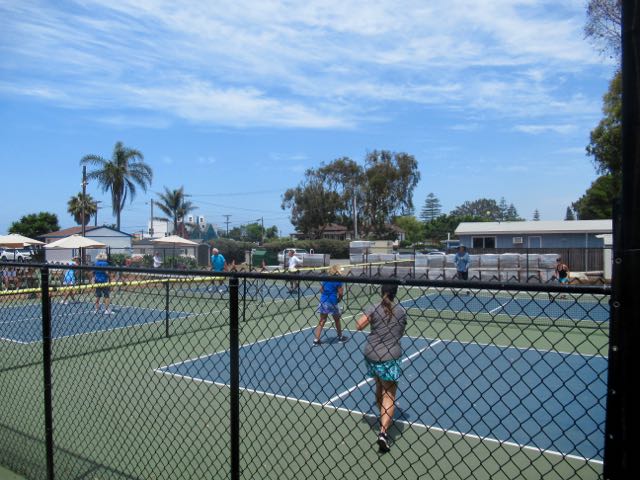
Bari is the principal city of the Puglia region of southeast Italy. Bari’s cruise port is located within a 10 to 15 minute walk of the old town district, Bari Vecchia, where bikes are allowed on the narrow streets when feasible to ride. Interesting features abound, such as ladies making and selling their pasta along the ancient streets, while on another street vendors fry and sell polenta, called Sgagliozze. At the harbor fishermen sort and sell their catch including octopus. Of the several historic churches, the main one is 12th Century San Nicola (Saint Nicolas) Basilica. Bari’s fortress, Castello Normanno-Svevo or Norman-Swabian Castle was first completed in 1132. A waterfront promenade makes for a nice scenic cycle for over a kilometer. Otherwise biking outside Bari Vecchia is on a few bike paths or with traffic in the newer sections, some streets having bike lanes or sharrows markings. Topography is fairly flat, so e-bikes while nice to have are not mandatory for an easy ride.

When planning I had seen several bike tours on the usual sites. One included a pasta making session. We did the basic 2.5 hour Highlights of Bari e-bike tour operated by ToursPuglia. Our guide, Rocco, was fun, enthusiastic and proud of his city and that made us appreciate it even more. We enjoyed the thorough introduction to Bari and the Puglia region, saw all the key sights, and had a great time. The e-bikes were the most comfortable of any on our trip, especially important for tall Steve, who had suffered in Messina. We would’ve liked even more actual riding with such nice bikes. After leaving Rocco we walked around Bari Vecchia until we were pooped. I can recommend doing a bike tour here, especially with Rocco of ToursPuglia, then walking around as we did. Cost: ~59€, booked directly or via an app.

Arriving into Bari’s port.
Rocco tells Steve about Castello Normanno-Svevo circa 1132.
Statua di San Nicola (Saint Nicolas) donated by Russia in 2003
The Basilica di San Nicola (circa 1197) holds religious significance to many and contains the tomb of St Nicolas. Rocco relayed the story of how St. Nicolas dropped a bag of money down the chimney of the family home of a woman with no dowry (in Ancient Greece), thus allowing her to marry and avoid a life of servitude.
Some real personality by the maker of Sgagliozze
Bari is situated between two modern harbors
Bari Cathedral or The Church of St Sabinus (Duomo di Bari or Cattedrale di San Sabino)

Bicycle Tours From Mediterranean Cruise Ports – Part 2: Spain

Rutas en bicicleta desde ciudades portuarias de España

By Richard Fox December 2023

Norwegian Breakaway docked in Barcelona. A shuttle takes passengers to the edge of the historic district. 

CADIZ

Cádiz, located west of Gibraltar on Spain’s southwest Atlantic Ocean coast, is Europe’s second oldest city after Athens  with a rich history dating back thousands of years including the embarkation point for Christopher Columbus’s voyages. It is situated on a peninsula surrounded by the Atlantic, with a bike path running around its waterfront with stunning views, and through the city. The cruise port is conveniently located adjacent to the old city. Topography is mainly flat, so an e-bike is not necessary to have an enjoyable bike ride here. We joined a 2.5 hour bike tour by Cadizfornia Tours. Our guide did a great job showing us the highlights and providing a thorough understanding of the history of Cádiz as we cycled on its coastal bike paths and some charming cobblestone side streets. We stopped in and toured a couple of beautiful parks en route. We loved this tour, although it would be easy to navigate the coastal paths on your own. Being able to keep the bikes for an hour or two after the tour would have been ideal. Cost: 35€ + 15€ e-bike supplement, booked directly. Also available on the apps.

MALAGA

Málaga is located on Spain’s southeast coast in the Mediterranean Sea. It has a beautiful port district and its old town is in a lovely setting backed by hills close in. We booked a tour by E-Bike Malaga, located a few minutes walk from the port entrance, although we took a shuttle bus in to save the 20 minute walk from our pier. Our guide was a fun animated architecture student and made the tour informative and enjoyable, providing a great introduction to the history and culture of Málaga. We toured the medieval old city and then were led up a beautiful wide paved path that climbed gradually, passing a mini Moorish Alhambra (Alcazaba), to a spectacular viewpoint across the city, port, and out to sea. We descended to town and rode around the port area, onto a nice greenbelt path, and to the lovely ample waterfront bike path. The beach near city center is very scenic, and the bike path leads to neighborhoods known for local, non touristy restaurants. Málaga is a gem of a city and a bike tour is recommended to get the most out of the bike ride since there are not a lot of bike paths per se. Cost: 50€ included keeping the e-bikes afterward to explore on our own. Booked via GetYourGuide.

Catedral de la Encarnación de Málaga
Alcazaba

VALENCIA

Valencia is Spain’s 3rd largest city with a busy port, and a cruise-affiliated shuttle is required to get from the cruise dock area to the edge of town. Unfortunately the medieval old city and other major attractions are quite a distance from this point. A city bus can take you to these areas, where there are also bike rental places. We didn’t find a convenient e-bike tour, so we rented e-bikes from well-reviewed Beach Bikes, about a 25 minute walk from the port. Afterwards we grabbed a taxi for 9€ that took us all the way back to the ship.

Valencia has a very impressive system of bike paths all over the city. Beach Bikes provided an on line pdf map that contained its recommended routes. A nice path follows the beach promenade, and a river drainage through the city was converted to a linear park with a bike path through it, while paths extend out from it. It was a treat to cycle through the narrow streets of the old city. The modern Ciudad de las Artes y las Ciencias (City of Arts and Sciences) next to L’Oceanogràfic, the largest aquarium in Europe, is a highlight attraction, and accessible via bike path. The paths are well used by locals and drivers were patient and appeared to have respect for bikes when paths crossed roadways. All in all this is one of the most bike friendly cities we’ve experienced. Terrain is mostly flat, so an e-bike is not a necessity, except that you may cover a good distance if you explore many of the bike paths. Cost: 25€ booked direct.

Paths through Valencia’s linear park
City of Arts and Sciences museums (Ciudad de las Artes y las Ciencias)
Cyclists in the old city

BARCELONA

In early October we had a three day stay in between our Carnival and Celebrity cruises. On arrival day we did a Gaudi Highlights E-Bike Tour conducted by Barcelona E-Bikes. The port shuttle bus dropped us off near the start of Las Ramblas, but we walked along the river path and cut across to the ornate Gothic Quarter to get to the shop in a scenic 25 minutes, timed perfectly for the 11:00 ride start. Barcelona is a large vibrant city, and a guided bike tour is highly recommended to find your way and see the sights. Our guide was well versed in history and everything Gaudi, and led us on the extensive system of Class IV cycletracks and pedestrian promenades all over the city to and from their shop, mostly staying off of the crazy roadways. On this beautiful day we felt like we gained a good overview of the city, especially the Gaudi sites, beyond the famed Sagrada Familia. There are many e-bike tours to choose from, and most of them are well reviewed. Cost 37€ , booked through Get Your Guide.

Parc de la Ciutadella
La Sagrada Familia by Gaudi
History lesson…
La Pedrera-Casa Milà by Gaudi
Riding through the very pleasant Eixample district

In mid November we returned to Barcelona for a port of call on Norwegian on our return home, and were lucky with great weather. We decided to just rent this time and Barcelona E-Bike Rent accommodated us well with comfortable e-bikes. They gave us directions to climb Montjuic, site of the 1992 Olympics. Steve navigated on Google Maps and we had a scenic ride up there for the pano views, then across town mostly on separated Class IV bike lanes to Sagrada Familia and Arc de Triomf. It was a fun scenic ride but I can still recommend a guided tour to optimize your route and your appreciation of Barcelona. Choose an e-bike tour that goes up Montjuic for the views and sights up there. Cost: 32€ for half day, booked direct

View from Montjuic
Estadi Olímpic Lluís Companys circa 1927, renovated for 1992 Olympics, now home to FC Barcelona football (soccer) team.
Arc de Triomf
Plaza de toros de las Arenas

COSTA BRAVA REGION NORTH OF BARCELONA

While not a viable option for a day trip from the Barcelona port, many cruises start or end in Barcelona, allowing for excursions farther afield on those extra days you may have. We rented a car in Barcelona and drove 90 minutes to the Costa Brava region to the north, known as Spain’s biking capital. We had arranged in advance to rent e-bikes and do a self guided tour selected by BikeOn of Palafrugell based on my criteria of beautiful countryside, not too many big hills, away from traffic, and past medieval villages. BikeOn has loaded a bunch of rides onto the Komoot app and set us up on this one, about a 30 mile (48 km) loop from their shop. The app worked brilliantly, giving verbal turn-by-turn directions. The e-mountain bikes were great on the varied terrain of pavement, gravel, and dirt. It was an intricate route down obscure lanes through the countryside, and actually went through the heart of medieval villages, which were quite impressive and had cafes where cyclists could stop for a beverage or tapas in beautiful squares. Much of the route was even signed as the Pirinexus regional bike route. Our batteries gave out a couple of km before the end, but the bikes were still OK to pedal. It was a fantastic ride and a great experience. Historic Girona to the northwest of Palafrugell has several bike rental options and tours available as well. Cost: 50€ booked direct.

Pals
Peratallada
Old Bridge over the river Daró, Gualta, Baix Empordà
Gualta
Part of the Pirinexus regional trail system.

IBIZA

Finally, truth be told we didn’t cycle on the isle of Ibiza, but did observe what was there. The best cycling is known to be in the more remote portions of the island, not reasonable for a time-limited cruise ship excursion. Cruise ships dock across the bay from Ibiza Town, aka Eivissa. A scenic 2 mile (3 km) bike/ped path runs around the bay from the cruise port to and past the town. However, there are no bike rentals at the port, so one needs to walk or take a shuttle bus or City Boat (as we did) to get there. The old town is a delight to walk through, with plenty of restaurants and shops to explore. Above the old town is a much older ancient town, Dalt Vila, with its fortress and cathedral, accessible via steep cobblestone streets. Bamboo Bike Tours offers a well reviewed tour that gives participants a nice history of the town, with some hills to tackle to get to Dalt Vila on regular bikes only. An e-bike concession is also located downtown. We were satisfied doing a self guided walking tour, a good workout to climb up to Dalt Vila, and relaxing time browsing the shops near the waterfront.  

Ibiza town and Dalt Vila above seen from the City Boat ride between port and town
Ped/bike walkway along waterfront at Ibiza town
On the way up to Dalt Vila
At Dalt Vila

CYCLING LA’S ISLAND PARADISE – AVALON ON CATALINA ISLAND

by Richard Fox

enCYCLEpedia ride #CAT1. See the book for a map and more detail.

Do you have the urge to visit a Mediterranean Island?  If you can choose a warm sunny day, which can happen any time of year, a visit to Santa Catalina Island can be a sublime experience.  There is no car ferry to the island so the only vehicles are from the residents of the village of Avalon. Most get around on golf carts.  You can bring your own bike, or rent from a couple of concessions including Brown’s Bikes.  It’s a great way to get around, combining a bike ride with the other activities that range from mini golf to zip line to scuba diving. There is no shortage of shops to engage you and plenty of restaurants to savor.  Accommodations range from high end B&B’s and inns to a campground. The 20+mile ferry crossing takes about 1- 1.5 hours from several ports in Orange and LA Counties, and bikes are allowed for a fee. Check for particulars on transporting e-bikes on the ferries.

The easiest cycling is around the quaint village and on ultra scenic waterfront roads north and south of town. A gradual hill through a canyon leads up to the must-see Wrigley Memorial and Botanic Garden. But for the most scenic roads and vistas, some substantial hill climbing north and south of town is required. You’ll need a multi-geared bike or better yet an e-bike to tackle those. Adventurous mountain bikers can get a permit or take a guided tour to cycle farther south, above Avalon, on Catalina Conservancy land, home of the bison herd. Or try cycling the  length of the rugged 22-mile island.

Avalon’s downtown waterfront.
Avalon, the village.
Short waterfront road north of the historic Casino.
Waterfront road south of the village.
Vista including historic Casino from road to Mt Ada, south of town.
Scenic riding on hilly roads north of the village.
Breathtaking vista from the hilly north roadways.
Dramatic but hilly roads north of the village.
Allow a lot of extra time to gaze at and photograph the vistas.

CLARKDALE – TUZIGOOT – SYCAMORE CANYON TOUR IN northern ARIZONA’s VERDE VALLEY

By Richard Fox

We enjoyed a 17.3 mile Camp ‘n Ride on a warm September day in the Clarkdale area of Northern Arizona. Clarkdale is near the towns of Cottonwood and Jerome, about 20 miles west of Sedona. We staged from the Rain Spirit RV Park, situated along the main road of Broadway on the southeast edge of town. The ride encompassed historic Clarkdale, Tuzigoot National Monument, and the paved first 5 miles of scenic Sycamore Canyon Road along the Verde River. On another day we continued on the dirt road for a few more miles.

Clarkdale is known to most northern Arizona visitors as the place to catch the scenic Verde Canyon Railroad ride. We experienced that excursion once in late November, a good time of year with fall foliage usually peaking in the area. The depot is accessed off a side road from Broadway near downtown, over a narrow bridge.

The small historic town of Clarkdale founded in 1912 was originally a company smelter town created by William A. Clark for his copper mine in nearby Jerome. The photos below show Jerome in the hills above, a smelter, a slag pile next to the Verde River, and a facility that recovers and repurposes the slag.

Clarkdale was an early example of a planned community, with telephone, telegraph, electrical, sewer and spring water services, making it very modern for its day, and the central part of town is on the National Register of Historic Places. The mine and smelter closed in 1953, and the town fell on hard times, though a Portland Cement company revitalized the economy somewhat.

Currently there are not many dining options in Clarkdale in contrast to booming Old Town Cottonwood and historic Jerome, each just a few miles away. An exception is Violette’s Bakery Cafe, in the center of Clarkdale in an old railway car serving delicious French-style breakfast and lunch on their outdoor patio, which made for a wonderful bike and brunch for us. Across the street is Arizona Copper Art Museum in the old High School building, and around the corner the central Clarkdale Park featuring a circa 1915 bandstand.

Adjacent to the southeast of Clarkdale is Tuzigoot (which means “Crooked Waters”) National Monument, a well preserved pueblo on a limestone hilltop built by the Sinagua people between 1125 and 1400 CE, overlooking an extinct oxbow in the Verde River. Admission is charged to walk around the ruins, but there is a free paved path with interpretive signs leading to a view deck near the oxbow, which is now an important wetland.

The Verde River flows through Clarkdale year round, and Sycamore Canyon Road, accessed off of the Tuzigoot access road, follows the river and leads to access points where many people set in with their river kayaks to float downstream to the south. The road is little used except for warm weekends by people driving to the river accesses, and on weekdays with some trucks that use a facility midway. There is one substantial hill en route and a few gradual hills. E-bikers will be happy to have some options on those, as we did with our Class I Townie Go’s. We stopped at the end of the paved section in about 5 miles at a cattle guard.

On another day we continued onto the unpaved Forest Service road past the cattle guard, which is not a 4WD road, but was still bumpy for our e-bikes. We found good paths though and it worked out fine. We felt like we were in the old west, with just chaparral and red rock cliffs beyond. We turned around in about 2.5 miles, but you can ride much farther and also explore scenic side roads.

Connecting the Tuzigoot access road and central Clarkdale is Broadway, the town’s main thoroughfare with bike lanes and an ample paved sidewalk/bike trail alongside it. In the other direction, toward Old Town Cottonwood, the sidewalk and bike lanes disappear for 0.8 mile.

A GRAND CANYON E-BIKING ODYSSEY – A Heavenly week during the pandemic from hell

By Richard Fox

During the Covid-19 summer of 2020, the Grand Canyon trams weren’t running. These free trams run throughout the park, including along the main 7-mile scenic Hermit Road that is closed to cars, transporting hordes of tourists from around the world to Hermits Rest, stopping at all of the famous spectacular lookout spots, including Maricopa Point, Hopi Pt, Mojave Pt, and others. The tourists swarm the viewpoints, jockeying for position to take photos, then fan out to hike between them. We cyclists can still find some solitude along the route, but rarely close to tram stops. The Hermit Rd bike ride is a spectacular opportunity to experience some of the most scenic portions of the Grand Canyon on a closed road, a 14 mile round trip piece of paradise. Due to some hills it’s not the easiest ride when combined with the ~7,000 ft elevation, but most acclimated to the altitude should be able to handle it with a multi-geared bike. When the trams go by, about every 15 minutes, cyclists are required to pull off the road and let them pass, which doesn’t happen all that often on a typical ride, but is a pain when it does. The bike-carrying trams can come in handy for cyclists though, in case they get tired or suffer a mechanical problem, which could result in a long walk back to the village otherwise. Also, the first hill up Hermit Rd from Grand Canyon Village can be daunting for those on non-electric bikes not used to the altitude, and a lift up with the tram can remedy that. The roadway eventually descends downhill to its terminus at Hermits Rest, so if cyclists are not up for the ride back over the hill they can hop on a tram with their bike.

Me on my TownieGo 8D at a Hermit Rd viewpoint.

With no trams running during our visit in late August, ending before Labor Day weekend, the road was only open to bikers and hikers, so the farther down Hermit Rd we went, the fewer of either we encountered, especially hikers.

Most cyclists rent their bikes at Bright Angel Bicycles, a well-respected concession located at the main Visitors Center complex, about 5 miles from Hermit Rd via the Greenway Trail system, which allows bikes. When they began operations in 2010 it was a game changer, turning Grand Canyon National Park into a biking destination. They currently rent 7-speed cruiser style bikes, but National Parks prohibits them from renting e-bikes. (Update, 2023, they once again rent e-bikes including my TownieGo 8D!) They also offer guided tours. In past years, tourists from all over the world rented bikes from them resulting in hordes of cyclists on wide Hermit Road, which could easily accommodate them. This summer there were still quite a few cyclists, always great to see, but with so few foreigners, the numbers were significantly less, and in the mornings and late afternoons, the road was virtually deserted, how wonderful for us.

This was our first time riding Hermit Rd with e-bikes; we had done the ride many times over the years on regular geared bikes, most recently our 21 speed Townie comfort bikes. We now have Class I TownieGo pedal-assist models; Steve rides the 7D and me the 8D, and we both love them. The first substantial hill up Hermit Rd required significant pedaling, but it wasn’t a taxing experience at all on our senior bones and muscles. The rest of the route is hilly as well, but more gradual, which is a piece of cake for pedal-assist bikes, even at this altitude. We had spent the rest of the summer in Big Bear Lake, California, at 7,000 feet, so we were already acclimated.

E-bikes are allowed in Grand Canyon National Park as follows per the NPS website:

E-Bikes: The term “e-bike” means a two-or three-wheeled cycle with fully operable pedals and an electric motor of less than 750 watts (1 h.p.).
E-bikes are allowed in Grand Canyon National Park where traditional bicycles are allowed.
E-bikes are prohibited where traditional bicycles are prohibited.
Except where the use of motor vehicles by the public is allowed, using the electric motor to move an e-bike without pedaling is prohibited.

Steve on his TownieGo 7D at a Hermit Rd viewpoint.

The biggest difference this year was that most of the famous viewpoints were empty, we had them to ourselves! It was like having our own private National Park, shared with a few friendly cyclists, and hikers along the first few miles. Private picnics on shaded benches overlooking the canyon were easy to accomplish, and we enjoyed many moments of Zen contemplating the amazing sequence of geological events that created the canyon. Our rides were like something out of a biking fantasy, a once in a lifetime opportunity ironically created by the most horrible of pandemics. Most of the other cyclists were smiling widely as well, save for a few on rental bikes struggling up the hills.

One of the busiest moments at a viewpoint during our stay. During most of our stops at Hopi Pt we had it all to ourselves.

Of the main Hermit Rd viewpoints, our favorite is the wide ranging Hopi Point, where you can see the Colorado River in five places. We had it to ourselves most of the times we stopped there, or other times with just a few cyclists. Besides the main viewpoints, several pullouts offer equally classic views of the canyon, some all the way down to the Colorado River. Those tend to be less crowded than the main viewpoints when the trams run.

About 2.7 miles before Hermit’s Rest is an isolated 1.7-mile section of Greenway Trail where bikes are allowed. The trail runs on the rim side of the road through a mixed piñon forest, and offers several idyllic pullouts with shaded benches overlooking the canyon. It’s a bit hillier than Hermit Rd through here, but a worthwhile option. We selected one for a picnic on Steve’s birthday ride; what a way to spend a birthday.

Piñon milieu from a bench along the Greenway Trail parallel to Hermit Rd.

On our last day I did a last minute solo ride in the late afternoon. I was virtually alone on Hermit Rd, a bit risky if I had a breakdown but well worth it. I had the place to myself, an amazing solo experience in the Grand Canyon. I would stop at many of the viewpoints and pullouts, and just gaze, mesmerized. That was my fourth time riding Hermit Road that week. Steve had joined me the first three times, and was equally enthralled with it.

We stayed at Trailer Village RV park near the center of the developed area of the park, in the forest about a mile from the rim. It’s nothing special, except for the location accessed by the Greenway Trail system and the fact that elk wander through it, which all campers love seeing, although during the fall rut one needs to be careful of the rowdy bulls. The campground was full, which made sense given the popularity of Covid-safe RV-ing during the pandemic. Mather Campground, which caters to tenters, was not open yet.

The Greenway bike trail system runs mostly through the forest passing both campgrounds, so that visitors can hop on their bikes and ride to the nearby Market Plaza with its general store in a few minutes, or to Grand Canyon Village, the hub of the park with its hotels and restaurants including the historic El Tovar hotel and restaurant. It was open but we don’t like the idea of indoor dining during the pandemic. The tourist train from Williams stops there, and the rim along this section is the most crowded with tourists. From the campgrounds and Yavapai Lodge area it’s about a 3 mile, or 20 minute ride gradually downhill to the village. When trams are running there is one that can take you and your bike back up to the campgrounds, but not this year during the pandemic. Hermit Road begins at the west end of Grand Canyon Village and rises to the west.

Heading east from the campgrounds on the Greenway trail system leads through the forest to the main Visitors Center in a couple of miles, where the bike rental concession is located. There’s plenty of car parking there if you need to rent a bike.

Typical Greenway Trail through the woods. Good directional signs help navigate.

The trail veers off and reaches the rim east of Mather Point. Bikes are not allowed on the typically crowded Rim Trail to the west of there, all the way to the Village, and adjacent to Hermit Road except the one section of Greenway Trail near Hermits Rest mentioned above. However, heading to the east from this point on the rim begins a section of Greenway Trail that bikes are indeed allowed, making it one of the most scenic two miles of bike trail anywhere. It darts between low forest and rim-side panoramas. Since it’s only about a 15 minute easy cycle from the campground to the rim at this point, we rode it at least once a day to be able to gaze at the canyon in different lights.

Next to the Greenway Trail east of Mather Pt.
Scenic cycling at its best – the flat rim-side Greenway Trail is open to bikes between the Visitors Center and the S Kaibab Trailhead.

The Greenway Trail along the rim here skirts a couple of road pullouts where car parking is allowed, so peds are sometimes milling about at those spots, but besides that it’s pure biking heaven. As it bends around along the rim to the north, different angles of the canyon come into view with a choice of rim-side viewpoints. We’ve frequently encountered elk along this section of trail as well.

The path winds around the rim some more until reaching the restricted parking lot for the South Kaibab Trailhead, my personal favorite trail into the canyon. I’ve hiked down a mile or two many times, and in my earlier foolish years all the way to the river and back. In recent years I’ve kept to the rim on my bike instead, being satisfied with the past memories.

From the S. Kaibab trailhead parking lot, where there is a water fill station and restrooms, you can turn right down the access road, then turn left on the closed-to-cars road to scenic Yaki Point to get in an extra mile each way. Typically a tram brings hikers to the South Kaibab trailhead, and also up to Yaki Point, but not this summer. This ride to the east is much easier than the Hermit Rd ride, as there is very minimal topographical change. From the campgrounds to Yaki point is about 4 miles each way.

We left on the Friday before Labor Day, and watched cars streaming into the park. Trams were set to resume the next day, but only at 1/4 capacity, and only servicing the closed roadways of Hermit Rd and the South Kaibab/Yaki Pt. route. Expect to see more people at the viewpoints with the trams running, but most likely a fraction of the usual for this peak season of summer/fall, due to the absence of foreign visitors.

We never tired of cycling along the rim this past week, around 140 miles total. The weather was fantastic, even with afternoon monsoons the first couple of days, which freshened the air. Temperatures began to rise during the week, but the skies and canyon became clearer as well. Once we arrived, we didn’t need our vehicle at all, it was all about the bikes.

All in all, this was one of our most memorable and enjoyable weeks in recent years.

Fun Pandemic Biking on Palm Desert’s Closed Desert Willow Golf Course

By Richard Fox

The horrible Covid-19 pandemic has been devastating to people around the world, while Mother Earth has been able to breath a sigh of relief as our skies and waters have been the cleanest in years.

Southern Californians have been sheltering in place since late March 2020 to avoid overwhelming hospitals with Covid-19 cases, but have been allowed to exercise out of doors in small groups. Along the coast beaches have been closed because of dangerous overcrowding conditions. Out in the desert however crowds are much lower, as the snowbirds have fled, festivals and all tourist activities cancelled, and hotels and B&B’s shuttered. For a while the golf courses were closed as well, but they were eventually re-opened with safety precautions in place.

While the golf courses were closed, many of them allowed local residents to use them as parks for strolling and biking. I rode the cart paths in the golf community where I live for the first time in my 9 years of living here, and that was pleasant. However another nearby course called Desert Willow is the most beautiful in the desert, with rolling hills of native vegetation, lakes, waterfalls, expansive lush fairways, and being the high point in the Coachella Valley, panoramic views of the surrounding mountain ranges. The colorful desert fauna, blue skies, and fresh mountain snows from an unusually heavy April snowstorm combined to make this as beautiful a place as any. Perhaps you were able to cycle or stroll on a closed nearby golf course as well?

Desert Willow is a Palm Desert municipal course that contains two 18-hole courses, the original Mountain View course and the newer spectacular Firecliff course. Golf cart paths meander around both courses, resulting in a 12-mile paved bike trail when the course was closed. Although it became a fairly popular place to walk, there were only a handful of bikes taking advantage of it and the walkers were spread out nicely on the paths or fairways and did not create much of a hindrance to cyclists.

I rode the paths 8 days straight from when I learned about the possibility to when the course sadly (for me) re-opened. It was akin to having a fantasy bike park nearby, and I rode up to 20 miles at a time, taking in the vistas and watching the wildlife including road runners, a coyote (not chasing a road runner thankfully), colorful birds like the Vermillion Flycatcher and Scott’s Oriole, California Quail, giant lizards, and lots of bunnies. It was a “once in a lifetime” experience I shall never forget. Here are some photos from the experience.

View over the Mountain View course from the 1/2-mile entry road bike trail that is always open to us. (Part of enCYCLEpedia rides PD1 and RM1 and 2).
Heavy April snows in the surrounding mountains as seen from the Firecliff course.
Steve at Hole 18 of Firecliff.
We saw numerous road runners. This one was cooing and bragging about his lunch, possibly to a female.
Great White Egrets roosting along the Firecliff Course.
Vermillion Flycatcher.
Very bloomy prickly pear near a Firecliff tee.
Ocotillo mixed in with other trees.
Big lizard!
Steve on a typical Firecliff cart path.
Paths meandering around the Mountain View course.
Firecliff course.
Giant ocotillo from the Mountain View Course cart path. The wild lands surrounding the course are available for a hiking loop of about 1 mile when the course is open.
Beautiful Firecliff Course from the cart path.
Native vegetation along the entry road, always open.

BIKE TO SOCAL PICKLEBALL! BEST BICYCLE RIDES TO PUBLIC OUTDOOR COURTS

by Richard Fox

Updated January 2023.

The only sport taking off faster than bicycling in Southern California is pickleball, that wacky, fun, addicting combination of tennis, badminton, racquetball and ping pong. While popular with all ages, it’s the senior citizens that are embracing it the most enthusiastically. With courts one quarter the size of tennis courts, it has a similar feel, but with less ground to cover, and the required underhand serve is much easier on the shoulder. It is more frenetic than tennis, however, and seniors have been getting injured fairly regularly, with pulled muscles and other injuries. That’s certainly not scaring too many away though, and pickleball courts are springing up everywhere to meet the demand.

Being able to combine your pickle with an easy scenic bicycle ride makes for the perfect day, especially if you bike to an al fresco lunch or brunch afterwards. It serves as a good cross training warm up for one’s muscles as well. Or, bring your bike with you and use it as a starting point for your ride. If one of you wants to ride and the other wants to pickle, knowing which courts are close to bike rides is helpful.

Pickleball courts are springing up everywhere as the demand from the public increases, and many parks now have at least courts with temporary nets available, with many permanent courts built as well. Most are free except where clubs have been established that collect membership dues or day use fees for visitors. Many community HOA’s have private courts not open to the public. Country clubs and resorts will either have courts open exclusively to members, or offer day use for a fee. This article highlights some of SoCal’s most popular pickleball facilities available to the public with notable easy scenic bike rides nearby. The courts are mostly outdoor, although you can also find indoor courts in public recreation buildings in many cities.

The bike rides are referenced from my book enCYCLEpedia Southern California – The Best Easy Scenic Bike Rides (3rd Ed 2021) and many of the pickleball facilities are plotted on the downloadable maps available to book owners at enCYCLEpedia.net.


The DESERTS
The Coachella Valley is overflowing with senior snowbirds starting late October, peaking in February-March-April, then fading into May through the hot summer. Year round residents still play in the hot seasons, but need to either start at the break of dawn, or try one of the several indoor public gym facilities.


Palm Springs (enCYCLEpedia Rides PS1,2,3): Demuth Park is the only game in town for outdoor play, with 12 permanent courts. It’s popular most mornings, especially Saturdays, and most late afternoons as well, making pickup games a cinch. It is located along Mesquite Blvd, east of El Cielo, along the Tahquitz Creek bike loop (PS3). In fact a new state of the art path, a CV Linker that will connect to the valley-wide CV Link path in the future, runs along Mesquite between El Cielo and Demuth Park, then adjacent to Demuth’s south perimeter (photo). There are also indoor facilities in the Demuth Park Community Gym and in North Palm Springs, with two courts at the Desert Highland Unity Center.

A post-pickle ride near Demuth Park on a CV Link section of the Tahquitz Creek Loop (PS3).


Rancho Mirage (Ride RM2): Two very nice new courts are located in Rancho Mirage Park along San Jacinto Dr north of The River center. This is more of a BYO player situation with no set open play times.

Great al fresco dining awaits at The River, a few blocks from the courts. How about a pickle, bike and brunch?


Palm Desert: Freedom Park is an excellent public facility with 8 courts located along Country Club Dr west of Washington. In peak season it’s easy to get a pick up game here in the mornings. There’s no specific enCYCLEpedia rides here, but it is easily accessed from other rides such as RM1,2 via the Country Club sidewalks or bike lanes. Across Country Club is Palm Desert Resorter, a private club that is the largest pickleball community in the desert, most popular with higher level players, but all levels are represented. Visitors are usually welcome for a fee. Palm Desert Community Center has a gym facility with indoor pickleball courts, available for a drop-in or modest annual fee. It is in Palm Desert Community Park, one of the highlights of Rancho Mirage/Palm Desert bike tours.

Riding around the Rancho/Mirage Palm Desert area gives you a choice of nicely landscaped sidewalk bike paths or boulevards with bike lanes.


La Quinta (Rides LQ1, 2, 3): The very popular Fritz Burns Park has 8 permanent courts located at the southeast corner of Eisenhower and 52nd, a few blocks south of Old Town La Quinta, and at the base of La Quinta Cove. Even if you don’t ride to here, bring your bike and enjoy a cruise up the Bear Creek Trail afterwards, or to other La Quinta locales, with lots of Bike ‘n Brunch options available in Old Town. One day in peak winter season it was so crowded I went for a 20 minute bike ride while waiting for my paddle to come up, and still had to wait 5 minutes.

Fritz Burns Park, permanent courts in La Quinta
Scenic Bear Creek Trail in adjacent La Quinta Cove.


Indian Wells (Ride IW1, LQ3, PD2): The world-renowned Indian Wells Tennis Garden offers pickleball drop-in play several days a week ($10). Either ride in on the paths off of Warner Trail to the west entrance bike racks, or if that entrance is not available, such as during special events, ride around on the north service road to the main entrance off of Washington to the bike racks across from the box office. The National Pickleball Championships are held in November and the BNP Paribas tennis classic is in March.

Margaritaville National Pickleball Championships at the Indian Wells Tennis Garden.

THE MOUNTAINS

Big Bear Lake (Ride BB1, BB3) SoCal’s four season playground in the San Bernardino Mountains is the home of Snow Summit, the largest ski area in SoCal, which converts to a mountain bike park in summer. Winter brings cold weather and snow, and summer boasts beautiful sunny weather, a welcome respite from the heat of the lowlands. Monsoons with thunderstorms develop periodically, but they usually wait until after morning pickleball sessions. Spring and fall can bring the mixed bag that the 7,000 foot elevation dictates. Alpine Pedal Path is a beautiful 2.5-mile paved path along the lake’s northeast shore connecting most of the area’s campgrounds and RV resorts. It connects to new bike paths across the Stanfield Cutoff, and along Big Bear Blvd to Sandalwood (behind the Vons). Other on-road bike routes on side streets are marked around town, and in the future the Rathbun Creek corridor will contain a path from the lake to near Bear Mtn Ski area — a 1-mile section is completed from behind the Sizzler to near the new zoo location.

Along the Alpine Pedal Path, north shore of Big Bear Lake.
New path along Stanfield Cutoff is very scenic.

The active and friendly Big Bear Pickleball Club plays outdoors seasonally Monday, Wednesday and Saturday mornings at Erwin Ranch Recreation Center, located on Hwy 38 on the way out of town, east of the Sugarloaf neighborhood ($3 visitor fee, $20 membership). A bike route weaves through the east side of Big Bear, requiring a short stint on a dirt road, past the famous wild burros, to reach it from the main part of town. Another venue is Meadows Park, located along the southeast shore of the lake, easily accessible via pleasant bike routes. The city built four permanent courts on a tennis court here, and club members play here on their alternate days, with no fees for visitors. I have enjoyed many fabulous days combining pickleball at Meadows Park with a cycle along the lake on the Alpine Pedal Path in perfect summer weather.

At Meadows Park are four new (2021) permanent pickleball courts next to the lake. Afternoons can be breezy here.
Taking the backroads bike route to Erwin Ranch leads to a 1/4 mile of dirt paths where you may just meet some local residents!

THE COAST
SAN DIEGO COUNTY

Coronado (Ride SD7): This is one of the ultimate bike ‘n pickle places, with scenic flat Coronado for great riding, and two pickleball options. The Coronado Marriott has six good permanent courts and two temporary courts. Check for open play mornings ($6), frequently Monday and Thursday. Otherwise it’s open to be booked by the court for $24. Fees include 2-hour validated parking. The waterfront bike trail passes nearby as well, about ¼-mile south of the ferry landing from downtown San Diego, so even if you don’t ride to here, bring your bike by all means. You can go for a short jaunt, a cruise down the Silver Strand rail trail (aka Bayshore Bikeway), or book it all the way around the bay using the ferry to return. The other facility consists of 8 courts in Coronado Cays Park, located along the Bayshore Bikeway across from Silver Strand State Beach, just south of Loews resort. The city converts 2 tennis courts to 8 pickleball courts with temporary lines. Open play fees are $9 ($6 residents) Wednesdays and Saturdays. You can join an organization that is lobbying for permanent courts in Coronado.

Bike/ped ferry connects the San Diego Waterfront with Coronado Island, near the Coronado Marriott.
Bayshore Bikeway south of Coronado Cays


Santee (Ride SD12): There’s a paucity of outdoor public pickleball in south San Diego County, so Big Rock Park‘s 8 permanent courts can get crowded at peak times. From here you can easily ride to the east entrance of Mission Trails Regional Park, west on Mission Gorge Road, without having to ride up and over the big hill to the main entrance. Mountain bikes give you the most options here. There are also trailheads at Big Rock Park itself into another section of the park, mostly for hiking though. Although not along bike routes, 8 popular new courts at Mackenzie Creek Park in east Chula Vista is only a few miles from Sweetwater Summit Regional Park, which is accessible via paved and dirt trails from San Diego Bay at National City.

Big Rock Park (when courts were temporary).

Encinitas: Bobby Riggs Racket and Paddle Club (drop-in’s welcome ($7) has 12 courts featuring clinics, lessons and organized play. However, it is over a mile inland from the coastal route (SDC1) in south Encinitas, at 875 Santa Fe Dr, with a so-so busy class 2 road to access it by bike. You could always bring your bike, then afterwards drive to the coast for that very scenic ride. Or take your bike on the Coaster and ride to the club.

The Vista at Swami’s Beach in Encinitas near the junction of Santa Fe Drive.

Carlsbad: (Ride SDC1) Poinsettia Community Park in Carlsbad has 6 new state of the art open-play permanent courts with no fee. From South Carlsbad State Beach, ride east up Poinsettia Road. After I-5 turn left on Paseo Del Norte, right on Camino de las Ondas, left on Hidden Valley Rd to the park on the left at #6600. This route is hilly but bike-friendly. Very crowded on weekends.

Poinsettia Park in Carlsbad

Also in Carlsbad, St. Michaels by-the-Sea Church near town center has two popular drop in courts, 2 blocks from the ocean. Enter off Beech west of Carlsbad Blvd. $4 donation ($2 members, $30/year). Open play days/times or reservations, see website. Along Ride SDC-1.

St Michaels church courts in Carlsbad.
You don’t want to miss the biking along the north San Diego County coast. It’s on-road but to me it’s worth the “danger.”


Oceanside (Ride OC1): Melba Bishop Recreation Center in east Oceanside is a very popular facility, with 11 courts used by members Mon-Sat mornings ($3 guests). It’s free to the public at other times. It can be reached from the fabulous San Luis Rey River Trail at the College Ave crossing. It’s across the river, then back to the east on North River Road. Ride to the beach in 8 miles from here, and in the afternoon, the breeze will most likely be with you heading inland to the courts.

The Melba Bishop courts during a sanctioned tournament in November 2019.
The San Luis Rey River Trail is a 9-mile bike highway to the Oceanside beaches. Note the rare snow in the local mountains.


San Marcos : Innovation Park has 4 popular permanent courts at 1151 Armorlite Dr. (No fee). Courts are open daily but for drop in try the designated mornings. The Inland Rail Trail (Ride SMR2) runs near the park, and there is a Sprinter train station nearby, which runs between Oceanside and Escondido. The rail trail is accessible from bike routes around Cal State San Marcos and the city’s bike trail system (Ride SMR1).

Cycling around San Marcos needs to include the short loop round Discovery Lake.

San Diego Come on San Diego, you should be included in this list already. A stalwart advocacy group has been fighting to get permanent courts somewhere in the city, with the most likely candidate now being on or near the tennis courts at Robb Field in Ocean Beach, along the San Diego River bike path (Ride SD3) with easy access to the Mission Bay loop ride (SD1). Currently San Diego Pickleball sets up 8 courts at Pacific Beach Tennis Club for foursomes ($32/court) with reservations, no drop in. It is located adjacent to the northeast corner of the Mission Bay loop ride (SD1).

ORANGE COUNTY

San Clemente (Rides DP1, SC1, 2, 3, SJ1): The active San Clemente pickleball community plays at San Gorgonio Park, up a big hill, which is no biggee if you have an e-bike. From El Camino Real at the San Clemente – Dana Point border, head up Camino Capistrano, and make your way UP Vaquero and Calle Vista Torito to the park in less than a mile. Don’t miss out on bike riding here, though, as trails connect from San Clemente through Dana Point to eastern San Juan Capistrano.

Great viewpoint at the west end of Dana Point Harbor behind the Ocean Institute.

San Juan Capistrano and Dana Point (Ride SJ1) At the northeast end of the San Juan Creek bike path at Ortega Hwy and Antonio Pkwy are the four permanent courts at Sendero Field, operated by the Rancho Mission Viejo HOA. The public is invited to play Saturday mornings and other times as described. You can park here, play some games, then ride all the way to the beach at Dana Point and San Clemente on a paved path. Or continue on to the public courts at San Gorgonio Park. Along the San Juan Creek Trail (photo) in Dana Point is Del Obispo Park which has several temporary courts near the Senior Center.

San Juan Creek bike path from Doheny State Beach to Sendero Field.

Laguna Beach (Ride LB1) Alta Laguna Park in the Top of the World district has 3 permanent courts, plus additional temporary courts. Bike around this area with fabulous views of the ocean and Aliso & Wood Canyons Park. Make a tricky connection to the Arch Beach Heights District along an ultra scenic but hilly fire road. Lang Park down on PCH and Wesley near the Montage resort has temporary courts available. I don’t bike on PCH in Laguna.

View from the Fire Road between Top of the World & Arch Beach Heights


Laguna Niguel (near Rides SV1, 2, 3, 4): Laguna Niguel Regional Park has four permanent drop in courts, but no organized play. Ride SV2 connects that park with Salt Creek Beach via a hilly route. SV2 also connects to the Aliso Creek Regional Trail (SV1) and Aliso & Wood Canyons road and mountain bike area (SV3,4). Perhaps drop off a non-pickling cyclist at the north end of SV1 (Aliso Creek Trail) at Cooks Corner and they can cruise all the way down to meet or join you. Many of the more advanced players in this area have joined the Nellie Gail pickleball club, not near our bike rides.

The reward for tackling a few hills is the beautiful Salt Creek Beach below the Ritz Carlton.


Irvine (New Ride IR3): The new Portola Springs Community Park in the Great Park district of northeast Irvine has 6 lighted pickleball courts with no fee. By bike take Portola Pkwy northeast from Sand Canyon (side trail or bike lane) to Pearblossom. Turn left on the road or take paths up to the park. This is a fairly hilly but not daunting route, though e-bikers will be happiest. There are also nine hybrid tennis and pickleball courts in Irvine located at at Heritage, Knollcrest, Los Olivos, San Carlo, and University Community Parks, most near Irvine bike routes.

Portola Springs Park during a spring 2019 tournament.
Great bike riding abounds in Irvine. Paths in the Great Park are part of a nice loop mostly on bike trails that can include Portola Springs Park.

Tustin (Near Rides IR1, TU1): The active Tustin Pickleball Club ($75/year membership) plays on 10 courts at a school facility Mon-Sat 7-10 am at 1302 Service Road. At other times the courts are open to the public with no fee. The closest enCYCLE ride of note is TU1-3, the Mountains to the Sea ride, but the connection to the courts is not the greatest. From Harvard in Irvine take Class II Edinger northwest, past the Metrolink Station. Turn right on Red Hill and a quick left on Service Road.

The Mountains to the Sea route ends up in scenic Irvine Regional Park.

Fountain Valley (Ride FV1): Pickleball is offered at the Fountain Valley Tennis Courts by Agape Pickleball at the north end of Mile Square Park every day ($fees vary). Also access the park via a one mile on-road connection from the the Santa Ana River Trail (SAR1) that begins at the Huntington Beach bike path (HB1).

Mile Square Park was home to the Western Regional Tournament in Sept 2019. I rode via the SART to the Huntington Beach and Newport Beach trails.
Santa Ana River Trail can be busy on weekend mornings. Take it between the beach and Mile Square Park.

Huntington Beach (RIdes HB1, 2): Four free outdoor lighted permanent courts hosted by Surf City Pickleball are located at Worthy Community Park, 1801 Main Street (at 17th Street). From the fabulous Huntington Beach coastal trail (HB1), take the bike route up 17th Street for less than a mile to the park. The August annual Surf City Pickleball Tournament is located at Murdy Park on temporary courts set up for that purpose, and is not as good to combine with a cycle, although you can access the pleasant paths around Huntington Beach Central Park (Ride HB2) via road or sidewalk from there. The newest facility is at Golden West College, with 24 lighted courts, morning or evening sessions ($5 drop in fee or memberships available), however it is only accessible via several miles of bike lanes on Golden West Blvd from the beach.

A great rest stop along the Huntington Beach path above the dog beach, north of the pier.


LOS ANGELES COUNTY

Hermosa Beach: Located a few blocks from the South Bay Beach trail, the four courts here are crowded, competitive, and subject to prior reservation by city residents. From The Strand (Ride LA2) take 8th or 10th Streets east toward the Kelly Courts off Valley Drive. Don’t come here to just pickle with one of the best, most scenic bike trails in the country a few blocks away.

The south half of the Marvin Braude Bike Trail along the LA County beaches spans the South Bay region.

Los Angeles There are no stellar pickle/bike combos in LA. Here is a summary of where courts are. Pending are fee-based courts at Balboa Sports Complex, along our Sepulveda Dam Rec Area paths ride (LA5). In Burbank, the four Maxam Park Courts at Hollywood Way and Pacific Ave (open play every day) are 1.5 miles north of the Chandler Bikeway (LA7).

Long Beach and Seal Beach Some of the best easy scenic cycling is around Long Beach and you can combine it with a pickle at the three waterfront Bayshore courts at 54th Place and Ocean Blvd during open play 8am-12pm Mon, Wed, Fri and Sun. It is at the junction of rides LO1 along the beach to downtown and the Queen Mary and LO2 through Naples Island to Seal Beach. Also, From the San Gabriel River Trail (SGR1) you can take the south Spring St sidewalk across the river to El Dorado Tennis Center for open play Tues & Thur 8-11am and Fri 6-9pm ($5). Or, from the Belmont Shore area (LO2) ride north from Marine Stadium to Billy Jean King Tennis Center with drop in play Sat & Sun 2-6pm ($5).

Lots of scenic treats riding the paths of Long Beach, that can lead to the Bayshore pickleball courts.

In Seal Beach (Ride SE1) four new permanent courts are in Marina Park open all the time for free open play. It is located at the corner of Marina Dr and 1st St, a block from the San Gabriel River Trail (SGR1) and the bridge to Long Beach (LO2). Seal Beach is actually in Orange County.

Santa Clarita: The main pickleball facility is at Bouquet Canyon Park, located about 2.75 miles northeast from the Santa Clara River bike path (up Class II Bouquet Canyon to Urbandale). It is always available for open play with no fee.

VENTURA COUNTY

Ventura and Ojai: Ventura is one of the best places for SoCal easy scenic cycling between its beach paths (VE1, VE4) and its rail trails inland to Ojai (VE2, VE3). There’s not a lot to pickle about yet, but Harry A. Lyon Park offers Sat 9am-12pm and Thurs 3:30pm-dusk open play and is located a few blocks off of the Ventura River rail trail (VE3). Juanamaria Park, that has Sun & Thurs afternoons available is not near the bike paths.

Ventura waterfront path (VE1) with an easy connection to Ventura River Rail Trail (VE3)

Ojai has four dedicated courts located near City Hall a block south of the rail trail (VE3) via Ventura St. It is all open play with no fee and morning and afternoon sessions, but “green zone” quiet paddles are required, and the city has some for lend. You can bike up from Ventura on the rail trails, play some games if you arrive at the right time, have lunch since the courts are closed mid-day anyway, and enjoy a mostly downhill cruise on the way back.

Simi Valley: The Arroyo Simi Bike Path aka Greenway extends along the wash about 6.5 miles between Madera Rd (south of Easy St) east to Cochran Ave (between Fig and Ralston Streets). Of the three public pickleball facilities, only Duck Park at Rancho Simi Community Park is located near the path at 1765 Royal Ave at Erringer Rd, with six dedicated courts available every day. The other locations with dedicated courts are farther away in the city; Lemon Park at Rancho Tapo Community Park, 3700 Avenida Simi (4 permanent, 2 shared, open everyday) and Sinaloa Middle School, 301 Royal Ave, with 12 permanent courts available Sat & Sun.

SANTA BARBARA COUNTY

Santa Barbara: The active Santa Barbara facility ($5 fee) is situated adjacent to the noisy 101 freeway. From the beach trail (Ride SB1) take Cabrillo Blvd east, under the freeway and just past the ramps (caution through here!) look for a short paved path across the road and before the traffic circle that cuts up to Old Coast Hwy. Ride left on the sidewalk (or bike lane across the road) for a mile to the first left on Park Place to the 12 dedicated courts.

Combine a pickle with a delightful pedal along the Beachway waterfront path, ride into town, or do a more extensive ride up or down the coast. Amtrak stops nearby.


SAN LUIS OBISPO COUNTY
Pismo Beach (Ride PB3): Palisades Tennis Courts at 3990 Shell Beach Rd in Shell Beach/Pismo Beach has four popular free pickleball courts with an ocean view. Along the Class II / Class I scenic north Pismo Beach bike routes near Avila Beach. E-bikers will enjoy the routes that go back and forth to the cliffside coastline. Private Pismo Beach Athletic Club near downtown and all PB rides has four courts and offers a $10 day pass.

View of Pirates Cove from walkway in the Shell Beach district of Pismo Beach.

Morro Bay (Ride MB1): Four very nice permanent courts ($1 fee) are located in Del Mar Park. From the north end of town, cross Hwy 1 either on Yerba Buena or Sycamore. Ride on Class II Main Street right or left (respectively) to Island Street. Ride UP the hill a couple blocks to road’s end and turn right to the park. Take the park path over to the courts on the right.

Biking around Morro Bay on a sunny day can be heavenly. You may want to pickle when it’s overcast and bike when it’s not!


Cambria (Ride CA1): Cambria’s six excellent courts are at the Old Cambria Grammar School, 1350 Main St, between the east and west villages on the west side of the road. The venue is popular with upper-level players but all are welcome ($3 guest fee in AM, free in PM, memberships available).

Cambria’s pickleball facility.
Don’t miss out on cycling around Cambria if you come to pickle. This is the Moonstone area.

San Luis Obispo: Although not on a best featured ride, bike paths run through French Park, where the city’s permanent courts are located, then through nearby neighborhood greenbelts and Islay Park. Temporary courts are set up at Meadow Park, which has bike paths and an on-road connection to the rail trail that starts at the Amtrak station.

INLAND EMPIRE

Claremont (Ride CL1, PET): The Pacific Electric rail trail starts in Claremont and runs about 21 miles east through Montclair, Upland, Rancho Cucamonga and Fontana ending in Rialto. It is serviced by Metrolink trains. About 1 mile south of town and the enCYCLE bike routes, locals play at Wheeler Park’s 5 lighted courts with permanent nets, open every day, morning through evening. Find bike lanes south on College and west on San Jose.

Rancho Cucamonga (Ride PET) Red Hill Park has three new permanent courts. From the Pacific Electric Trail exit onto Vineyard and take it a few blocks north to the park. There’s also temporary courts at Rancho Cucamonga Sports Center, located on Rochester 1.5 miles south of the PET.

Pacific Electric Trail, Rancho Cucamonga

Riverside (Ride R2) From the historic Victoria Ave citrus country bike ride, Riverside Pickleball hosts play at Shamel Courts with established play times, 1 mile north on Mary St then Brockton St under CA91; and at Viegas Community Center, 3091 Esperanza St, temporary courts, a half mile to the north of Victoria Ave via Madison St then east.

South San Diego Camp ‘n Ride – Sweetwater Hills to the Sea

by Richard Fox

Here’s a fun Camp ‘n Ride, or an option if you are cycling around San Diego Bay (enCYCLEpedia Ride SD7 Option 2) and want to explore some new territory.

Sweetwater Summit Regional Park is located east of the southern San Diego suburb of Chula Vista.  This San Diego County Park has a large spacious campground on top of a hill with RV hookups, adjacent to the Sweetwater Reservoir, which is not accessible to the public.  A series of packed sand trails meander through the park, and down to a pedestrian bridge over the SR 125 toll freeway.  This is the only hill involved in the route, and the return back up to the summit campground may be strenuous for some.  The bridge leads to wide packed sand paths popular with cyclists, strollers, and equestrians, running adjacent to Bonita Golf Course and Chula Vista Golf Course, and past the town of Bonita where there are lots of restaurants. There is only one street crossing along the entire path to the sea.  Road bikers stick to the main roadway, Bonita Road.

After crossing under Willow Street the path veers away from civilization and becomes a bit narrower and more isolated but also more scenic with riparian riverbottom vegetation, and resting benches. At about mile 5 this “Sweetwater Riverbottom Trail” meets a paved path.  To the left leads to Bonita Road, and straight ahead continues to San Diego Bay.  It emerges at Plaza Bonita Road in front of the Plaza Bonita Mall with several restaurants, where it becomes a painted path on a wide sidewalk. It veers off onto the Sweetwater Bikeway that follows the channelized Sweetwater River for 2.5 miles to San Diego Bay at National City’s Pier 32 Marina, crossing under several roadways en route including I-805 and I-5.

Near the end it crosses and becomes part of the 26-mile Bayshore Bikeway route that encircles San Diego Bay by way of the San Diego-Coronado ped/bike ferry, discussed in another blog post. The Waterfront Grill at the marina is a popular spot for cyclists with its large patio, open for lunch and weekend breakfast.  At this point you’ve cycled a little under 9 miles.

Safety note: Except for the section between the campground and Bonita, this seems to be a “ride with a friend” trail because of the isolated sections in the thick brush, and homeless encampments as you get closer to Plaza Bonita.  The path along the Sweetwater River has a lot of graffiti and abandoned shopping carts, and the section between the freeway and the river has no exit options.  I rode it solo on a summer Saturday morning with no issues.

CA_SD7SwtWtrReservoir
Sweetwater Reservoir, adjacent to Sweetwater Summit campground. It dams the Sweetwater River that starts in the mountains at Cuyamaca State Park.
CA_SD7SwtWtrSummitBrdg
Dirt paths meander around Sweetwater Summit Regional Park. Ride right from the campsites, across the bike bridge over SR125 to continue through Bonita on dirt paths. Road bikers use the roadways and connect to the Sweetwater Bikeway near the Plaza Bonita Mall.
CA_SD7SwtWtrDirtPath
Dirt paths past golf courses and riparian areas through Bonita connect Sweetwater Summit Regional Park with the Sweetwater Bikeway to the bay.
CA_SD7SwtWtrRiverPath
Sweetwater Bikeway runs 2.5 miles between the Plaza Bonita (Westfield) Mall to National City’s Pier 32 Marina and joins the Bayshore Bikeway that circumnavigates the bay. The river here has a natural bottom, and is tidal, attracting bird life. The last 2 miles are between the SR54 Freeway and the river, with no exit until Hoover Ave, just before I-5.
CA_SD7SwtWtrMarina1
Sweetwater Bikeway rounds a bend to reach the Pier 32 Marina in National City. This section is part of the Bayshore Bikeway.
CA_SD7SwtWtrMarinaEnd
End of the ride at Pier 32 Marina and the Waterfront Cafe for an al fresco lunch. The one-way ride is under 9 miles. Of course you have the option of adding the 26 mile Bayshore Bikeway loop around San Diego Bay, which requires a ferry ride between downtown San Diego and Coronado.

A Eurostyle Bicycle and Train Holiday Along the Southern California Coast

by Richard Fox,   Updated June 2021

Europe is known for it’s extended bike trail systems like EuroVelo 6 through lovely villages, pastoral countryside, and medieval cities. The routes along  pretty rivers such as the Danube attract thousands of cyclists, and easy access to rail enables hopping from place to place.  Although Southern California does not offer the same wealth of cycling infrastructure, it does have its fair share of bike trails and pleasant bike routes that are conducive to touring the region on two wheels. Using its bike friendly rail system, cyclists can experience a Euro-style holiday, particularly along its spectacular coastal region that attracts visitors from the world over to its beautiful beaches and charming towns, many with Spanish-influenced architecture. A trip can last a weekend or a month, depending on schedule and budget.  If being away from your car is too inconvenient, you can still use the trains to cover more ground on day trips.

enCYCLEpedia3rdEdCoverSpine
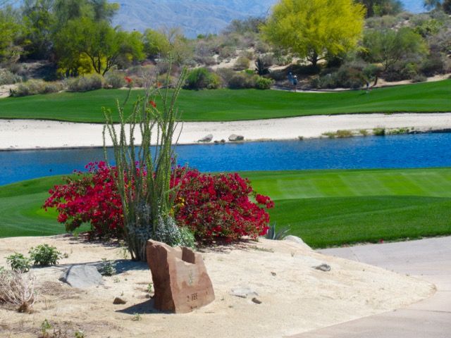
My guidebook enCYCLEpedia Southern California – The Best Easy Scenic Bike Rides (3rd Ed, 2021) contains detailed ride descriptions through the most scenic areas, referenced throughout this article. enCYCLEpedia‘s rides are geared for the average cyclist who prefers to stay away from traffic whenever possible, and avoid high speed, dangerous, or very hilly roads.

The goal of this journey is to use the train to access the most desirable areas, and skip over the parts that are overly difficult, dangerous, or uninteresting. Based on our experiences, the zen of taking a bike on the train adds to the excitement of it all. Options are also mentioned for more advanced riders who may prefer to ride through some of those areas anyway rather than taking the train past them.  

You’ll find lots of accommodation options in the featured locales, and if you prefer bike camping, many of the coastal State Parks have reservable tent sites, but they fill fast at peak times, so advance planning is required. A few also have non reservable bike-in campsites, although spaces are not guaranteed, especially on summer weekends.

The northern part of our trip (San Luis Obispo to Los Angeles) is serviced primarily by the bike-friendly Amtrak Surfliner line that runs from San Luis Obispo to San Diego, stopping at many of the lovely locales described. To travel on the Surfliner, you will need some advance planning, since a free reservation is required to bring your bike along. The good news is it doesn’t have to be boxed like on other Amtrak lines. From LA’s Union Station and south, lots of options open up for less expensive and more bike-friendly commuter lines.

SurflinerTrestlesBeach SanClemente
Amtrak Surfliner on rebuilt “trestles” next to San Clemente’s famous Trestles surf beach (SC3).

Whistlestop 1:  San Luis Obispo (SLO)

Taking the Amtrak Surfliner north from Los Angeles to San Luis Obispo, or SLO Town, is a world class spectacular ride, with California coastal scenery on display between Ventura and Pismo Beach, much of which is not even accessible to the public past Santa Barbara. If you arrive in SLO from the north via Amtrak’s Coast Starlight train, it is also scenic but is not along the coast, as that would mean it would be along the Big Sur coast, which can barely handle a roadway. The Coast Starlight (between LA and Seattle) is not as bike friendly, since bikes need to be boxed and incur baggage and box fees.

CA_LO1_JalamaCoastTrimmed
View of the Santa Barbara County coastline from the Surfliner. 

SLO Town is a charming university city about 13 miles inland from the coastal town of Morro Bay. While SLO Town does not have much in the way of bike trails, it does have bike friendly streets and plenty of desirable places to sleep and eat in the vital downtown sector west of the train depot.  It is a good place to spend some time to explore, provision and get oriented. You can try a wine country tour, or a popular bike route to the coast at Los Osos/Morro Bay via Los Osos Valley Road.

P1050710
Mission San Luis Obispo de Tolosa, downtown SLO

At the coast you can explore Morro Bay, which offers some delightful coastal riding (enCYCLE Ride MB1), and lots of accommodations (reserve for best selection in summer) and popular waterfront seafood restaurants.  To its south is Montana de Oro State Park (Ride MB2), a coastal gem with a couple of great easy rides on packed dirt, some more challenging mountain biking, and spectacular hiking trails.  Bike-in or reservable tent camping is available at Morro Bay, Morro Strand, and Montana de Oro State Parks.

The existing short and sweet Harborwalk path leading to Morro Rock.
Bike path to Morro Rock in Morro Bay (MB1)

Whistlestop 2:  Grover Beach/Pismo Beach

Pubic passage south down the coast from Morro Bay is blocked by the Diablo Canyon nuclear plant property, so you’ll need to ride back to SLO. Continuing south from SLO you can either ride along Class II roads adjacent to Hwy 101 (or a steep route over the hills on dirt roads) or take the Surfliner to the next stop in Grover Beach/Pismo Beach.  If you cycle, your next destination can be the small, quaint beach community of Avila Beach, with the last few miles along the lovely creekside Bob Jones Trail, that will someday connect to SLO, making that a must-do stretch by bike (Ride AV1).  Continue riding south to the Pismo station from Avila Beach. You can also reach Avila Beach on a scenic coastal Class II bike route north from the Pismo station if you choose that option.

CA_AvilaBeachPier_FullRes
Avila Beach Pier  (AV1)

Pismo Beach is the southern end of our recommended exploration in SLO County, and the train station is just south of town in Grover Beach. There’s no bike trails in town, yet, so hop on the bike lanes along Hwy 1 and head north into town (Ride PB2), past several public campgrounds, and the spot where the Monarch butterflies congregate in winter. The delightful downtown has a bunch of restaurants and accommodations.  At lower tides, you can ride on the compact sands of the wide beautiful beach here, our only recommended SoCal beach ride (Ride PB1).  The route north of downtown (Ride PB3) is on Class 2 lanes of a fairly busy roadway, but the ocean vistas are  spectacular in places and you can detour to the waterfront and ride on some parkside trails.  If you chose to ride all the way south from SLO, you’ll be southbound on that route toward downtown and the Pismo station.  And now, back to the Surfliner for our next destination. 

PismoBeachBike
Riding the compact sands of Pismo Beach  (PB1)

Whistlestop 3:  Surf Beach/Lompoc, Santa Barbara County

An optional stop, Surf Beach is the loneliest Amtrak stop along the coast, located in a beach parking lot adjacent to Vandenberg Air Force Base. You can walk for miles along the beautiful beach, but signs warn against swimming here due to two fatal shark attacks.  Amtrak doesn’t stop here often, so schedule carefully. 

CA_LOM1_SurfAmtrakSign
The lonely Surf Amtrak Station, 9 miles west of Lompoc  (LOM1)

From here you can easily ride to pretty Ocean Beach County Park at the delta of the Santa Ynez River.  For grub and overnight accommodations, including hotels, B&B’s, and camping (River Park), the city of Lompoc awaits (Ride LOM1).  The City of Arts and Flowers with murals on its downtown buildings is reached via a flat 9 mile ride along Class II Ocean Ave (55 mph speed), an interesting stretch when the fields of cultivated flowers are in bloom in spring and summer. Lompoc is not as appealing as some of the other coastal towns, but is a good place to restock and refresh.

Those in tip top condition may consider a road trip over substantial and steep hills and windy rural roads, to isolated Jalama County Beach, where there is a beach campground and general store and grill.  If you took the Surfliner northbound you would’ve gone right by it. This would make an epic weekend trip on its own from the big city.

Another option, though risky logistically, is to take the Wine Country Express bus from Lompoc to the Danish tourist village of Solvang, and explore the beautiful Santa Barbara Wine Country in Los Olivos and Santa Ynez by bike (Ride SO1). Buses have bike racks, but can take only a couple at a time.  You could also leave your bikes at your Lompoc accommodation, take the bus, and rent bikes in Solvang.

Whistlestops 4, 5, 6, 7:  Goleta, Santa Barbara, Carpinteria, Ventura

The ride between Lompoc and Santa Barbara is very hilly and/or along the 101 Freeway, only for the most advanced riders. So, all aboard the Surfliner at Surf!  The corridor between the next stops of Goleta, Santa Barbara, Carpinteria and Ventura is rideable by most cyclists, so you can pick and choose where you’d like to explore, how far to ride, and when to use the Surfliner to help you out.

From the Goleta Station, ride to the coast and explore the beautiful paths along the University of California at Santa Barbara (Ride SB2).

SB2UCSBLagoon
Paths around the UCSB Lagoon (SB2)

Class I and II routes connect to the downtown and waterfront district of Santa Barbara (Ride SB1).  A scenic beachfront path passes a multitude of restaurants and accommodations there, although there is no bike camping in town.  The Amtrak station is in the center of town, so if you disembark there, you can easily explore the extensive Spanish-influenced downtown and beautiful waterfront.

OLYMPUS DIGITAL CAMERA
Cabrillo Beachway, Santa Barbara Waterfront (SB1)

A Class II route, very doable but not the most wonderful, leads through the tony community of Montecito, then Summerland, to the lovely low-key beach town of Carpinteria, and the next Amtrak station (Ride SB1, Option 2).  Find lots of great restaurants and choice of accommodations from B&B’s to bike-in and reservable campsites at Carpinteria State Beach.

Someday there will be a bike path connecting Carpinteria to the new path to Ventura, but for now there is only a 3-mile fairly hilly on-road route.  If you are willing to tackle that, the reward is the new waterfront bike path adjacent to the 101 Freeway that leads to the north end of Ventura (Ride VE4).  You could also access it if you take the train directly to Ventura and ride north.

CA VE4 CoastTrail
Rincon Bike Path along US 101 between Carpinteria and Ventura (VE4)

The bike path ends on the Old Rincon Hwy, a popular bike route that leads to the Ventura waterfront trail system (Ride VE1).  Via that path you can access the historic downtown center, enjoy the beautiful coastline and pier, and find all sorts of restaurants and accommodations.  The depot is downtown between the beach and Main Street. Bike-in and reservable camping are available at McGrath State Beach nearby in Oxnard.

OLYMPUS DIGITAL CAMERA
Path through San Buenaventura State Beach near downtown Ventura (VE1)

From Ventura consider riding up a scenic rail trail about 16 miles inland to the lovely spa resort town of Ojai, either as a day trip and lunch stop or an overnight destination (Rides VE2 and 3).  Camping is available at two county parks near the route.

OLYMPUS DIGITAL CAMERA
Rail trail through the Ojai Valley  (VE3)

Ventura is the last stop for the northern part of our adventure. Cycling south from Ventura is only for very experienced cyclists.  The subsequent 50-mile coastal route first passes through the city of Oxnard, while the last 35 miles is along the busy, hilly, speedy, Coast Highway to and through Malibu. The reward is that it ends up on the fabulous 22-mile Los Angeles beach trail. But you can also access that path by taking local rail from downtown, along our rail route. So, most of you will want to hop on the Surfliner in Ventura and head to downtown LA. Or, make your way across town to Oxnard and take the more bike friendly Metrolink commuter train from that route’s western terminus (weekdays only).

Whistlestop 8:  Los Angeles Union Station

Historic Union Station is an attraction in itself, but riding in downtown LA is not for the faint of heart, except perhaps early on a Sunday morning.  However, if you can very securely lock up your bike and belongings, or find an accommodation nearby, it is a worthwhile area to spend some time exploring on foot, with attractions such as the touristy Olvera Street, El Pueblo de Los Angeles, Chinatown, and lots more.

CA_LA_OlveraSt
Historic Olvera Street near LA’s Union Station

From Union Station you have a choice, depending on your timing and preferences. Logistically, the easiest thing to do is hop on Metrolink’s Orange County Line, and head south to our next stop, San Juan Capistrano.  Or, if you would like to experience LA and Orange County’s best and most fabulous coastal trails, joining up with the train route further south, make the following extra trip using local Metro Rail:

Extra Trip: The Urban LA and OC Coastal Paths

LA County’s world renowned beach trail runs some 22 miles through Santa Monica and Venice, Hermosa, Manhattan and Redondo Beaches (Rides LA1 and 2). Metro Rail’s new Exposition Line can get you there: Take the Red or Purple lines from Union Station to meet the Expo Line, and get off at its terminus in Santa Monica. There’s no tent camping along the coast, so you’ll need hotel accommodations near the beach communities, preferably as close to the beach as possible to avoid some dicey areas and possibly dangerous street riding

P1010210.JPG
North end of  LA coastal bike trail aka Martin Braude Trail (LA1)

Believe me you don’t want to ride between the LA beach trail through the industrial districts to Long Beach, so head back to a Metro Rail train, either the Expo Line in Santa Monica or the Green Line accessible further south.  Connect to the Blue Line southbound and get off in downtown Long Beach, a bike-friendly city. Explore the world class rejuvenated waterfront area and visit the Queen Mary or Aquarium of the Pacific (Ride LO1). There’s no tent camping but find oodles of accommodations, dining and shopping.

P1010094.JPG
Bike path through Long Beach’s Shoreline Village restaurant area  (LO1)

A state of the art bike trail runs along the beach to the Belmont Shore district, a great place to stroll and dine.  Explore the canals of Italian-inspired Naples Island (Ride LO2), and ride across the San Gabriel River and into Orange County and the delightful beach community of Seal Beach (Ride SE1).  Carefully navigate a couple miles on the Class II Coast Highway into the community of Sunset Beach, taking the parallel residential street when able, that leads to the fabulous 8 mile Huntington Beach coastal trail (Ride HB1). Camping along here is only for self contained RV’s, so find accommodations and restaurants in Sunset Beach or halfway down the trail in the revitalized downtown core near the pier.

HBTrailMay2015
Huntington Beach path near the pier (HB1).

From the south end of the beach path connect via residential streets to the Newport Beach coastal trail that runs along the Balboa Peninsula, where you’ll find plenty of accommodations and food (Ride NB1). Take the cute 3-car ferry across to Balboa Island to continue the ride south.  An expensive tent-camping option is at Newport Dunes resort in the Back Bay, a great place to get some fun riding in (Ride NB2).

OLYMPUS DIGITAL CAMERA
Newport Beach’s oceanfront path.

Only very experienced cyclists should do the through-ride south along the coast from here. It is indeed a scenic journey, however, perhaps warranting an up-and-back ride for the first few miles. It starts with the Corona del Mar waterfront, connecting to the spectacular Crystal Cove State Park with its blufftop oceanview bike path (Ride NB3) and option to stop at the historic Crystal Cove district for lunch on the beach. Mountain bikers may be able to access a primitive campsite in the inland section of the park. The hilly coastal highway into Laguna Beach is a busy 4 lane road. Once in town, alternate routes are available through most of it (Ride LB2), but in South Laguna there are no good options to get off of the highway until you reach Dana Point, where bike lanes widen as you pass beautiful Salt Creek Beach Park, the Ritz Carlton, and the main business district. From Dana Point you can access bike trails to the San Juan Capistrano or San Clemente train stations.

LB2-2
Laguna Beach is the jewel of Orange County, with its rocky coves, sandy beaches, and lovely downtown right on the beach, but it can be a bitch to bike through (LB2).

Those who prefer bike paths to busy roadways should skip the route through Laguna Beach and follow the excellent paths along Newport Back Bay (Ride NB2) connecting to the San Diego Creek path inland through Irvine (Ride IR1) and end up at either the Tustin (Ride TU1) or Irvine train stations.  From either station, take the Metrolink train south to San Juan Capistrano, joining those who skipped the urban coastal section and took the train directly there from Union Station, or braved the ride through Laguna Beach.

Whistlestop 9:  San Juan Capistrano

The Santa Fe Depot is in the center of the restored historic Spanish downtown that includes the popular and beautiful San Juan Capistrano Mission and the Del Rio district, the oldest neighborhood in California (Ride SJ1). Bike paths lead one way into horse country, and the other way to the sea at Dana Point, another area to explore at its harbor (Ride DP1).  A coastal bike trail connects to San Clemente, and coastal tent camping is available in Dana Point at Doheny State Beach and at San Clemente State Beach, atop a bluff at the south end of its lovely beach trail (Ride SC1).

SJ1-3LosRios
San Juan Capistrano’s historic Los Rios District next to the train depot (SJ1).

Most cyclists will want to hop on the Metrolink at San Clemente’s North Beach Station for the scenic oceanfront trip south to Oceanside.  More adventurous cyclists may enjoy the ride past classic surfing beaches like Trestles (Ride SC3) and perhaps ride into San Diego County through Camp Pendleton all the way to Oceanside.  However getting an advance  permit to ride through the Camp Pendleton roadways has become quite an ordeal. An option is to ride along I-5 for that stretch which is permitted, if you dare.  Tent camping is available near the north end of the route at San Onofre State Beach’s inland San Mateo or summer-only coastal Bluffs campgrounds.

OLYMPUS DIGITAL CAMERA
Elevated portion of San Clemente’s Beach Trail (SC1).

Whistlestop 10: Oceanside

Oceanside is a transit hub, where LA’s Metrolink ends and San Diego’s Coaster and Sprinter train lines begin. Amtrak’s Surfliner also stops here. You can ride inland on the 9 mile San Luis Rey River Trail, visit California’s largest mission en route, and access camping at Guajome Regional Park at trail’s end. Oceanside’s waterfront has a bike lane along its beach promenade, a pier, and a revitalized downtown core.

OceansideOC1-3
Oceanside Harbor, a great place to stop for a meal after the ride through Camp Pendleton from San Clemente (SC3) or just riding around town (OC1).

Those who prefer to stay off of busy roadways should continue on the Coaster train to the San Diego stations.  Otherwise, make your way down the very scenic Class II coastal highway through the lovely beach cities of Carlsbad, Encinitas and Solana Beach. We do this ride frequently, it’s one of our exceptions of road riding since it’s so much fun (Ride SDC1). Tent camping is available at South Carlsbad and San Elijo State Beaches. Advance reservations are needed at both, and they do not have bike-in sites.

CA_SDC1_VistaSouth
A typical view heading south along the north San Diego County coastal highway (SDC1).

Whistlestop 11: Solana Beach

I recommend for those who rode down the coast to hop on the southbound Coaster train in Solana Beach.  After Solana Beach the train bipasses the next city, Del Mar, then heads inland.  If you choose to cycle to San Diego, the route becomes extremely hilly past Del Mar, recommended for experienced and top-shape riders, or those on e-bikes with plenty of battery power left, who can make their way through La Jolla and reach the Mission Bay area.

RailSDCoaster
A Coaster station in north San Diego County

Whistlestop 12:  San Diego Old Town

This major transit center is adjacent to San Diego Old Town State Historic Park, a restored settlement and mega tourist attraction with lots of museums and Mexican restaurants in and around it.  You’ll need to lock up and walk or wheel your bike through here, but it’s worthwhile to do so.  From here, you can connect to the fabulous bike trails around Mission Bay and the boardwalk along Mission Beach/Pacific Beach, and also access Sea World by bike (Ride SD1).  Tent camping is available at private Campland-on-the-Bay.

SDOceanFrontWalkN
Scenic north end of Ocean Front Walk in Pacific Beach (SD1)

From the Mission Bay area you can ride to ritzy La Jolla (Ride SD2) and laid back Ocean Beach (Ride SD3).  A Class II route leads to the stimulating bike trail along San Diego Harbor (Ride SD4). From there, a bike/ped ferry accesses the beautiful bike riding on the Coronado peninsula (Ride SD7: Cover photo – Hotel del Coronado). And, on-road bike routes lead up to the very European Balboa Park and the San Diego Zoo (Ride SD6).

CA_SD6_PandaZoo
The amazing San Diego Zoo (SD6).

Whistlestop 13:  Downtown San Diego Santa Fe Depot

The historic downtown depot, just a couple of blocks from the harborfront trail, is our final stop, and the best station to access the harbor ride (SD4), Coronado via the ferry (SD7) and Balboa Park/Zoo (SD6).  More advanced riders or e-bikers with battery to spare can continue UP the hill to the spine of the Point Loma Peninsula to visit the spectacular Cabrillo National Monument at its tip (Ride SD5).

SDCoronadoBikeMobile
A moving bike statue along Coronado’s scenic waterfront path (SD7)

Return to your origin from downtown San Diego, either taking the Coaster, transferring to the Metrolink in Oceanside, or Amtrak’s Pacific Surfliner the entire way.

Casual Cycling at Big Bear Lake, CA

By Richard Fox Updated September 2021

Big Bear Lake sits about 7,000 feet above the urban valley floor in the spectacular San Bernardino Mountains of Southern California. Long known as a year round recreation playground with winter ski resorts and summer lake activities, cycling has mostly been of the hard-core variety, with little to offer to the more casual cyclist… until now.

The long-established Alpine Pedal Path runs ~2.4 miles along the northeast shore of Big Bear Lake, connecting campgrounds to the Stanfield Cutoff that leads to town.  It’s not flat, but is easy enough, with plenty of gorgeous lake views and forest scenery. On warm days the pines emit a delightful aroma, and summer wildflowers can abound.  A beautiful but hilly 1-mile spur leads through the pretty forest to the Discovery Center.  In summer 2017 the main path was widened and re-paved making it much better for bikes and peds to coexist.  Still, weekdays are much preferred in that regard. Meanwhile, the City of Big Bear Lake has developed a system of bike routes through serene residential streets, leading to the quaint Village, the hub of dining and tourist shopping. A bike path runs parallel to Pine Knot Ave.

Projects are underway to make a better connection between Alpine Pedal Path and the rest of the city bike routes. A separated bike path across Stanfield Cutoff connecting to the Pedal Path was completed in 2020 along the west side of roadway, which is short but sweet and one of the most scenic stretches of path in SoCal with iconic views across the lake.  At time of writing that path is being extended (expect by late 2021) to Big Bear Blvd, and to the southwest adjacent to that main road, connecting to Sandalwood and pleasant in-town bike routes.  Future plans also include a bike path from the Bear Mountain ski area all the way down to the lake along the Rathbun Creek corridor, intersecting Sandalwood.  A very impressive 0.7-mile portion is already completed between Elm St near the new Zoo location and the Sizzler parking lot.  Several agencies, including the US Forest Service, CALTRANS, San Bernardino  County and the City of Big Bear Lake have been coordinating all of these projects.  Signed bike routes through neighborhoods also traverse Big Bear City. 

The other option for casual cyclists with fat tires is the Sky Chair lift at Snow Summit ski resort that leads to a choice of a fire road or the new Skyline Trail east down the mountain, as well as other options, depending on ability.  You can also ride up the mountain on Forest Service Road 2N10 from the Bear Mountain area, a trip that e-bikers will be more appreciative of.  A reward of a meal at the outdoor Skyline Taphouse BBQ (when open) can await you.  It’s a very scenic ride through the National Forest with some awesome vistas.   

We’ve spent one to two months RV camping near the lake’s northeast corner every summer since July 2017, and enjoyed near perfect weather (high 70’s – low 80’s, sunny, with an occasional fun monsoon thunderstorm) while the valley below was baking. We rarely needed our truck; we just hopped on our bikes to explore the paths and new routes, which I mapped out for enCYCLEpedia’s 2nd and 3rd Editions, with the latest maps available on the enCYCLEpedia website for book owners.  

CA_BB1_Alpine_MomKid
Re-paved and widened Alpine Pedal Path, north shore.


CA_BB1_EndofAPPSteveChair
Steve relaxing at the west end of the Alpine Pedal Path along the lake. The Solar Observatory in the background at times has offered free tours to small groups weekly in summer.


BB3_Rich_Lake_Pose
Rich pausing along the bike routes on the south shore near town.


CA_BB3_StevePinkKnot
Steve on Pine Knot, the main Village street, with horse and buggy going by.


CA_BB2_TowneTrail
The Towne Trail is a fairly hilly forest path, an alternate route to taking the city streets from the Snow Summit lifts west to The Village.  It also serves as a feeder for MTB’ers who descended the west side of the mountain, returning to the lifts.  The Snow Summit website says e-bikes are not allowed on this trail, for what that’s worth. 
Spur trail off the Alpine Pedal Path to the Discovery Center.
Sunset from the Stanfield Cutoff (pre-bike trail).
New ultra scenic path along Stanfield Cutoff connects to Alpine Pedal Path.
Bumpy boardwalks above Stanfield Marsh and dirt paths create a safer
alternative to the busy main roads between Stanfield Cutoff and Division.
Signed bike routes through Big Bear City.
Short but sweet completed section of the Rathbun Creek Trail.
Cycling up FS 2N10 with views of Mt San Gorgonio.
View of Big Bear Lake from near the Snow Summit lift station.
Skyline Taphouse at Snow Summit near the lifts, accessible via FS 2N10D.
Cyclists arriving via the Snow Summit Sky Chair.