“Because of its elevation (4,392 m), relief, hydrothermal alteration, icecap, glacier-fed radial valleys, and proximity to encroaching suburbs of the Seattle-Tacoma metropolis, Mount Rainier is the most threatening volcano in the Cascades. Its next eruption could produce volcanic ash, lava flows, and avalanches of intensely hot rock and volcanic gases, called pyroclastic flows. Some of these events swiftly melt snow and ice and could produce torrents of meltwater that pick up loose rock and become rapidly flowing slurries of mud and boulders known as lahars. The greatest risk at the volcano comes from its potential for generating huge lahars triggered by sector collapse or magma- water-ice interaction rather than from an eruption itself.” (Source: USGS)

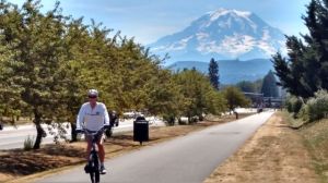
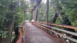
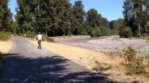
One of the most beautiful multi-use trails in the Seattle vicinity is the Foothills Rail Trail that currently extends about 15 miles from Puyallup through Orting to South Prairie, in the shadow of mighty Mt. Rainier, aka Tahama. Scenery is a mix of rural residential and agricultural, chalky-white glacial rivers, and the cute historic town of Orting, perfect for your breakfast or lunch stop. Make sure to ride this paved trail on a clear day so that you’ll be treated to magnificent views of the volcano on your eastbound pedal. The elevation gain over the 15 miles is only about 350 feet, but it is still best to start at the bottom, or west end. We enjoy lunch in Orting, and return downhill to the East Puyallup Trailhead off E 80th Street.
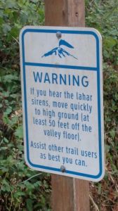
Much of the trail, a former rail bed, lies in the Puyallup Valley which is one of the potential routes of the devastating lahars, and signs indicate that if a siren sounds to quickly run to high ground, at least 50 feet above the valley floor, post haste. The last time this occurred was about 500 years ago, but, as shown on a special episode on The Weather Channel, “It Can Happen Tomorrow!”


